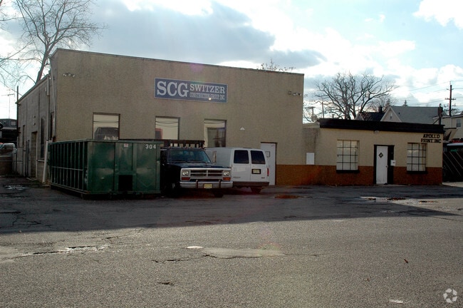
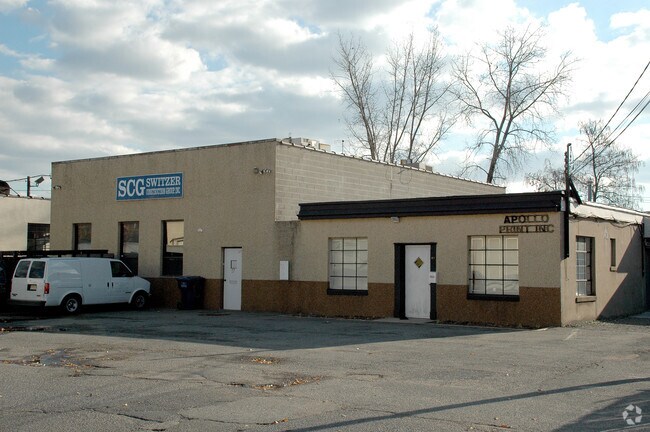
Property Record
51 Orchard St, Hackensack, NJ 07601


Property Detail
51 Orchard St
23-00528-0000-00011
50X150 3LT
Industrialgeneral
BERGEN
M2
New Jersey
AE The base floodplain where base flood elevations are provided. AE Zones are now used on new format FIRMs instead of A1-A30 Zones.
11
2024
0.17 AC
2025
Hackensack/Teaneck
023202
Northern New Jersey
1,680 SF
New York-Jersey City-White Plains, NY-NJ
NEARBY LISTINGS FOR SALE OR LEASE
DEMOGRAPHICS near 51 Orchard St
1 mile
3 mile
5 mile
2024 Total Population
24,954
212,435
528,219
2029 Population
26,106
219,069
542,100
Pop Growth 2024-2029
+ 4.62%
+ 3.12%
+ 2.63%
Average Age
42
42
42
2024 Total Households
10,161
77,118
190,878
HH Growth 2024-2029
+ 4.76%
+ 3.25%
+ 2.71%
Median Household Inc
$102,263
$105,543
$105,567
Avg Household Size
2.30
2.60
2.70
2024 Avg HH Vehicles
1.00
2.00
2.00
Median Home Value
$471,211
$527,576
$574,663
Median Year Built
1964
1956
1956
Nearby Places
Map Layers
Map Styles
 Street
 Aerial
Transit
 Traffic
 Biking
Places
Listings with unknown addresses are not visible on the map
- Restaurants
- Banks
- Shops
- Fitness
- Groceries
Nearby Properties
Address
Land Use
TOTAL SIZE
Lot Size
Zoning
Address
Land Use
TOTAL SIZE
Lot Size
Zoning
488,779 SF
7.55 AC
HCS
Address
Land Use
TOTAL SIZE
Lot Size
Zoning
1,267 SF
0.14 AC
BML
Address
Land Use
TOTAL SIZE
Lot Size
Zoning
Address
Land Use
TOTAL SIZE
Lot Size
Zoning
988,414 SF
34.89 AC
BG
Address
Land Use
TOTAL SIZE
Lot Size
Zoning
4.37 AC
HCS
Address
Land Use
TOTAL SIZE
Lot Size
Zoning
378,400 SF
39.30 AC
BML
Address
Land Use
TOTAL SIZE
Lot Size
Zoning
512,862 SF
14.16 AC
Address
Land Use
TOTAL SIZE
Lot Size
Zoning
281,720 SF
3.93 AC
R-3
Address
Land Use
TOTAL SIZE
Lot Size
Zoning
20.07 AC
H
Address
Land Use
TOTAL SIZE
Lot Size
Zoning
102,070 SF
29.70 AC
BL
Address
Land Use
TOTAL SIZE
Lot Size
Zoning
160,036 SF
21.93 AC
R75
Address
Land Use
TOTAL SIZE
Lot Size
Zoning
608,596 SF
27.10 AC
LID
Address
Land Use
TOTAL SIZE
Lot Size
Zoning
232,368 SF
5.10 AC
Address
Land Use
TOTAL SIZE
Lot Size
Zoning
25,620 SF
21.37 AC
Address
Land Use
TOTAL SIZE
Lot Size
Zoning
197,742 SF
6.20 AC
R3
Address
Land Use
TOTAL SIZE
Lot Size
Zoning
5.22 AC
APT
Address
Land Use
TOTAL SIZE
Lot Size
Zoning
4.54 AC
R-M3
Address
Land Use
TOTAL SIZE
Lot Size
Zoning
250,833 SF
13.49 AC
BG
Address
Land Use
TOTAL SIZE
Lot Size
Zoning
2.55 AC
RC-1
Address
Land Use
TOTAL SIZE
Lot Size
Zoning
261,303 SF
5.60 AC
O
Address
Land Use
TOTAL SIZE
Lot Size
Zoning
341,076 SF
40.02 AC
R100
Address
Land Use
TOTAL SIZE
Lot Size
Zoning
303,434 SF
13.34 AC
Address
Land Use
TOTAL SIZE
Lot Size
Zoning
Address
Land Use
TOTAL SIZE
Lot Size
Zoning
259,273 SF
19.77 AC
BIL
Address
Land Use
TOTAL SIZE
Lot Size
Zoning
394,046 SF
1.88 AC
R3
Address
Land Use
TOTAL SIZE
Lot Size
Zoning
2,191 SF
1.34 AC
B2
Address
Land Use
TOTAL SIZE
Lot Size
Zoning
13 AC
B-3
Address
Land Use
TOTAL SIZE
Lot Size
Zoning
31,896 SF
1.64 AC
O
Address
Land Use
TOTAL SIZE
Lot Size
Zoning
2.92 AC
RC-2
Address
Land Use
TOTAL SIZE
Lot Size
Zoning
5.53 AC
RS
The World's #1 Commercial Real Estate Marketplace
Connect with us
© 2026 CoStar Group
The information above has been obtained from sources believed reliable. While we do not doubt its accuracy we have not verified it and make no guarantee, warranty or representation about it. It is your responsibility to independently confirm its accuracy and completeness. Any projections, opinions, assumptions, or estimates used are for example only and do not represent the current or future performance of the property. The value of this transaction to you depends on tax and other factors which should be evaluated by your tax, financial, and legal advisors. You and your advisors should conduct a careful, independent investigation of the property to determine to your satisfaction the suitability of the property for your needs.