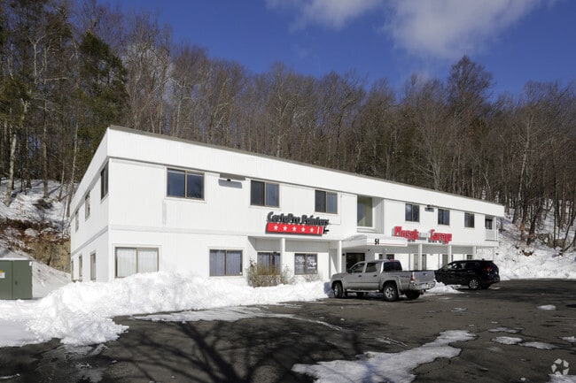
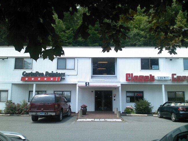
Property Record
51 Sugar Hollow Rd, Danbury, CT 06810
Current Lease Availabilities
NEARBY LISTINGS FOR SALE OR LEASE
Property Detail
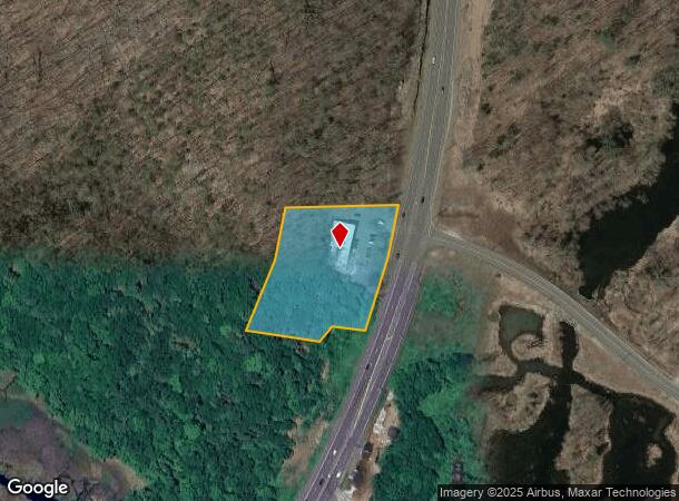
51 Sugar Hollow Rd
DANB-000024G-000000-000005
Fairfield
Officebuilding
Connecticut
X
5
09001C0228F
1.39 AC
2025
Danbury
2025
Westchester/So Connecticut
210502
Bridgeport-Stamford-Norwalk, CT
11,770 SF
DEMOGRAPHICS near 51 Sugar Hollow Rd
1 Mile
3 Mile
5 Mile
2024 Total Population
637
14,437
92,045
2029 Population
660
14,567
91,675
Pop Growth 2024-2029
+ 3.61%
+ 0.90%
(0.40%)
Average Age
44
43
40
2024 Total Households
240
5,182
33,882
HH Growth 2024-2029
+ 3.75%
+ 0.85%
(0.46%)
Median Household Inc
$117,187
$140,012
$85,847
Avg Household Size
2.50
2.70
2.60
2024 Avg HH Vehicles
2.00
2.00
2.00
Median Home Value
$336,508
$496,467
$431,676
Median Year Built
1957
1967
1972
Nearby Places
Map Layers
Map Styles
 Street
 Aerial
- Restaurants
- Banks
- Shops
- Fitness
- Groceries
PUBLIC TRANSPORTATION
COMMUTER RAIL
Redding Station (New Haven Line - Metro-North Commuter Railroad Company (Metro-North))
DRIVE
WALK
Distance
Redding Station (New Haven Line - Metro-North Commuter Railroad Company (Metro-North))
8 min
2.9 mi
Danbury Station (New Haven Line - Metro-North Commuter Railroad Company (Metro-North))
DRIVE
WALK
Distance
Danbury Station (New Haven Line - Metro-North Commuter Railroad Company (Metro-North))
11 min
5.2 mi
AIRPORT
Westchester County
DRIVE
WALK
Distance
Westchester County
45 min
31.0 mi
Tweed/New Haven
DRIVE
WALK
Distance
Tweed/New Haven
65 min
44.3 mi
New York Stewart International
DRIVE
WALK
Distance
New York Stewart International
62 min
46.5 mi
Freight Ports
Port of New Haven
DRIVE
WALK
Distance
Port of New Haven
60 min
41.4 mi
Nearby Properties
Address
Land Use
TOTAL SIZE
Lot Size
Zoning
Address
Land Use
TOTAL SIZE
Lot Size
Zoning
135.19 AC
IL40
Address
Land Use
TOTAL SIZE
Lot Size
Zoning
18.63 AC
CG20
Address
Land Use
TOTAL SIZE
Lot Size
Zoning
273,127 SF
10.33 AC
RA-40
Address
Land Use
TOTAL SIZE
Lot Size
Zoning
478,816 SF
39.59 AC
IL40
Address
Land Use
TOTAL SIZE
Lot Size
Zoning
92,775 SF
85.83 AC
RAA
Address
Land Use
TOTAL SIZE
Lot Size
Zoning
10 AC
CG-20
Address
Land Use
TOTAL SIZE
Lot Size
Zoning
17.24 AC
IL-40
Address
Land Use
TOTAL SIZE
Lot Size
Zoning
117,561 SF
16.23 AC
RCDD
Address
Land Use
TOTAL SIZE
Lot Size
Zoning
10.51 AC
IL40
Address
Land Use
TOTAL SIZE
Lot Size
Zoning
1,639 SF
30 AC
RA40
Address
Land Use
TOTAL SIZE
Lot Size
Zoning
100,734 SF
22.55 AC
B-2
Address
Land Use
TOTAL SIZE
Lot Size
Zoning
304,561 SF
5.02 AC
IL40
Address
Land Use
TOTAL SIZE
Lot Size
Zoning
4,226 SF
11.13 AC
B-2
Address
Land Use
TOTAL SIZE
Lot Size
Zoning
52,703 SF
48.18 AC
CCF
Address
Land Use
TOTAL SIZE
Lot Size
Zoning
19.10 AC
IL40
Address
Land Use
TOTAL SIZE
Lot Size
Zoning
1,238 SF
8.03 AC
ARHD2
Address
Land Use
TOTAL SIZE
Lot Size
Zoning
2,694 SF
156.19 AC
CDD
Address
Land Use
TOTAL SIZE
Lot Size
Zoning
3.84 AC
CG20
Address
Land Use
TOTAL SIZE
Lot Size
Zoning
33,550 SF
2.75 AC
CG20
Address
Land Use
TOTAL SIZE
Lot Size
Zoning
7.88 AC
CG20
Address
Land Use
TOTAL SIZE
Lot Size
Zoning
48,811 SF
20.21 AC
RAA
Address
Land Use
TOTAL SIZE
Lot Size
Zoning
10.55 AC
IL40
Address
Land Use
TOTAL SIZE
Lot Size
Zoning
273.40 AC
RAAA
Address
Land Use
TOTAL SIZE
Lot Size
Zoning
17.32 AC
RAAA
Address
Land Use
TOTAL SIZE
Lot Size
Zoning
53,938 SF
2.48 AC
IL-40
Address
Land Use
TOTAL SIZE
Lot Size
Zoning
5.19 AC
IL40
Address
Land Use
TOTAL SIZE
Lot Size
Zoning
7,138 SF
13.27 AC
RAA
Address
Land Use
TOTAL SIZE
Lot Size
Zoning
33,750 SF
3.28 AC
IL40
Address
Land Use
TOTAL SIZE
Lot Size
Zoning
82,090 SF
8.04 AC
IL-40
Address
Land Use
TOTAL SIZE
Lot Size
Zoning
240.15 AC
IP
The World's #1 Commercial Real Estate Marketplace
Connect with us
© 2025 CoStar Group
The information above has been obtained from sources believed reliable. While we do not doubt its accuracy we have not verified it and make no guarantee, warranty or representation about it. It is your responsibility to independently confirm its accuracy and completeness. Any projections, opinions, assumptions, or estimates used are for example only and do not represent the current or future performance of the property. The value of this transaction to you depends on tax and other factors which should be evaluated by your tax, financial, and legal advisors. You and your advisors should conduct a careful, independent investigation of the property to determine to your satisfaction the suitability of the property for your needs.