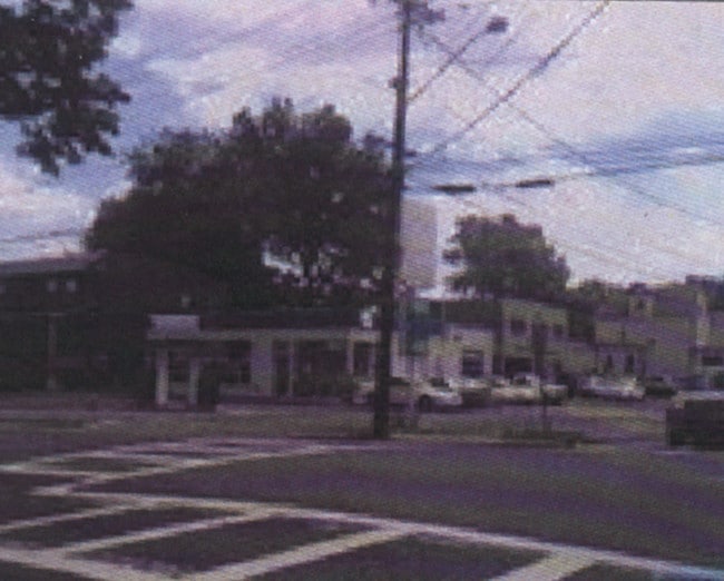
Property Record
51 Union Ave, Rutherford, NJ 07070


Property Detail
51 Union Ave
New York-Jersey City-White Plains, NY-NJ
90X90
56-00076-0000-00032
Bergen
Vacantlandnec
New Jersey
B3
32
B and X Area of moderate flood hazard, usually the area between the limits of the 100-year and 500-year floods.
0.19 AC
2024
Meadowlands
2025
Northern New Jersey
051300
NEARBY LISTINGS FOR SALE OR LEASE
DEMOGRAPHICS near 51 Union Ave
1 mile
3 mile
5 mile
2025 Total Population
25,929
196,090
550,518
2030 Population
26,361
199,496
561,525
Pop Growth 2025-2030
+ 1.67%
+ 1.74%
+ 2.00%
Average Age
41
39
40
2025 Total Households
9,890
70,276
201,220
HH Growth 2025-2030
+ 1.58%
+ 1.75%
+ 2.09%
Median Household Inc
$114,671
$93,085
$91,216
Avg Household Size
2.50
2.70
2.60
2025 Avg HH Vehicles
2.00
2.00
2.00
Median Home Value
$619,232
$525,275
$476,231
Median Year Built
1949
1953
1954
Nearby Places
Map Layers
Map Styles
 Street
 Aerial
Layers
 Traffic
 Biking
Places
Listings with unknown addresses are not visible on the map
- Restaurants
- Banks
- Shops
- Fitness
- Groceries
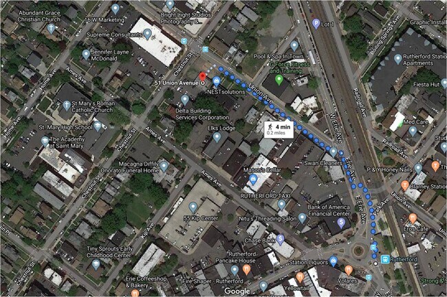
PUBLIC TRANSPORTATION
TRANSIT/SUBWAY
Rutherford (Bergen County/Port Jervis Line - NJ Transit Commuter Rail (NJ Transit))
Drive
Walk
Distance
Rutherford (Bergen County/Port Jervis Line - NJ Transit Commuter Rail (NJ Transit))
1 min
5 min
0.2 mi
COMMUTER RAIL
Rutherford (Bergen County/Port Jervis Line - NJ Transit Commuter Rail (NJ Transit))
Drive
Walk
Distance
Rutherford (Bergen County/Port Jervis Line - NJ Transit Commuter Rail (NJ Transit))
1 min
5 min
0.2 mi
Lyndhurst (Main/Port Jervis Line - NJ Transit Commuter Rail (NJ Transit))
Drive
Walk
Distance
Lyndhurst (Main/Port Jervis Line - NJ Transit Commuter Rail (NJ Transit))
6 min
2.4 mi
AIRPORT
Newark Liberty International
Drive
Walk
Distance
Newark Liberty International
16 min
12.6 mi
LaGuardia
Drive
Walk
Distance
LaGuardia
35 min
21.9 mi
John F Kennedy International
Drive
Walk
Distance
John F Kennedy International
47 min
27.2 mi
Freight Ports
Maher Terminal
Drive
Walk
Distance
Maher Terminal
26 min
14.8 mi
SALE & LEASE HISTORY
LISTING DATE
SALE/LEASE

May 08, 2023
For Sale
Jan 19, 2021
For Sale
Nearby Properties
Address
Land Use
TOTAL SIZE
Lot Size
Zoning
Address
Land Use
TOTAL SIZE
Lot Size
Zoning
Address
Land Use
TOTAL SIZE
Lot Size
Zoning
Address
Land Use
TOTAL SIZE
Lot Size
Zoning
4,014 SF
21 AC
Address
Land Use
TOTAL SIZE
Lot Size
Zoning
612 AC
SEA
Address
Land Use
TOTAL SIZE
Lot Size
Zoning
335.71 AC
AF
Address
Land Use
TOTAL SIZE
Lot Size
Zoning
Address
Land Use
TOTAL SIZE
Lot Size
Zoning
Address
Land Use
TOTAL SIZE
Lot Size
Zoning
Address
Land Use
TOTAL SIZE
Lot Size
Zoning
Address
Land Use
TOTAL SIZE
Lot Size
Zoning
Address
Land Use
TOTAL SIZE
Lot Size
Zoning
9.57 AC
I2
Address
Land Use
TOTAL SIZE
Lot Size
Zoning
3,956 SF
250 AC
C2
Address
Land Use
TOTAL SIZE
Lot Size
Zoning
68.93 AC
Address
Land Use
TOTAL SIZE
Lot Size
Zoning
7.10 AC
R-3
Address
Land Use
TOTAL SIZE
Lot Size
Zoning
Address
Land Use
TOTAL SIZE
Lot Size
Zoning
602,220 SF
25.91 AC
Address
Land Use
TOTAL SIZE
Lot Size
Zoning
5.80 AC
CGI
Address
Land Use
TOTAL SIZE
Lot Size
Zoning
433,716 SF
10.49 AC
Address
Land Use
TOTAL SIZE
Lot Size
Zoning
30.46 AC
I
Address
Land Use
TOTAL SIZE
Lot Size
Zoning
8.88 AC
ORD
Address
Land Use
TOTAL SIZE
Lot Size
Zoning
1,218 SF
41.30 AC
RB
Address
Land Use
TOTAL SIZE
Lot Size
Zoning
100,014 SF
8.80 AC
M2
Address
Land Use
TOTAL SIZE
Lot Size
Zoning
1.12 AC
M-O
Address
Land Use
TOTAL SIZE
Lot Size
Zoning
7.29 AC
Address
Land Use
TOTAL SIZE
Lot Size
Zoning
Address
Land Use
TOTAL SIZE
Lot Size
Zoning
275,260 SF
11.88 AC
Address
Land Use
TOTAL SIZE
Lot Size
Zoning
18.30 AC
Address
Land Use
TOTAL SIZE
Lot Size
Zoning
11.59 AC
Address
Land Use
TOTAL SIZE
Lot Size
Zoning
138,764 SF
1.47 AC
LM
Address
Land Use
TOTAL SIZE
Lot Size
Zoning
24.29 AC
The World's #1 Commercial Real Estate Marketplace
Connect with us
© 2026 CoStar Group
The information above has been obtained from sources believed reliable. While we do not doubt its accuracy we have not verified it and make no guarantee, warranty or representation about it. It is your responsibility to independently confirm its accuracy and completeness. Any projections, opinions, assumptions, or estimates used are for example only and do not represent the current or future performance of the property. The value of this transaction to you depends on tax and other factors which should be evaluated by your tax, financial, and legal advisors. You and your advisors should conduct a careful, independent investigation of the property to determine to your satisfaction the suitability of the property for your needs.