Property Record
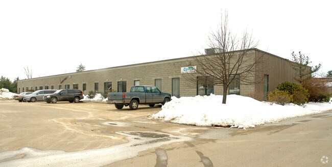
51 Wentworth Ave, Londonderry, NH 03053


NEARBY LISTINGS FOR SALE OR LEASE
Property Detail
51 Wentworth Ave
Industrialcondominium
Rockingham
X
New Hampshire
33011C0395D
44c01
2024
Rockingham
2024
Boston
003703
Boston-Cambridge-Newton, MA-NH
13,200 SF
LOND M:014 L:044C01-B01
DEMOGRAPHICS near 51 Wentworth Ave
1 Mile
3 Mile
5 Mile
2024 Total Population
1,232
19,665
71,488
2029 Population
1,285
20,389
73,746
Pop Growth 2024-2029
+ 4.30%
+ 3.68%
+ 3.16%
Average Age
41
41
42
2024 Total Households
418
7,609
27,695
HH Growth 2024-2029
+ 4.31%
+ 3.72%
+ 3.12%
Median Household Inc
$130,871
$105,369
$101,819
Avg Household Size
2.90
2.50
2.50
2024 Avg HH Vehicles
2.00
2.00
2.00
Median Home Value
$408,264
$362,307
$361,740
Median Year Built
1985
1986
1983
Nearby Places
Map Layers
Map Styles
 Street
 Aerial
- Restaurants
- Banks
- Shops
- Fitness
- Groceries
PUBLIC TRANSPORTATION
AIRPORT
Manchester Boston Regional
DRIVE
WALK
Distance
Manchester Boston Regional
12 min
3.8 mi
Portsmouth International at Pease
DRIVE
WALK
Distance
Portsmouth International at Pease
72 min
46.8 mi
Freight Ports
Port of Boston
DRIVE
WALK
Distance
Port of Boston
80 min
50.6 mi
SALE & LEASE HISTORY
LISTING DATE
SALE/LEASE

Sep 30, 2024
For Lease
Nearby Properties
Address
Land Use
TOTAL SIZE
Lot Size
Zoning
Address
Land Use
TOTAL SIZE
Lot Size
Zoning
768,020 SF
74.47 AC
I-II
Address
Land Use
TOTAL SIZE
Lot Size
Zoning
603,357 SF
45.12 AC
GB
Address
Land Use
TOTAL SIZE
Lot Size
Zoning
8,064 SF
34.29 AC
Address
Land Use
TOTAL SIZE
Lot Size
Zoning
1,710 SF
65 AC
AR-I
Address
Land Use
TOTAL SIZE
Lot Size
Zoning
56,997 SF
31.28 AC
INDUST
Address
Land Use
TOTAL SIZE
Lot Size
Zoning
46,906 SF
552.35 AC
Address
Land Use
TOTAL SIZE
Lot Size
Zoning
0.60 AC
PZ
Address
Land Use
TOTAL SIZE
Lot Size
Zoning
42,228 SF
15.58 AC
PZ
Address
Land Use
TOTAL SIZE
Lot Size
Zoning
50.47 AC
GB
Address
Land Use
TOTAL SIZE
Lot Size
Zoning
723,875 SF
38.08 AC
Address
Land Use
TOTAL SIZE
Lot Size
Zoning
180,600 SF
14.19 AC
IND-I
Address
Land Use
TOTAL SIZE
Lot Size
Zoning
366,008 SF
41.69 AC
IND-I
Address
Land Use
TOTAL SIZE
Lot Size
Zoning
487,970 SF
79.74 AC
IND-I
Address
Land Use
TOTAL SIZE
Lot Size
Zoning
201,831 SF
18.46 AC
IND-II
Address
Land Use
TOTAL SIZE
Lot Size
Zoning
151,002 SF
6.95 AC
PZ
Address
Land Use
TOTAL SIZE
Lot Size
Zoning
119,139 SF
25.87 AC
IND-I
Address
Land Use
TOTAL SIZE
Lot Size
Zoning
142,318 SF
26.13 AC
GB
Address
Land Use
TOTAL SIZE
Lot Size
Zoning
227,589 SF
GB
Address
Land Use
TOTAL SIZE
Lot Size
Zoning
244,637 SF
27.28 AC
IND-II
Address
Land Use
TOTAL SIZE
Lot Size
Zoning
304,312 SF
29.62 AC
IND-II
Address
Land Use
TOTAL SIZE
Lot Size
Zoning
13,395 SF
8.16 AC
PZ
Address
Land Use
TOTAL SIZE
Lot Size
Zoning
116.34 AC
IND-II
Address
Land Use
TOTAL SIZE
Lot Size
Zoning
90,406 SF
24.78 AC
AR-I
Address
Land Use
TOTAL SIZE
Lot Size
Zoning
192,520 SF
34.20 AC
Address
Land Use
TOTAL SIZE
Lot Size
Zoning
187,046 SF
17.40 AC
PZ
Address
Land Use
TOTAL SIZE
Lot Size
Zoning
24.20 AC
GB
Address
Land Use
TOTAL SIZE
Lot Size
Zoning
124,836 SF
28.60 AC
Address
Land Use
TOTAL SIZE
Lot Size
Zoning
146,997 SF
16.88 AC
Address
Land Use
TOTAL SIZE
Lot Size
Zoning
5,894 SF
12.50 AC
RESIDE
Address
Land Use
TOTAL SIZE
Lot Size
Zoning
94,419 SF
6 AC
The World's #1 Commercial Real Estate Marketplace
Connect with us
© 2025 CoStar Group
The information above has been obtained from sources believed reliable. While we do not doubt its accuracy we have not verified it and make no guarantee, warranty or representation about it. It is your responsibility to independently confirm its accuracy and completeness. Any projections, opinions, assumptions, or estimates used are for example only and do not represent the current or future performance of the property. The value of this transaction to you depends on tax and other factors which should be evaluated by your tax, financial, and legal advisors. You and your advisors should conduct a careful, independent investigation of the property to determine to your satisfaction the suitability of the property for your needs.