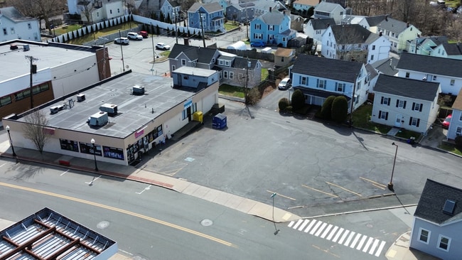
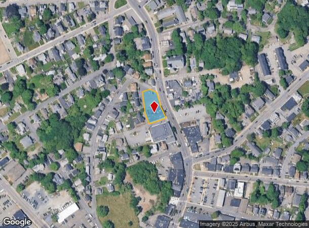
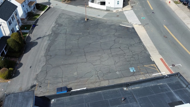
Property Record
510 Main St, Woburn, MA 01801

Current Lease Availabilities
NEARBY LISTINGS FOR SALE OR LEASE
Property Detail
510 Main St
WOBU-000043-000018-000001
Middlesex
Storebuilding
Massachusetts
X
1
25017C0407F
0.34 AC
2025
Burlington/Woburn
2025
Boston
333502
Boston-Cambridge-Newton, MA-NH
6,665 SF
DEMOGRAPHICS near 510 Main St
1 Mile
3 Mile
5 Mile
2024 Total Population
16,963
93,522
267,857
2029 Population
16,785
92,878
264,983
Pop Growth 2024-2029
(1.05%)
(0.69%)
(1.07%)
Average Age
42
42
42
2024 Total Households
6,879
36,851
105,053
HH Growth 2024-2029
(1.12%)
(0.76%)
(1.17%)
Median Household Inc
$97,681
$117,739
$127,207
Avg Household Size
2.40
2.50
2.50
2024 Avg HH Vehicles
2.00
2.00
2.00
Median Home Value
$613,245
$732,090
$745,682
Median Year Built
1956
1966
1958
Nearby Places
Map Layers
Map Styles
 Street
 Aerial
- Restaurants
- Banks
- Shops
- Fitness
- Groceries
PUBLIC TRANSPORTATION
COMMUTER RAIL
Winchester Center (Lowell Line - Massachusetts Bay Transportation Authority Commuter Rail (Purple Line))
DRIVE
WALK
Distance
Winchester Center (Lowell Line - Massachusetts Bay Transportation Authority Commuter Rail (Purple Line))
5 min
2.5 mi
Wedgemere (Lowell Line - Massachusetts Bay Transportation Authority Commuter Rail (Purple Line))
DRIVE
WALK
Distance
Wedgemere (Lowell Line - Massachusetts Bay Transportation Authority Commuter Rail (Purple Line))
8 min
3.4 mi
AIRPORT
General Edward Lawrence Logan International
DRIVE
WALK
Distance
General Edward Lawrence Logan International
23 min
14.0 mi
Manchester Boston Regional
DRIVE
WALK
Distance
Manchester Boston Regional
61 min
43.1 mi
Nearby Properties
Address
Land Use
TOTAL SIZE
Lot Size
Zoning
Address
Land Use
TOTAL SIZE
Lot Size
Zoning
42.20 AC
S-2
Address
Land Use
TOTAL SIZE
Lot Size
Zoning
169 AC
OS
Address
Land Use
TOTAL SIZE
Lot Size
Zoning
14.97 AC
C
Address
Land Use
TOTAL SIZE
Lot Size
Zoning
388,978 SF
23.23 AC
RG
Address
Land Use
TOTAL SIZE
Lot Size
Zoning
27.56 AC
R-2
Address
Land Use
TOTAL SIZE
Lot Size
Zoning
37.77 AC
PD
Address
Land Use
TOTAL SIZE
Lot Size
Zoning
15.95 AC
BG
Address
Land Use
TOTAL SIZE
Lot Size
Zoning
153,732 SF
12.50 AC
SCI
Address
Land Use
TOTAL SIZE
Lot Size
Zoning
23.91 AC
IG
Address
Land Use
TOTAL SIZE
Lot Size
Zoning
476,332 SF
5.37 AC
Address
Land Use
TOTAL SIZE
Lot Size
Zoning
405,606 SF
33.40 AC
RO
Address
Land Use
TOTAL SIZE
Lot Size
Zoning
18.62 AC
O-P
Address
Land Use
TOTAL SIZE
Lot Size
Zoning
346,106 SF
42.04 AC
RO
Address
Land Use
TOTAL SIZE
Lot Size
Zoning
330,500 SF
7.44 AC
PD
Address
Land Use
TOTAL SIZE
Lot Size
Zoning
12.02 AC
IG
Address
Land Use
TOTAL SIZE
Lot Size
Zoning
281,240 SF
15 AC
IG
Address
Land Use
TOTAL SIZE
Lot Size
Zoning
30.92 AC
RO
Address
Land Use
TOTAL SIZE
Lot Size
Zoning
265,827 SF
10.38 AC
IH
Address
Land Use
TOTAL SIZE
Lot Size
Zoning
6.69 AC
PD
Address
Land Use
TOTAL SIZE
Lot Size
Zoning
720 SF
632 AC
SA8
Address
Land Use
TOTAL SIZE
Lot Size
Zoning
186,516 SF
40 AC
R-1
Address
Land Use
TOTAL SIZE
Lot Size
Zoning
31.56 AC
HB
Address
Land Use
TOTAL SIZE
Lot Size
Zoning
7.90 AC
PD
Address
Land Use
TOTAL SIZE
Lot Size
Zoning
14.82 AC
RO
Address
Land Use
TOTAL SIZE
Lot Size
Zoning
191,050 SF
3.15 AC
Address
Land Use
TOTAL SIZE
Lot Size
Zoning
9.82 AC
PD
Address
Land Use
TOTAL SIZE
Lot Size
Zoning
9.01 AC
S-I
Address
Land Use
TOTAL SIZE
Lot Size
Zoning
341,593 SF
3.38 AC
I-P2
Address
Land Use
TOTAL SIZE
Lot Size
Zoning
9.50 AC
SCI
Address
Land Use
TOTAL SIZE
Lot Size
Zoning
300,720 SF
16.16 AC
IG
The World's #1 Commercial Real Estate Marketplace
Connect with us
© 2026 CoStar Group
The information above has been obtained from sources believed reliable. While we do not doubt its accuracy we have not verified it and make no guarantee, warranty or representation about it. It is your responsibility to independently confirm its accuracy and completeness. Any projections, opinions, assumptions, or estimates used are for example only and do not represent the current or future performance of the property. The value of this transaction to you depends on tax and other factors which should be evaluated by your tax, financial, and legal advisors. You and your advisors should conduct a careful, independent investigation of the property to determine to your satisfaction the suitability of the property for your needs.