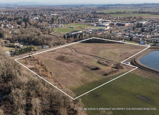
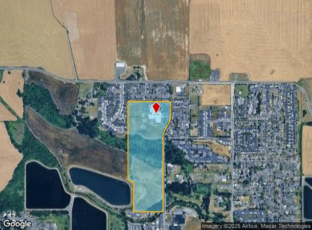
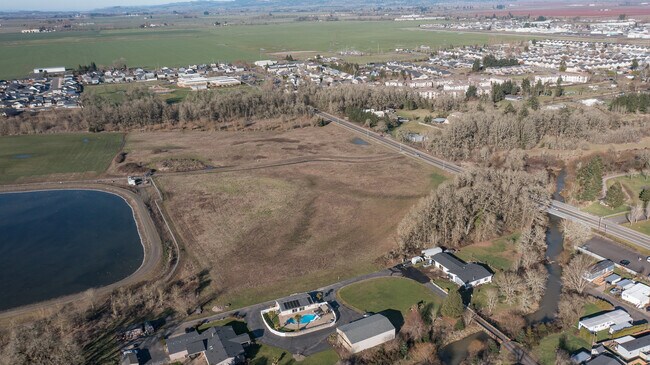
Property Record
510 N 16Th St, Monmouth, OR 97361
NEARBY LISTINGS FOR SALE OR LEASE
Property Detail
510 N 16Th St
Salem, OR
Partition Plat 2002-0017
215105
PARTITION PLAT 2002-0017 LOT 2
Publicschool
Polk
AE
Oregon
41053C0402F
2
0
41.98 AC
2025
Polk County
020306
Portland
58,305 SF
DEMOGRAPHICS near 510 N 16Th St
1 Mile
3 Mile
5 Mile
2024 Total Population
8,456
23,262
24,964
2029 Population
9,034
25,110
26,871
Pop Growth 2024-2029
+ 6.84%
+ 7.94%
+ 7.64%
Average Age
35
35
36
2024 Total Households
2,789
7,823
8,448
HH Growth 2024-2029
+ 7.14%
+ 8.19%
+ 7.85%
Median Household Inc
$63,138
$62,073
$64,214
Avg Household Size
2.80
2.80
2.80
2024 Avg HH Vehicles
2.00
2.00
2.00
Median Home Value
$301,113
$337,329
$349,451
Median Year Built
1992
1994
1993
Nearby Places
Map Layers
Map Styles
 Street
 Aerial
- Restaurants
- Banks
- Shops
- Fitness
- Groceries
SALE & LEASE HISTORY
LISTING DATE
SALE/LEASE

May 22, 2025
For Sale
Nearby Properties
Address
Land Use
TOTAL SIZE
Lot Size
Zoning
Address
Land Use
TOTAL SIZE
Lot Size
Zoning
80,258 SF
8.24 AC
PSC
Address
Land Use
TOTAL SIZE
Lot Size
Zoning
10 SF
32.46 AC
PSC
Address
Land Use
TOTAL SIZE
Lot Size
Zoning
10 SF
14.45 AC
PSC
Address
Land Use
TOTAL SIZE
Lot Size
Zoning
216,688 SF
16.43 AC
PS
Address
Land Use
TOTAL SIZE
Lot Size
Zoning
22,385 SF
7.28 AC
PSC
Address
Land Use
TOTAL SIZE
Lot Size
Zoning
98,870 SF
2.50 AC
PSC
Address
Land Use
TOTAL SIZE
Lot Size
Zoning
94,783 SF
15.86 AC
PS
Address
Land Use
TOTAL SIZE
Lot Size
Zoning
65,155 SF
4.09 AC
RH
Address
Land Use
TOTAL SIZE
Lot Size
Zoning
10 SF
2.50 AC
PSC
Address
Land Use
TOTAL SIZE
Lot Size
Zoning
195,605 SF
10.13 AC
MUPC
Address
Land Use
TOTAL SIZE
Lot Size
Zoning
6,322 SF
9.88 AC
PSC
Address
Land Use
TOTAL SIZE
Lot Size
Zoning
541,879 SF
3.52 AC
RH
Address
Land Use
TOTAL SIZE
Lot Size
Zoning
201,840 SF
15.43 AC
RM
Address
Land Use
TOTAL SIZE
Lot Size
Zoning
10 SF
5.84 AC
RMX
Address
Land Use
TOTAL SIZE
Lot Size
Zoning
43,319 SF
1.80 AC
PS
Address
Land Use
TOTAL SIZE
Lot Size
Zoning
10 SF
2.50 AC
PSC
Address
Land Use
TOTAL SIZE
Lot Size
Zoning
10 SF
23.37 AC
IL
Address
Land Use
TOTAL SIZE
Lot Size
Zoning
159,089 SF
3.26 AC
IH
Address
Land Use
TOTAL SIZE
Lot Size
Zoning
58,945 SF
4.24 AC
PS
Address
Land Use
TOTAL SIZE
Lot Size
Zoning
159,089 SF
1.94 AC
IH
Address
Land Use
TOTAL SIZE
Lot Size
Zoning
18,896 SF
1.17 AC
CRD
Address
Land Use
TOTAL SIZE
Lot Size
Zoning
41,314 SF
8.01 AC
CR
Address
Land Use
TOTAL SIZE
Lot Size
Zoning
48,242 SF
2.32 AC
CH
Address
Land Use
TOTAL SIZE
Lot Size
Zoning
71,956 SF
6.08 AC
RS
Address
Land Use
TOTAL SIZE
Lot Size
Zoning
63,560 SF
2.83 AC
RM
Address
Land Use
TOTAL SIZE
Lot Size
Zoning
76,852 SF
8.55 AC
MUPC
Address
Land Use
TOTAL SIZE
Lot Size
Zoning
46,880 SF
13.54 AC
PSC
Address
Land Use
TOTAL SIZE
Lot Size
Zoning
33,138 SF
0.41 AC
CRD
Address
Land Use
TOTAL SIZE
Lot Size
Zoning
13,792 SF
1.83 AC
CO
The World's #1 Commercial Real Estate Marketplace
Connect with us
© 2026 CoStar Group
The information above has been obtained from sources believed reliable. While we do not doubt its accuracy we have not verified it and make no guarantee, warranty or representation about it. It is your responsibility to independently confirm its accuracy and completeness. Any projections, opinions, assumptions, or estimates used are for example only and do not represent the current or future performance of the property. The value of this transaction to you depends on tax and other factors which should be evaluated by your tax, financial, and legal advisors. You and your advisors should conduct a careful, independent investigation of the property to determine to your satisfaction the suitability of the property for your needs.