Property Record
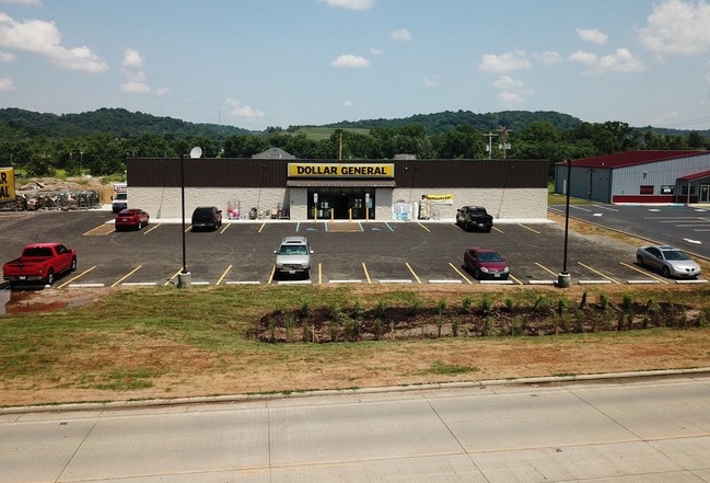
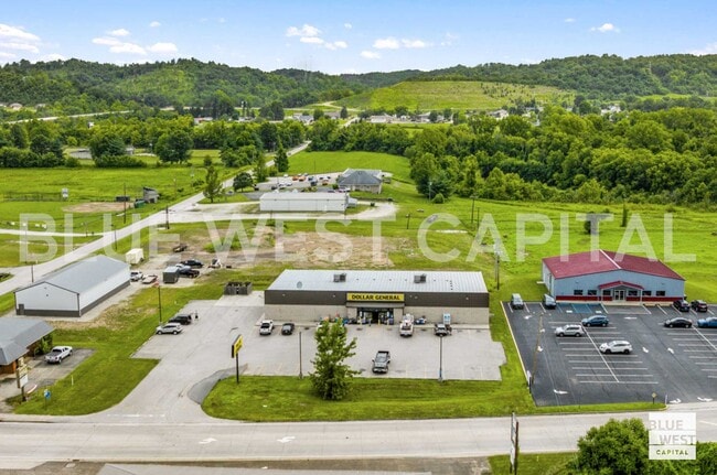
510 State St, Proctorville, OH 45669

NEARBY LISTINGS FOR SALE OR LEASE
Property Detail
510 State St
26-072-0200.001
16-1-24 25 1 PT N & E OF CORPLINE PT 1.34AC
Commercialnec
Lawrence
AE
Ohio
54099C0050C
1.34 AC
0
Lawrence County
2024
Huntington/Ashland
051300
Huntington-Ashland, WV-KY-OH
9,220 SF
DEMOGRAPHICS near 510 State St
1 Mile
3 Mile
5 Mile
2024 Total Population
3,359
31,073
68,493
2029 Population
3,308
30,511
67,463
Pop Growth 2024-2029
(1.52%)
(1.81%)
(1.50%)
Average Age
42
40
40
2024 Total Households
1,462
13,189
29,554
HH Growth 2024-2029
(1.50%)
(1.92%)
(1.56%)
Median Household Inc
$35,171
$45,317
$47,536
Avg Household Size
2.20
2.20
2.10
2024 Avg HH Vehicles
2.00
2.00
2.00
Median Home Value
$104,545
$118,564
$148,076
Median Year Built
1965
1964
1965
Nearby Places
Map Layers
Map Styles
 Street
 Aerial
- Restaurants
- Banks
- Shops
- Fitness
- Groceries
PUBLIC TRANSPORTATION
COMMUTER RAIL
Huntington Amtrak Station (Cardinal - Amtrak)
DRIVE
WALK
Distance
Huntington Amtrak Station (Cardinal - Amtrak)
13 min
6.2 mi
AIRPORT
Tri-State/Milton J Ferguson Field
DRIVE
WALK
Distance
Tri-State/Milton J Ferguson Field
29 min
18.4 mi
Freight Ports
Port of Toledo
DRIVE
WALK
Distance
Port of Toledo
357 min
275.1 mi
SALE & LEASE HISTORY
LISTING DATE
SALE/LEASE

Jul 22, 2025
For Sale
Nearby Properties
Address
Land Use
TOTAL SIZE
Lot Size
Zoning
Address
Land Use
TOTAL SIZE
Lot Size
Zoning
26.52 AC
Address
Land Use
TOTAL SIZE
Lot Size
Zoning
1.35 AC
Address
Land Use
TOTAL SIZE
Lot Size
Zoning
0.20 AC
Address
Land Use
TOTAL SIZE
Lot Size
Zoning
6.13 AC
Address
Land Use
TOTAL SIZE
Lot Size
Zoning
0.27 AC
Address
Land Use
TOTAL SIZE
Lot Size
Zoning
0.79 AC
Address
Land Use
TOTAL SIZE
Lot Size
Zoning
83.50 AC
Address
Land Use
TOTAL SIZE
Lot Size
Zoning
16.47 AC
Address
Land Use
TOTAL SIZE
Lot Size
Zoning
0.55 AC
Address
Land Use
TOTAL SIZE
Lot Size
Zoning
29.35 AC
Address
Land Use
TOTAL SIZE
Lot Size
Zoning
1.41 AC
Address
Land Use
TOTAL SIZE
Lot Size
Zoning
4.12 AC
Address
Land Use
TOTAL SIZE
Lot Size
Zoning
1.25 AC
Address
Land Use
TOTAL SIZE
Lot Size
Zoning
2.29 AC
Address
Land Use
TOTAL SIZE
Lot Size
Zoning
49.03 AC
Address
Land Use
TOTAL SIZE
Lot Size
Zoning
35.03 AC
Address
Land Use
TOTAL SIZE
Lot Size
Zoning
14.23 AC
Address
Land Use
TOTAL SIZE
Lot Size
Zoning
2,550 SF
5.47 AC
Address
Land Use
TOTAL SIZE
Lot Size
Zoning
12.40 AC
Address
Land Use
TOTAL SIZE
Lot Size
Zoning
Address
Land Use
TOTAL SIZE
Lot Size
Zoning
Address
Land Use
TOTAL SIZE
Lot Size
Zoning
144,332 SF
13.43 AC
Address
Land Use
TOTAL SIZE
Lot Size
Zoning
Address
Land Use
TOTAL SIZE
Lot Size
Zoning
50.86 AC
Address
Land Use
TOTAL SIZE
Lot Size
Zoning
9.71 AC
Address
Land Use
TOTAL SIZE
Lot Size
Zoning
200.77 AC
Address
Land Use
TOTAL SIZE
Lot Size
Zoning
16.27 AC
Address
Land Use
TOTAL SIZE
Lot Size
Zoning
14.10 AC
Address
Land Use
TOTAL SIZE
Lot Size
Zoning
11.07 AC
Address
Land Use
TOTAL SIZE
Lot Size
Zoning
32.70 AC
The World's #1 Commercial Real Estate Marketplace
Connect with us
© 2025 CoStar Group
The information above has been obtained from sources believed reliable. While we do not doubt its accuracy we have not verified it and make no guarantee, warranty or representation about it. It is your responsibility to independently confirm its accuracy and completeness. Any projections, opinions, assumptions, or estimates used are for example only and do not represent the current or future performance of the property. The value of this transaction to you depends on tax and other factors which should be evaluated by your tax, financial, and legal advisors. You and your advisors should conduct a careful, independent investigation of the property to determine to your satisfaction the suitability of the property for your needs.