Property Record
510 Table Rock Rd, Cleveland, SC 29635


NEARBY LISTINGS FOR SALE OR LEASE
-
-
View all Cleveland listings for sale on LoopNet.com
Property Detail
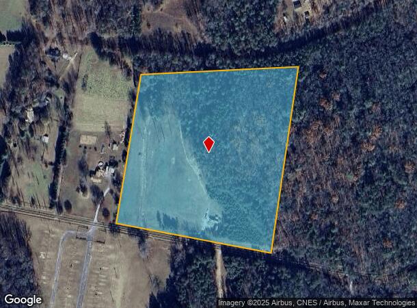
510 Table Rock Rd
Greenville-Anderson-Mauldin, SC
Survey For John H Bowles
0687.06-01-009.06
1,PT.2
Agriculturalland
Greenville
X
South Carolina
45045C0175E
009.06
2024
13.80 AC
2024
Travelers Rest
004102
Greenville/Spartanburg
DEMOGRAPHICS near 510 Table Rock Rd
1 Mile
3 Mile
5 Mile
2024 Total Population
263
1,548
2,986
2029 Population
297
1,667
3,232
Pop Growth 2024-2029
+ 12.93%
+ 7.69%
+ 8.24%
Average Age
50
47
48
2024 Total Households
120
663
1,307
HH Growth 2024-2029
+ 13.33%
+ 8.14%
+ 8.65%
Median Household Inc
$62,282
$43,312
$52,750
Avg Household Size
2.20
2.30
2.20
2024 Avg HH Vehicles
2.00
2.00
2.00
Median Home Value
$214,706
$207,317
$226,260
Median Year Built
1992
1991
1992
Nearby Places
Map Layers
Map Styles
 Street
 Aerial
- Restaurants
- Banks
- Shops
- Fitness
- Groceries
PUBLIC TRANSPORTATION
AIRPORT
Greenville Spartanburg International
DRIVE
WALK
Distance
Greenville Spartanburg International
62 min
35.5 mi
Asheville Regional
DRIVE
WALK
Distance
Asheville Regional
59 min
43.0 mi
Freight Ports
North Charleston Terminal
DRIVE
WALK
Distance
North Charleston Terminal
275 min
230.1 mi
SALE & LEASE HISTORY
LISTING DATE
SALE/LEASE

Dec 09, 2020
For Sale
Nearby Properties
Address
Land Use
TOTAL SIZE
Lot Size
Zoning
Address
Land Use
TOTAL SIZE
Lot Size
Zoning
1,240.70 AC
UNZONED
Address
Land Use
TOTAL SIZE
Lot Size
Zoning
1,828 AC
UNZONED
Address
Land Use
TOTAL SIZE
Lot Size
Zoning
592 AC
UNZONED
Address
Land Use
TOTAL SIZE
Lot Size
Zoning
305.20 AC
R20
Address
Land Use
TOTAL SIZE
Lot Size
Zoning
251 AC
UNZONED
Address
Land Use
TOTAL SIZE
Lot Size
Zoning
350 AC
UNZONED
Address
Land Use
TOTAL SIZE
Lot Size
Zoning
154.63 AC
UNZONED
Address
Land Use
TOTAL SIZE
Lot Size
Zoning
212 AC
UNZONED
Address
Land Use
TOTAL SIZE
Lot Size
Zoning
94.29 AC
UNZONED
Address
Land Use
TOTAL SIZE
Lot Size
Zoning
53.60 AC
Address
Land Use
TOTAL SIZE
Lot Size
Zoning
48.03 AC
UNZONED
Address
Land Use
TOTAL SIZE
Lot Size
Zoning
16.26 AC
UNZONED
Address
Land Use
TOTAL SIZE
Lot Size
Zoning
30.20 AC
UNZONED
Address
Land Use
TOTAL SIZE
Lot Size
Zoning
6,848.42 AC
UNZONED
Address
Land Use
TOTAL SIZE
Lot Size
Zoning
11.70 AC
Address
Land Use
TOTAL SIZE
Lot Size
Zoning
40.10 AC
UNZONED
Address
Land Use
TOTAL SIZE
Lot Size
Zoning
23.80 AC
UNZONED
Address
Land Use
TOTAL SIZE
Lot Size
Zoning
Address
Land Use
TOTAL SIZE
Lot Size
Zoning
10.80 AC
UNZONED
Address
Land Use
TOTAL SIZE
Lot Size
Zoning
2,248 SF
1.99 AC
Address
Land Use
TOTAL SIZE
Lot Size
Zoning
7.60 AC
UNZONED
Address
Land Use
TOTAL SIZE
Lot Size
Zoning
1 AC
UNZONED
Address
Land Use
TOTAL SIZE
Lot Size
Zoning
23.90 AC
UNZONED
Address
Land Use
TOTAL SIZE
Lot Size
Zoning
6,536 SF
7 AC
Address
Land Use
TOTAL SIZE
Lot Size
Zoning
0.62 AC
R20
Address
Land Use
TOTAL SIZE
Lot Size
Zoning
1,336 SF
1.35 AC
Address
Land Use
TOTAL SIZE
Lot Size
Zoning
2.10 AC
UNZONED
Address
Land Use
TOTAL SIZE
Lot Size
Zoning
4.08 AC
UNZONED
Address
Land Use
TOTAL SIZE
Lot Size
Zoning
30.04 AC
Address
Land Use
TOTAL SIZE
Lot Size
Zoning
1,500 SF
12.79 AC
The World's #1 Commercial Real Estate Marketplace
Connect with us
© 2025 CoStar Group
The information above has been obtained from sources believed reliable. While we do not doubt its accuracy we have not verified it and make no guarantee, warranty or representation about it. It is your responsibility to independently confirm its accuracy and completeness. Any projections, opinions, assumptions, or estimates used are for example only and do not represent the current or future performance of the property. The value of this transaction to you depends on tax and other factors which should be evaluated by your tax, financial, and legal advisors. You and your advisors should conduct a careful, independent investigation of the property to determine to your satisfaction the suitability of the property for your needs.