Property Record
510 Us Highway 202, Bennington, NH 03442


NEARBY LISTINGS FOR SALE OR LEASE
-
-
View all Bennington listings for sale on LoopNet.com
Property Detail
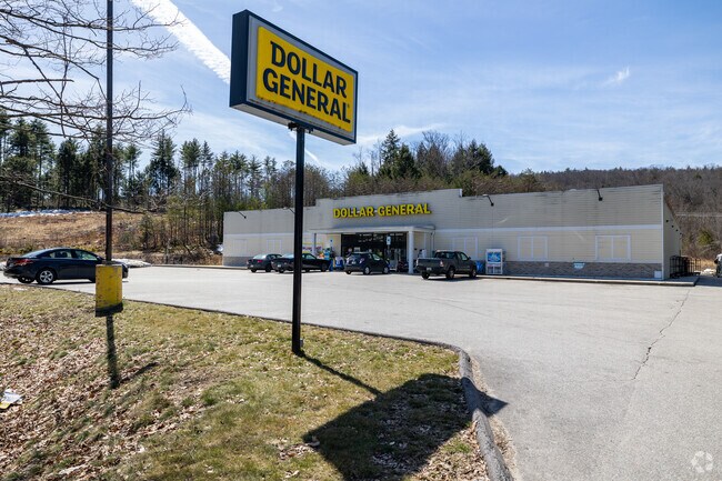
510 Us Highway 202
BENN-000016-000002
Hillsborough
Residentialacreage
New Hampshire
X
19.39 AC
33011C0143D
Hillsborough
2024
Boston
2024
Manchester-Nashua, NH
021500
DEMOGRAPHICS near 510 Us Highway 202
1 Mile
3 Mile
5 Mile
2024 Total Population
702
3,443
6,303
2029 Population
698
3,474
6,398
Pop Growth 2024-2029
(0.57%)
+ 0.90%
+ 1.51%
Average Age
41
43
45
2024 Total Households
279
1,411
2,613
HH Growth 2024-2029
(0.36%)
+ 0.92%
+ 1.49%
Median Household Inc
$68,231
$70,440
$74,980
Avg Household Size
2.50
2.40
2.40
2024 Avg HH Vehicles
2.00
2.00
2.00
Median Home Value
$269,444
$272,712
$320,398
Median Year Built
1961
1969
1971
Nearby Places
Map Layers
Map Styles
 Street
 Aerial
- Restaurants
- Banks
- Shops
- Fitness
- Groceries
PUBLIC TRANSPORTATION
AIRPORT
Manchester Boston Regional
DRIVE
WALK
Distance
Manchester Boston Regional
72 min
35.3 mi
Freight Ports
Port of Boston
DRIVE
WALK
Distance
Port of Boston
134 min
81.8 mi
SALE & LEASE HISTORY
LISTING DATE
SALE/LEASE

Jul 26, 2023
For Sale
Nearby Properties
Address
Land Use
TOTAL SIZE
Lot Size
Zoning
Address
Land Use
TOTAL SIZE
Lot Size
Zoning
0.39 AC
Address
Land Use
TOTAL SIZE
Lot Size
Zoning
Address
Land Use
TOTAL SIZE
Lot Size
Zoning
209,372 SF
50.38 AC
IND I
Address
Land Use
TOTAL SIZE
Lot Size
Zoning
22,864 SF
1.79 AC
VIL V
Address
Land Use
TOTAL SIZE
Lot Size
Zoning
35,472 SF
0.98 AC
RESIDE
Address
Land Use
TOTAL SIZE
Lot Size
Zoning
Address
Land Use
TOTAL SIZE
Lot Size
Zoning
42,788 SF
10 AC
CR C
Address
Land Use
TOTAL SIZE
Lot Size
Zoning
6,500 SF
5.35 AC
RESIDE
Address
Land Use
TOTAL SIZE
Lot Size
Zoning
8,549 SF
147.40 AC
RA R
Address
Land Use
TOTAL SIZE
Lot Size
Zoning
4,500 SF
12.87 AC
HIGHWA
Address
Land Use
TOTAL SIZE
Lot Size
Zoning
47,470 SF
4.66 AC
VILLAG
Address
Land Use
TOTAL SIZE
Lot Size
Zoning
87.60 AC
GRD
Address
Land Use
TOTAL SIZE
Lot Size
Zoning
9,727 SF
2.58 AC
CR C
Address
Land Use
TOTAL SIZE
Lot Size
Zoning
3,732 SF
2.36 AC
VILLAG
Address
Land Use
TOTAL SIZE
Lot Size
Zoning
VIL V
Address
Land Use
TOTAL SIZE
Lot Size
Zoning
9,360 SF
0.60 AC
VILLAG
Address
Land Use
TOTAL SIZE
Lot Size
Zoning
2,713 SF
6.03 AC
RURAL
Address
Land Use
TOTAL SIZE
Lot Size
Zoning
5,429 SF
0.65 AC
VILLAG
Address
Land Use
TOTAL SIZE
Lot Size
Zoning
9,621 SF
233 AC
RA R
Address
Land Use
TOTAL SIZE
Lot Size
Zoning
6,497 SF
1.30 AC
VILLAG
Address
Land Use
TOTAL SIZE
Lot Size
Zoning
6,031 SF
0.29 AC
VILLAG
Address
Land Use
TOTAL SIZE
Lot Size
Zoning
5,642 SF
5.10 AC
Address
Land Use
TOTAL SIZE
Lot Size
Zoning
8,778 SF
0.96 AC
RESIDE
Address
Land Use
TOTAL SIZE
Lot Size
Zoning
7,918 SF
3.72 AC
CR C
Address
Land Use
TOTAL SIZE
Lot Size
Zoning
13,516 SF
1.60 AC
VILLAG
Address
Land Use
TOTAL SIZE
Lot Size
Zoning
5,886 SF
5.32 AC
RURALR
Address
Land Use
TOTAL SIZE
Lot Size
Zoning
3,625 SF
1.33 AC
RESIDE
Address
Land Use
TOTAL SIZE
Lot Size
Zoning
11,500 SF
2.16 AC
HIGHWA
Address
Land Use
TOTAL SIZE
Lot Size
Zoning
3,054 SF
2.76 AC
VILLAG
Address
Land Use
TOTAL SIZE
Lot Size
Zoning
35,789 SF
2.07 AC
VILLAG
The World's #1 Commercial Real Estate Marketplace
Connect with us
© 2026 CoStar Group
The information above has been obtained from sources believed reliable. While we do not doubt its accuracy we have not verified it and make no guarantee, warranty or representation about it. It is your responsibility to independently confirm its accuracy and completeness. Any projections, opinions, assumptions, or estimates used are for example only and do not represent the current or future performance of the property. The value of this transaction to you depends on tax and other factors which should be evaluated by your tax, financial, and legal advisors. You and your advisors should conduct a careful, independent investigation of the property to determine to your satisfaction the suitability of the property for your needs.