Property Record
510 W Main St, Azle, TX 76020

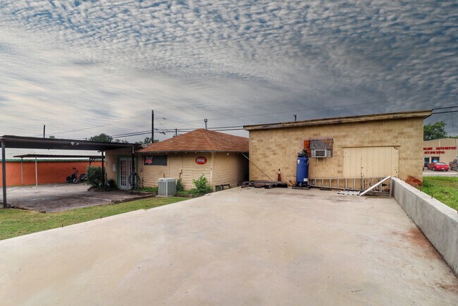
Property Detail
510 W Main St
Dallas-Fort Worth-Arlington, TX
ACRES: 0.227 LOT: 2 BLK: 1 SUBD: LEAH SEE ADDN 2
R000080819
Parker
Commercialnec
Texas
B and X Area of moderate flood hazard, usually the area between the limits of the 100-year and 500-year floods.
2
2024
0.23 AC
2025
Parker County
140408
Dallas/Ft Worth
1,680 SF
NEARBY LISTINGS FOR SALE OR LEASE
DEMOGRAPHICS near 510 W Main St
1 mile
3 mile
5 mile
2024 Total Population
7,387
31,182
49,402
2029 Population
9,496
40,276
63,867
Pop Growth 2024-2029
+ 28.55%
+ 29.16%
+ 29.28%
Average Age
39
40
40
2024 Total Households
2,920
12,323
19,035
HH Growth 2024-2029
+ 28.56%
+ 29.25%
+ 29.31%
Median Household Inc
$47,256
$61,520
$67,460
Avg Household Size
2.40
2.40
2.50
2024 Avg HH Vehicles
2.00
2.00
2.00
Median Home Value
$191,829
$238,874
$278,821
Median Year Built
1974
1991
1999
Nearby Places
Map Layers
Map Styles
 Street
 Aerial
Transit
 Traffic
 Biking
Places
Listings with unknown addresses are not visible on the map
- Restaurants
- Banks
- Shops
- Fitness
- Groceries
PUBLIC TRANSPORTATION
AIRPORT
Dallas-Fort Worth International
Drive
Walk
Distance
Dallas-Fort Worth International
51 min
38.6 mi
SALE & LEASE HISTORY
LISTING DATE
SALE/LEASE

Oct 05, 2018
For Sale
May 30, 2019
For Sale
Mar 10, 2020
For Sale
Jun 24, 2021
For Sale
Nearby Properties
Address
Land Use
TOTAL SIZE
Lot Size
Zoning
Address
Land Use
TOTAL SIZE
Lot Size
Zoning
504.76 AC
Address
Land Use
TOTAL SIZE
Lot Size
Zoning
281,946 SF
16.01 AC
Address
Land Use
TOTAL SIZE
Lot Size
Zoning
228,201 SF
9.96 AC
Address
Land Use
TOTAL SIZE
Lot Size
Zoning
208,984 SF
14.42 AC
Address
Land Use
TOTAL SIZE
Lot Size
Zoning
262,793 SF
67.85 AC
Address
Land Use
TOTAL SIZE
Lot Size
Zoning
185,807 SF
14.03 AC
Address
Land Use
TOTAL SIZE
Lot Size
Zoning
43,610 SF
15.02 AC
Address
Land Use
TOTAL SIZE
Lot Size
Zoning
28,901 SF
14.03 AC
Address
Land Use
TOTAL SIZE
Lot Size
Zoning
62,068 SF
18.93 AC
Address
Land Use
TOTAL SIZE
Lot Size
Zoning
119.88 AC
Address
Land Use
TOTAL SIZE
Lot Size
Zoning
36,452 SF
10 AC
Address
Land Use
TOTAL SIZE
Lot Size
Zoning
221.50 AC
Address
Land Use
TOTAL SIZE
Lot Size
Zoning
105,385 SF
20 AC
Address
Land Use
TOTAL SIZE
Lot Size
Zoning
50,103 SF
11.48 AC
Address
Land Use
TOTAL SIZE
Lot Size
Zoning
62,536 SF
30.53 AC
Address
Land Use
TOTAL SIZE
Lot Size
Zoning
32,091 SF
117.44 AC
Address
Land Use
TOTAL SIZE
Lot Size
Zoning
1,728 SF
17.73 AC
Address
Land Use
TOTAL SIZE
Lot Size
Zoning
90,949 SF
5.32 AC
Address
Land Use
TOTAL SIZE
Lot Size
Zoning
32,334 SF
3.52 AC
Address
Land Use
TOTAL SIZE
Lot Size
Zoning
69,227 SF
19.02 AC
Address
Land Use
TOTAL SIZE
Lot Size
Zoning
62,538 SF
9.19 AC
Address
Land Use
TOTAL SIZE
Lot Size
Zoning
82.25 AC
Address
Land Use
TOTAL SIZE
Lot Size
Zoning
21,141 SF
4.14 AC
Address
Land Use
TOTAL SIZE
Lot Size
Zoning
33,930 SF
18.70 AC
Address
Land Use
TOTAL SIZE
Lot Size
Zoning
71,740 SF
1.75 AC
Address
Land Use
TOTAL SIZE
Lot Size
Zoning
148.37 AC
Address
Land Use
TOTAL SIZE
Lot Size
Zoning
44,264 SF
2.57 AC
Address
Land Use
TOTAL SIZE
Lot Size
Zoning
42,206 SF
2.67 AC
Address
Land Use
TOTAL SIZE
Lot Size
Zoning
41,371 SF
1.62 AC
Address
Land Use
TOTAL SIZE
Lot Size
Zoning
42,008 SF
4.13 AC
The World's #1 Commercial Real Estate Marketplace
Connect with us
© 2026 CoStar Group
The information above has been obtained from sources believed reliable. While we do not doubt its accuracy we have not verified it and make no guarantee, warranty or representation about it. It is your responsibility to independently confirm its accuracy and completeness. Any projections, opinions, assumptions, or estimates used are for example only and do not represent the current or future performance of the property. The value of this transaction to you depends on tax and other factors which should be evaluated by your tax, financial, and legal advisors. You and your advisors should conduct a careful, independent investigation of the property to determine to your satisfaction the suitability of the property for your needs.