Property Record
510 W Mesquite Blvd, Mesquite, NV 89027
NEARBY LISTINGS FOR SALE OR LEASE
-
-
View all Mesquite listings for sale on LoopNet.com
Property Detail
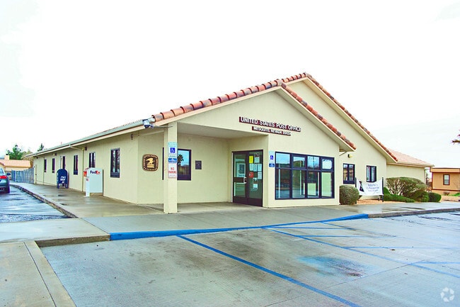
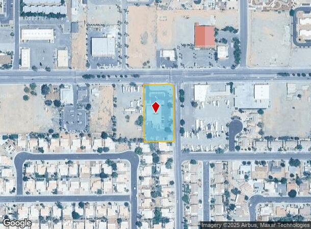
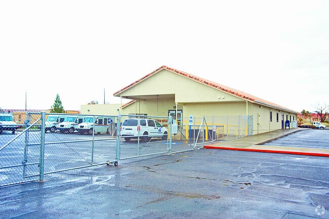
510 W Mesquite Blvd
Las Vegas-Henderson-North Las Vegas, NV
Parcel Map File 116 Page 100
001-17-701-040
PARCEL MAP FILE 116 PAGE 100 LOT 2
Governmentalpublicusegeneral
Clark
X
Nevada
04015C0400G
2
2024
1.49 AC
2025
Outlying NE Clark County
005607
Las Vegas
7,654 SF
DEMOGRAPHICS near 510 W Mesquite Blvd
1 Mile
3 Mile
5 Mile
2024 Total Population
9,618
25,562
27,578
2029 Population
10,536
28,287
30,414
Pop Growth 2024-2029
+ 9.54%
+ 10.66%
+ 10.28%
Average Age
45
55
54
2024 Total Households
3,836
11,796
12,595
HH Growth 2024-2029
+ 9.52%
+ 10.79%
+ 10.52%
Median Household Inc
$61,003
$65,045
$64,485
Avg Household Size
2.40
2.10
2.10
2024 Avg HH Vehicles
2.00
2.00
2.00
Median Home Value
$308,864
$366,574
$366,258
Median Year Built
2000
2004
2004
Nearby Places
Map Layers
Map Styles
 Street
 Aerial
- Restaurants
- Banks
- Shops
- Fitness
- Groceries
PUBLIC TRANSPORTATION
AIRPORT
St George Regional
DRIVE
WALK
Distance
St George Regional
54 min
40.8 mi
Nearby Properties
Address
Land Use
TOTAL SIZE
Lot Size
Zoning
Address
Land Use
TOTAL SIZE
Lot Size
Zoning
148,373 SF
19.35 AC
HT
Address
Land Use
TOTAL SIZE
Lot Size
Zoning
197,938 SF
35.63 AC
HT
Address
Land Use
TOTAL SIZE
Lot Size
Zoning
123,397 SF
26.60 AC
HT
Address
Land Use
TOTAL SIZE
Lot Size
Zoning
568,553 SF
56.06 AC
IR1
Address
Land Use
TOTAL SIZE
Lot Size
Zoning
83,429 SF
23.92 AC
CRH
Address
Land Use
TOTAL SIZE
Lot Size
Zoning
496,775 SF
5.02 AC
HT
Address
Land Use
TOTAL SIZE
Lot Size
Zoning
33.73 AC
PF
Address
Land Use
TOTAL SIZE
Lot Size
Zoning
37.78 AC
PROS
Address
Land Use
TOTAL SIZE
Lot Size
Zoning
12.49 AC
PF
Address
Land Use
TOTAL SIZE
Lot Size
Zoning
154,961 SF
17.17 AC
PUD
Address
Land Use
TOTAL SIZE
Lot Size
Zoning
107,554 SF
10.04 AC
Address
Land Use
TOTAL SIZE
Lot Size
Zoning
10.09 AC
PF
Address
Land Use
TOTAL SIZE
Lot Size
Zoning
73,517 SF
164.64 AC
PF
Address
Land Use
TOTAL SIZE
Lot Size
Zoning
81,518 SF
1.87 AC
PUD
Address
Land Use
TOTAL SIZE
Lot Size
Zoning
67,184 SF
14.69 AC
HT
Address
Land Use
TOTAL SIZE
Lot Size
Zoning
3,450 SF
4.93 AC
PB
Address
Land Use
TOTAL SIZE
Lot Size
Zoning
17,110 SF
2.11 AC
Address
Land Use
TOTAL SIZE
Lot Size
Zoning
6,831 SF
6.01 AC
CR2
Address
Land Use
TOTAL SIZE
Lot Size
Zoning
111,642 SF
8.35 AC
IR1
Address
Land Use
TOTAL SIZE
Lot Size
Zoning
47,328 SF
4.65 AC
CR2
Address
Land Use
TOTAL SIZE
Lot Size
Zoning
66,537 SF
6.27 AC
PUD
Address
Land Use
TOTAL SIZE
Lot Size
Zoning
1,056 SF
5.96 AC
MF4
Address
Land Use
TOTAL SIZE
Lot Size
Zoning
60,114 SF
5.54 AC
HT
Address
Land Use
TOTAL SIZE
Lot Size
Zoning
13,286 SF
1.63 AC
Address
Land Use
TOTAL SIZE
Lot Size
Zoning
4.11 AC
CR3
Address
Land Use
TOTAL SIZE
Lot Size
Zoning
11,249 SF
220.36 AC
PUD
Address
Land Use
TOTAL SIZE
Lot Size
Zoning
52,240 SF
3.74 AC
CR2
The World's #1 Commercial Real Estate Marketplace
Connect with us
© 2026 CoStar Group
The information above has been obtained from sources believed reliable. While we do not doubt its accuracy we have not verified it and make no guarantee, warranty or representation about it. It is your responsibility to independently confirm its accuracy and completeness. Any projections, opinions, assumptions, or estimates used are for example only and do not represent the current or future performance of the property. The value of this transaction to you depends on tax and other factors which should be evaluated by your tax, financial, and legal advisors. You and your advisors should conduct a careful, independent investigation of the property to determine to your satisfaction the suitability of the property for your needs.