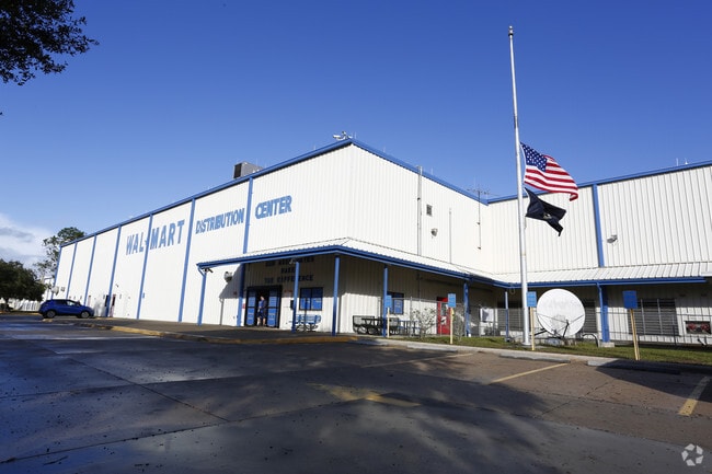
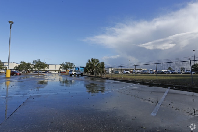
Property Record
5100 Kettering Rd, Brooksville, FL 34602

Property Detail
5100 Kettering Rd
R09-423-21-0000-0020-0020
THE N 3300 FT OF SEC 9 LYING W OF OLD R/R & E OF KETTERING RD LESS RD R/W AS DES IN OR 824 PG 1002
Warehouse
Hernando
AE The base floodplain where base flood elevations are provided. AE Zones are now used on new format FIRMs instead of A1-A30 Zones.
Florida
2025
193.60 AC
2025
Hernando County
040102
Tampa/St Petersburg
1,496,353 SF
Tampa-St. Petersburg-Clearwater, FL
NEARBY LISTINGS FOR SALE OR LEASE
DEMOGRAPHICS near 5100 Kettering Rd
1 mile
3 mile
5 mile
2025 Total Population
411
8,229
16,442
2030 Population
470
9,149
18,350
Pop Growth 2025-2030
+ 14.36%
+ 11.18%
+ 11.60%
Average Age
43
43
42
2025 Total Households
160
3,311
6,368
HH Growth 2025-2030
+ 14.38%
+ 11.05%
+ 11.42%
Median Household Inc
$59,999
$59,756
$63,280
Avg Household Size
2.40
2.40
2.50
2025 Avg HH Vehicles
1.00
2.00
2.00
Median Home Value
$281,481
$309,276
$299,745
Median Year Built
1995
1988
1988
Nearby Places
Map Layers
Map Styles
 Street
 Aerial
Layers
 Traffic
 Biking
Places
Listings with unknown addresses are not visible on the map
- Restaurants
- Banks
- Shops
- Fitness
- Groceries
Nearby Properties
Address
Land Use
TOTAL SIZE
Lot Size
Zoning
Address
Land Use
TOTAL SIZE
Lot Size
Zoning
113.10 AC
Address
Land Use
TOTAL SIZE
Lot Size
Zoning
150,269 SF
38.80 AC
Address
Land Use
TOTAL SIZE
Lot Size
Zoning
94,814 SF
12 AC
Address
Land Use
TOTAL SIZE
Lot Size
Zoning
8,924 SF
5.20 AC
Address
Land Use
TOTAL SIZE
Lot Size
Zoning
57.90 AC
Address
Land Use
TOTAL SIZE
Lot Size
Zoning
45,626 SF
4.72 AC
Address
Land Use
TOTAL SIZE
Lot Size
Zoning
Address
Land Use
TOTAL SIZE
Lot Size
Zoning
43,210 SF
6.40 AC
Address
Land Use
TOTAL SIZE
Lot Size
Zoning
48,724 SF
2.92 AC
Address
Land Use
TOTAL SIZE
Lot Size
Zoning
Address
Land Use
TOTAL SIZE
Lot Size
Zoning
25,021 SF
1.76 AC
Address
Land Use
TOTAL SIZE
Lot Size
Zoning
4,836 SF
3.25 AC
Address
Land Use
TOTAL SIZE
Lot Size
Zoning
74,493 SF
5.80 AC
Address
Land Use
TOTAL SIZE
Lot Size
Zoning
Address
Land Use
TOTAL SIZE
Lot Size
Zoning
4,282 SF
1.13 AC
Address
Land Use
TOTAL SIZE
Lot Size
Zoning
240 SF
336.60 AC
Address
Land Use
TOTAL SIZE
Lot Size
Zoning
26.60 AC
Address
Land Use
TOTAL SIZE
Lot Size
Zoning
11.72 AC
Address
Land Use
TOTAL SIZE
Lot Size
Zoning
10,986 SF
2.79 AC
Address
Land Use
TOTAL SIZE
Lot Size
Zoning
22,568 SF
2.54 AC
Address
Land Use
TOTAL SIZE
Lot Size
Zoning
8.70 AC
Address
Land Use
TOTAL SIZE
Lot Size
Zoning
1,020 SF
22.96 AC
Address
Land Use
TOTAL SIZE
Lot Size
Zoning
238.60 AC
Address
Land Use
TOTAL SIZE
Lot Size
Zoning
19,708 SF
60 AC
Address
Land Use
TOTAL SIZE
Lot Size
Zoning
33,700 SF
4.84 AC
Address
Land Use
TOTAL SIZE
Lot Size
Zoning
2,785 SF
1.07 AC
Address
Land Use
TOTAL SIZE
Lot Size
Zoning
22.96 AC
Address
Land Use
TOTAL SIZE
Lot Size
Zoning
192.40 AC
Address
Land Use
TOTAL SIZE
Lot Size
Zoning
9,830 SF
6.80 AC
The World's #1 Commercial Real Estate Marketplace
Connect with us
© 2026 CoStar Group
The information above has been obtained from sources believed reliable. While we do not doubt its accuracy we have not verified it and make no guarantee, warranty or representation about it. It is your responsibility to independently confirm its accuracy and completeness. Any projections, opinions, assumptions, or estimates used are for example only and do not represent the current or future performance of the property. The value of this transaction to you depends on tax and other factors which should be evaluated by your tax, financial, and legal advisors. You and your advisors should conduct a careful, independent investigation of the property to determine to your satisfaction the suitability of the property for your needs.