Property Record
5100 Jackson Rd, Ann Arbor, MI 48103


Property Detail
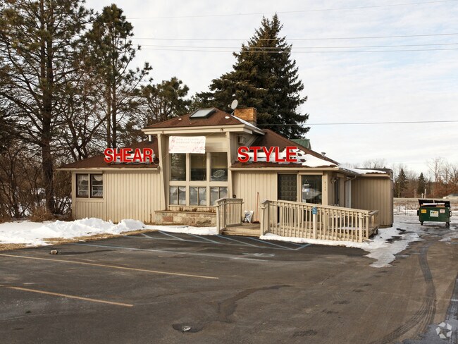
5100 Jackson Rd
08-22-302-011
COM AT E 1/4 COR OF SEC 22, TH S 86-35-28 W 2264.45 FT, TH S 1-11-32 E 1639.90 FT, TH N 80-19-57 W 323.28 FT TO POB, TH N
Commercialnec
Washtenaw
C-2
Michigan
B and X Area of moderate flood hazard, usually the area between the limits of the 100-year and 500-year floods.
1.53 AC
2025
Washtenaw W of 23
2025
Detroit
456000
Ann Arbor, MI
3,052 SF
NEARBY LISTINGS FOR SALE OR LEASE
DEMOGRAPHICS near 5100 Jackson Rd
1 mile
3 mile
5 mile
2025 Total Population
3,181
23,128
97,790
2030 Population
3,244
23,302
100,984
Pop Growth 2025-2030
+ 1.98%
+ 0.75%
+ 3.27%
Average Age
42
42
38
2025 Total Households
1,238
9,622
39,632
HH Growth 2025-2030
+ 2.18%
+ 0.84%
+ 3.32%
Median Household Inc
$145,509
$114,188
$95,634
Avg Household Size
2.50
2.40
2.30
2025 Avg HH Vehicles
2.00
2.00
2.00
Median Home Value
$501,720
$437,461
$462,813
Median Year Built
1995
1986
1980
Nearby Places
Map Layers
Map Styles
 Street
 Aerial
Layers
 Traffic
 Biking
Places
Listings with unknown addresses are not visible on the map
- Restaurants
- Banks
- Shops
- Fitness
- Groceries
PUBLIC TRANSPORTATION
COMMUTER RAIL
Ann Arbor Amtrak Station (Wolverine - Amtrak)
Drive
Walk
Distance
Ann Arbor Amtrak Station (Wolverine - Amtrak)
11 min
6.1 mi
AIRPORT
Detroit Metro Wayne County
Drive
Walk
Distance
Detroit Metro Wayne County
36 min
30.9 mi
Freight Ports
Port of Toledo
Drive
Walk
Distance
Port of Toledo
80 min
64.1 mi
Nearby Properties
Address
Land Use
TOTAL SIZE
Lot Size
Zoning
Address
Land Use
TOTAL SIZE
Lot Size
Zoning
1,760 SF
178.76 AC
MHP
Address
Land Use
TOTAL SIZE
Lot Size
Zoning
591,625 SF
80.39 AC
PUD
Address
Land Use
TOTAL SIZE
Lot Size
Zoning
303,524 SF
19.40 AC
R4B
Address
Land Use
TOTAL SIZE
Lot Size
Zoning
359,701 SF
37.70 AC
R4A
Address
Land Use
TOTAL SIZE
Lot Size
Zoning
231,262 SF
25.82 AC
C3
Address
Land Use
TOTAL SIZE
Lot Size
Zoning
179,981 SF
14.55 AC
R4A
Address
Land Use
TOTAL SIZE
Lot Size
Zoning
177,474 SF
58.03 AC
C-2
Address
Land Use
TOTAL SIZE
Lot Size
Zoning
182,625 SF
15.89 AC
C3
Address
Land Use
TOTAL SIZE
Lot Size
Zoning
13.77 AC
MR-3
Address
Land Use
TOTAL SIZE
Lot Size
Zoning
59.07 AC
R-C
Address
Land Use
TOTAL SIZE
Lot Size
Zoning
320 SF
20.95 AC
MR-3
Address
Land Use
TOTAL SIZE
Lot Size
Zoning
95,831 SF
26.98 AC
I-1
Address
Land Use
TOTAL SIZE
Lot Size
Zoning
180,899 SF
32.64 AC
C-2
Address
Land Use
TOTAL SIZE
Lot Size
Zoning
147,400 SF
34.07 AC
SEVERAL
Address
Land Use
TOTAL SIZE
Lot Size
Zoning
180,899 SF
28.14 AC
C-2
Address
Land Use
TOTAL SIZE
Lot Size
Zoning
11.21 AC
MR-3
Address
Land Use
TOTAL SIZE
Lot Size
Zoning
76,454 SF
8.94 AC
PUD
Address
Land Use
TOTAL SIZE
Lot Size
Zoning
177,614 SF
24.21 AC
SEVERAL
Address
Land Use
TOTAL SIZE
Lot Size
Zoning
443,838 SF
47.01 AC
I-1
Address
Land Use
TOTAL SIZE
Lot Size
Zoning
5.40 AC
MR-3
Address
Land Use
TOTAL SIZE
Lot Size
Zoning
114,441 SF
5.25 AC
R5
Address
Land Use
TOTAL SIZE
Lot Size
Zoning
34,992 SF
14.36 AC
C-4
Address
Land Use
TOTAL SIZE
Lot Size
Zoning
75,676 SF
5.22 AC
C3
Address
Land Use
TOTAL SIZE
Lot Size
Zoning
96,600 SF
7.41 AC
C-4
Address
Land Use
TOTAL SIZE
Lot Size
Zoning
73,480 SF
8 AC
C3
Address
Land Use
TOTAL SIZE
Lot Size
Zoning
69,050 SF
8.80 AC
R5
Address
Land Use
TOTAL SIZE
Lot Size
Zoning
61,728 SF
2.82 AC
C2B
Address
Land Use
TOTAL SIZE
Lot Size
Zoning
62,990 SF
3.70 AC
R4B
Address
Land Use
TOTAL SIZE
Lot Size
Zoning
2,913 SF
25.61 AC
C-3
Address
Land Use
TOTAL SIZE
Lot Size
Zoning
42,339 SF
10.13 AC
C-4
The World's #1 Commercial Real Estate Marketplace
Connect with us
© 2026 CoStar Group
The information above has been obtained from sources believed reliable. While we do not doubt its accuracy we have not verified it and make no guarantee, warranty or representation about it. It is your responsibility to independently confirm its accuracy and completeness. Any projections, opinions, assumptions, or estimates used are for example only and do not represent the current or future performance of the property. The value of this transaction to you depends on tax and other factors which should be evaluated by your tax, financial, and legal advisors. You and your advisors should conduct a careful, independent investigation of the property to determine to your satisfaction the suitability of the property for your needs.