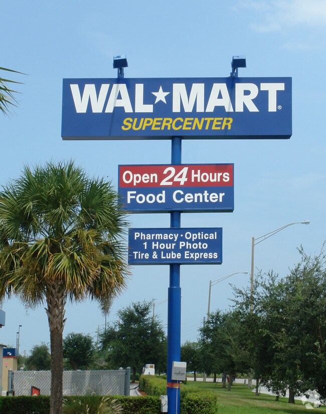
Property Record
5100 Okeechobee Rd, Fort Pierce, FL 34947


Property Detail
5100 Okeechobee Rd
24-19-602-0002-0004
WAL-MART AT FORT PIERCE TRACT B-LESS TO DOT AS IN OR 1118-2930 AND LESS THAT PART MPDAF: FROM SE COR OF TRACT C OF WAL-MART AT FORT PIERCE AND CURVE CONC NW,R OF 1850.08 FT,TH NELY ALG ARC 77.14 FT,TH N 25 41 39 W 17.13 FT TO POB,TH CONT N 25 41 39 W
Departmentstore
Saint Lucie
GENERAL CO
Florida
AE The base floodplain where base flood elevations are provided. AE Zones are now used on new format FIRMs instead of A1-A30 Zones.
b
2024
28.45 AC
2025
Fort Pierce
380700
Port St Lucie/Fort Pierce
204,977 SF
Port St. Lucie, FL
NEARBY LISTINGS FOR SALE OR LEASE
DEMOGRAPHICS near 5100 Okeechobee Rd
1 mile
3 mile
5 mile
2025 Total Population
3,828
34,448
86,961
2030 Population
4,508
39,406
99,775
Pop Growth 2025-2030
+ 17.76%
+ 14.39%
+ 14.74%
Average Age
37
37
39
2025 Total Households
1,483
11,909
31,682
HH Growth 2025-2030
+ 17.67%
+ 14.42%
+ 14.79%
Median Household Inc
$68,041
$54,456
$51,112
Avg Household Size
2.50
2.70
2.60
2025 Avg HH Vehicles
2.00
2.00
2.00
Median Home Value
$384,433
$293,244
$318,595
Median Year Built
2005
1981
1983
Nearby Places
Map Layers
Map Styles
 Street
 Aerial
Layers
 Traffic
 Biking
Places
Listings with unknown addresses are not visible on the map
- Restaurants
- Banks
- Shops
- Fitness
- Groceries
Nearby Properties
Address
Land Use
TOTAL SIZE
Lot Size
Zoning
Address
Land Use
TOTAL SIZE
Lot Size
Zoning
1,011,160 SF
129.52 AC
COMM PARKW
Address
Land Use
TOTAL SIZE
Lot Size
Zoning
206,371 SF
22.36 AC
OFFICE CO
Address
Land Use
TOTAL SIZE
Lot Size
Zoning
1,124,770 SF
201.84 AC
LIGHT INDU
Address
Land Use
TOTAL SIZE
Lot Size
Zoning
659,000 SF
67.06 AC
INDUSTRIAL
Address
Land Use
TOTAL SIZE
Lot Size
Zoning
352,224 SF
52.44 AC
SF INTERME
Address
Land Use
TOTAL SIZE
Lot Size
Zoning
95,390 SF
19.40 AC
HIGH DESIT
Address
Land Use
TOTAL SIZE
Lot Size
Zoning
245,900 SF
24.52 AC
INDUSTRIAL
Address
Land Use
TOTAL SIZE
Lot Size
Zoning
150,004 SF
29.19 AC
GENERAL CO
Address
Land Use
TOTAL SIZE
Lot Size
Zoning
119,847 SF
12.48 AC
GENERAL CO
Address
Land Use
TOTAL SIZE
Lot Size
Zoning
221,304 SF
12.71 AC
COMM PARKW
Address
Land Use
TOTAL SIZE
Lot Size
Zoning
128,427 SF
25.89 AC
MEDIUM DEN
Address
Land Use
TOTAL SIZE
Lot Size
Zoning
212,073 SF
58 AC
INSTITUTIO
Address
Land Use
TOTAL SIZE
Lot Size
Zoning
66,153 SF
24.36 AC
GENERAL &
Address
Land Use
TOTAL SIZE
Lot Size
Zoning
165,533 SF
356.77 AC
AR-1 COUNT
Address
Land Use
TOTAL SIZE
Lot Size
Zoning
225,499 SF
69.54 AC
UTILITIES
Address
Land Use
TOTAL SIZE
Lot Size
Zoning
251,724 SF
30.80 AC
GENERAL CO
Address
Land Use
TOTAL SIZE
Lot Size
Zoning
276,524 SF
53.32 AC
SF LOW DEN
Address
Land Use
TOTAL SIZE
Lot Size
Zoning
24,696 SF
18.41 AC
GENERAL CO
Address
Land Use
TOTAL SIZE
Lot Size
Zoning
42,150 SF
3.23 AC
GENERAL CO
Address
Land Use
TOTAL SIZE
Lot Size
Zoning
23,278 SF
2.67 AC
GENERAL CO
Address
Land Use
TOTAL SIZE
Lot Size
Zoning
8,312 SF
109.46 AC
COMM PARKW
Address
Land Use
TOTAL SIZE
Lot Size
Zoning
31,915 SF
2.86 AC
MEDIUM DEN
Address
Land Use
TOTAL SIZE
Lot Size
Zoning
143.81 AC
INDUST HEA
Address
Land Use
TOTAL SIZE
Lot Size
Zoning
76,783 SF
9.48 AC
INDUSTRIAL
Address
Land Use
TOTAL SIZE
Lot Size
Zoning
58,331 SF
11.31 AC
MEDIUM DEN
Address
Land Use
TOTAL SIZE
Lot Size
Zoning
115,443 SF
23.83 AC
SF INTERME
Address
Land Use
TOTAL SIZE
Lot Size
Zoning
19,123 SF
19.60 AC
INDUSTRIAL
Address
Land Use
TOTAL SIZE
Lot Size
Zoning
158,300 SF
18.61 AC
GENERAL CO
The World's #1 Commercial Real Estate Marketplace
Connect with us
© 2026 CoStar Group
The information above has been obtained from sources believed reliable. While we do not doubt its accuracy we have not verified it and make no guarantee, warranty or representation about it. It is your responsibility to independently confirm its accuracy and completeness. Any projections, opinions, assumptions, or estimates used are for example only and do not represent the current or future performance of the property. The value of this transaction to you depends on tax and other factors which should be evaluated by your tax, financial, and legal advisors. You and your advisors should conduct a careful, independent investigation of the property to determine to your satisfaction the suitability of the property for your needs.