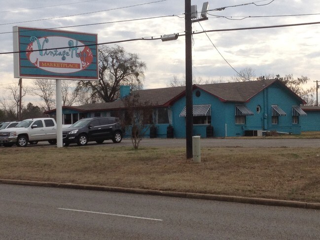
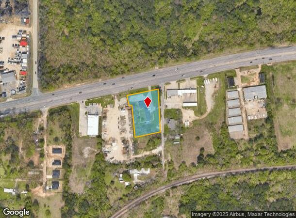
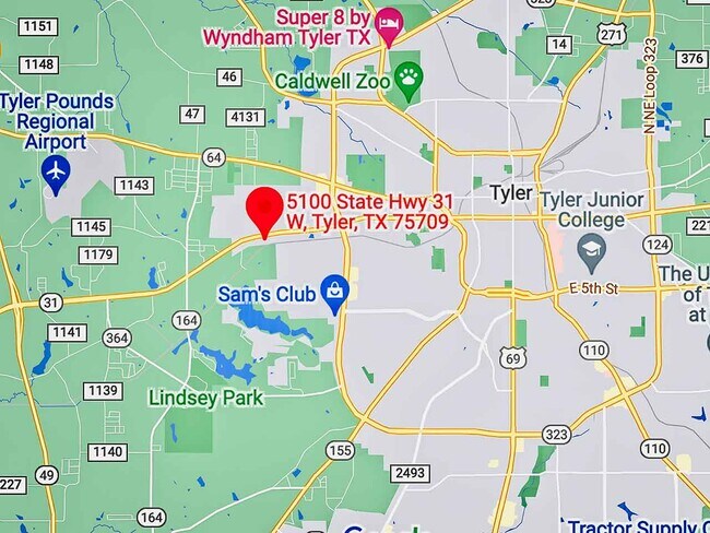
Property Record
5100 State Highway 31 W, Tyler, TX 75709
NEARBY LISTINGS FOR SALE OR LEASE
Property Detail
5100 State Highway 31 W
Tyler, TX
The Yard
1-50000-1537-00-023020
THE YARDBLOCK 1537 LOT 23B
Storebuilding
Smith
X
Texas
48423C0355D
23b
2024
1.30 AC
2025
Tyler & Longview
001602
Other Market Areas
4,194 SF
DEMOGRAPHICS near 5100 State Highway 31 W
1 Mile
3 Mile
5 Mile
2024 Total Population
1,523
25,730
78,305
2029 Population
1,667
27,951
85,178
Pop Growth 2024-2029
+ 9.46%
+ 8.63%
+ 8.78%
Average Age
38
37
38
2024 Total Households
601
9,315
29,674
HH Growth 2024-2029
+ 8.82%
+ 8.06%
+ 8.24%
Median Household Inc
$75,164
$52,584
$51,954
Avg Household Size
2.50
2.60
2.50
2024 Avg HH Vehicles
2.00
2.00
2.00
Median Home Value
$137,305
$119,029
$156,335
Median Year Built
1977
1971
1973
Nearby Places
Map Layers
Map Styles
 Street
 Aerial
- Restaurants
- Banks
- Shops
- Fitness
- Groceries
PUBLIC TRANSPORTATION
AIRPORT
Tyler Pounds Regional
DRIVE
WALK
Distance
Tyler Pounds Regional
12 min
5.4 mi
Freight Ports
Port of Shreveport
DRIVE
WALK
Distance
Port of Shreveport
126 min
110.1 mi
SALE & LEASE HISTORY
LISTING DATE
SALE/LEASE

Oct 05, 2017
For Sale
Nov 07, 2018
For Sale
Nov 07, 2018
For Sale
May 21, 2022
For Sale
Nearby Properties
Address
Land Use
TOTAL SIZE
Lot Size
Zoning
Address
Land Use
TOTAL SIZE
Lot Size
Zoning
11,332 SF
22.07 AC
PMF
Address
Land Use
TOTAL SIZE
Lot Size
Zoning
24.83 AC
Address
Land Use
TOTAL SIZE
Lot Size
Zoning
39.16 AC
C2
Address
Land Use
TOTAL SIZE
Lot Size
Zoning
31.74 AC
Address
Land Use
TOTAL SIZE
Lot Size
Zoning
84,560 SF
15.70 AC
M1
Address
Land Use
TOTAL SIZE
Lot Size
Zoning
Address
Land Use
TOTAL SIZE
Lot Size
Zoning
187.64 AC
R1A
Address
Land Use
TOTAL SIZE
Lot Size
Zoning
311.96 AC
Address
Land Use
TOTAL SIZE
Lot Size
Zoning
237,916 SF
11.17 AC
PMF
Address
Land Use
TOTAL SIZE
Lot Size
Zoning
126.94 AC
Address
Land Use
TOTAL SIZE
Lot Size
Zoning
3,806 SF
18.86 AC
RMF
Address
Land Use
TOTAL SIZE
Lot Size
Zoning
63 AC
R1A
Address
Land Use
TOTAL SIZE
Lot Size
Zoning
22.85 AC
Address
Land Use
TOTAL SIZE
Lot Size
Zoning
2,802 SF
14 AC
RMF
Address
Land Use
TOTAL SIZE
Lot Size
Zoning
Address
Land Use
TOTAL SIZE
Lot Size
Zoning
14.16 AC
Address
Land Use
TOTAL SIZE
Lot Size
Zoning
45,114 SF
30.60 AC
Address
Land Use
TOTAL SIZE
Lot Size
Zoning
80,070 SF
9.04 AC
Address
Land Use
TOTAL SIZE
Lot Size
Zoning
205,196 SF
25.19 AC
C2
Address
Land Use
TOTAL SIZE
Lot Size
Zoning
85,804 SF
8.69 AC
M1
Address
Land Use
TOTAL SIZE
Lot Size
Zoning
14.02 AC
R2
Address
Land Use
TOTAL SIZE
Lot Size
Zoning
25.57 AC
Address
Land Use
TOTAL SIZE
Lot Size
Zoning
60,956 SF
8.31 AC
M1
Address
Land Use
TOTAL SIZE
Lot Size
Zoning
302,618 SF
27.95 AC
M1
Address
Land Use
TOTAL SIZE
Lot Size
Zoning
60,328 SF
8 AC
M1
Address
Land Use
TOTAL SIZE
Lot Size
Zoning
3,490 SF
12.92 AC
RMF
Address
Land Use
TOTAL SIZE
Lot Size
Zoning
3,096 SF
13.97 AC
M1
Address
Land Use
TOTAL SIZE
Lot Size
Zoning
171,588 SF
16.21 AC
Address
Land Use
TOTAL SIZE
Lot Size
Zoning
49,110 SF
2.19 AC
C2
Address
Land Use
TOTAL SIZE
Lot Size
Zoning
239,900 SF
52.09 AC
The World's #1 Commercial Real Estate Marketplace
Connect with us
© 2025 CoStar Group
The information above has been obtained from sources believed reliable. While we do not doubt its accuracy we have not verified it and make no guarantee, warranty or representation about it. It is your responsibility to independently confirm its accuracy and completeness. Any projections, opinions, assumptions, or estimates used are for example only and do not represent the current or future performance of the property. The value of this transaction to you depends on tax and other factors which should be evaluated by your tax, financial, and legal advisors. You and your advisors should conduct a careful, independent investigation of the property to determine to your satisfaction the suitability of the property for your needs.