Property Record
5100 Valley Industrial Blvd S, Shakopee, MN 55379

NEARBY LISTINGS FOR SALE OR LEASE
Property Detail
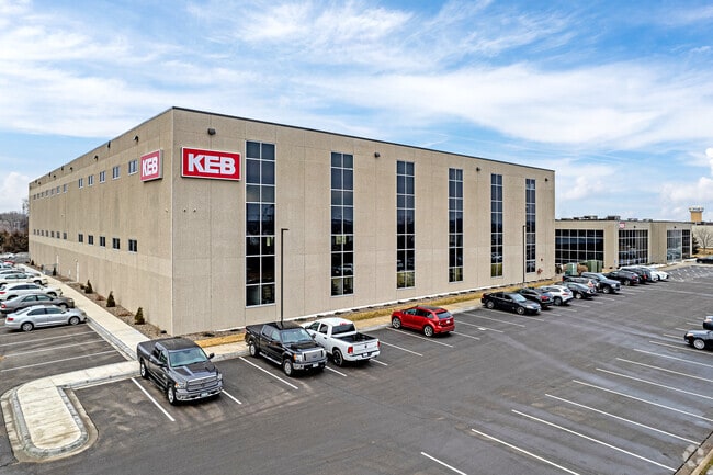
5100 Valley Industrial Blvd S
Minneapolis/St Paul
Valley Park Seventh Addn
Minneapolis-St. Paul-Bloomington, MN-WI
VALLEY PARK 7TH ADDN LOT 002 BLOCK 001
27-141-002-0
Scott
Manufacturinglight
Minnesota
2025
2
2025
7.35 AC
080304
Southwest
146,102 SF
DEMOGRAPHICS near 5100 Valley Industrial Blvd S
1 Mile
3 Mile
5 Mile
2024 Total Population
911
37,015
121,764
2029 Population
967
38,966
125,882
Pop Growth 2024-2029
+ 6.15%
+ 5.27%
+ 3.38%
Average Age
34
36
39
2024 Total Households
314
12,558
44,668
HH Growth 2024-2029
+ 6.69%
+ 5.62%
+ 3.24%
Median Household Inc
$94,601
$109,258
$108,628
Avg Household Size
2.90
2.90
2.60
2024 Avg HH Vehicles
3.00
2.00
2.00
Median Home Value
$321,687
$361,307
$386,431
Median Year Built
1999
2000
1993
Nearby Places
Map Layers
Map Styles
 Street
 Aerial
- Restaurants
- Banks
- Shops
- Fitness
- Groceries
PUBLIC TRANSPORTATION
AIRPORT
Minneapolis-St Paul International/Wold-Chamberlain
DRIVE
WALK
Distance
Minneapolis-St Paul International/Wold-Chamberlain
27 min
18.1 mi
Freight Ports
Port Milwaukee
DRIVE
WALK
Distance
Port Milwaukee
396 min
355.3 mi
Nearby Properties
Address
Land Use
TOTAL SIZE
Lot Size
Zoning
Address
Land Use
TOTAL SIZE
Lot Size
Zoning
66.08 AC
Address
Land Use
TOTAL SIZE
Lot Size
Zoning
475,471 SF
12.90 AC
Address
Land Use
TOTAL SIZE
Lot Size
Zoning
10.02 AC
Address
Land Use
TOTAL SIZE
Lot Size
Zoning
151,074 SF
17.27 AC
Address
Land Use
TOTAL SIZE
Lot Size
Zoning
1,008,768 SF
93.90 AC
Address
Land Use
TOTAL SIZE
Lot Size
Zoning
33.02 AC
Address
Land Use
TOTAL SIZE
Lot Size
Zoning
38.59 AC
Address
Land Use
TOTAL SIZE
Lot Size
Zoning
26.13 AC
Address
Land Use
TOTAL SIZE
Lot Size
Zoning
397,347 SF
28.62 AC
Address
Land Use
TOTAL SIZE
Lot Size
Zoning
691,276 SF
28.74 AC
Address
Land Use
TOTAL SIZE
Lot Size
Zoning
374,700 SF
24.09 AC
Address
Land Use
TOTAL SIZE
Lot Size
Zoning
16.08 AC
Address
Land Use
TOTAL SIZE
Lot Size
Zoning
80 AC
A1
Address
Land Use
TOTAL SIZE
Lot Size
Zoning
Address
Land Use
TOTAL SIZE
Lot Size
Zoning
497,443 SF
37.88 AC
Address
Land Use
TOTAL SIZE
Lot Size
Zoning
302,500 SF
23.79 AC
Address
Land Use
TOTAL SIZE
Lot Size
Zoning
153,695 SF
8.21 AC
Address
Land Use
TOTAL SIZE
Lot Size
Zoning
216,960 SF
19.58 AC
Address
Land Use
TOTAL SIZE
Lot Size
Zoning
369,867 SF
22.19 AC
Address
Land Use
TOTAL SIZE
Lot Size
Zoning
299,600 SF
16.48 AC
Address
Land Use
TOTAL SIZE
Lot Size
Zoning
217,495 SF
22.77 AC
Address
Land Use
TOTAL SIZE
Lot Size
Zoning
109,720 SF
10.65 AC
Address
Land Use
TOTAL SIZE
Lot Size
Zoning
242,004 SF
16.54 AC
Address
Land Use
TOTAL SIZE
Lot Size
Zoning
231,842 SF
21.61 AC
Address
Land Use
TOTAL SIZE
Lot Size
Zoning
131,981 SF
15.18 AC
RM25
Address
Land Use
TOTAL SIZE
Lot Size
Zoning
136,637 SF
11 AC
Address
Land Use
TOTAL SIZE
Lot Size
Zoning
203,280 SF
12.40 AC
Address
Land Use
TOTAL SIZE
Lot Size
Zoning
122,765 SF
4.58 AC
Address
Land Use
TOTAL SIZE
Lot Size
Zoning
188,841 SF
12.09 AC
Address
Land Use
TOTAL SIZE
Lot Size
Zoning
182,880 SF
11.15 AC
The World's #1 Commercial Real Estate Marketplace
Connect with us
© 2026 CoStar Group
The information above has been obtained from sources believed reliable. While we do not doubt its accuracy we have not verified it and make no guarantee, warranty or representation about it. It is your responsibility to independently confirm its accuracy and completeness. Any projections, opinions, assumptions, or estimates used are for example only and do not represent the current or future performance of the property. The value of this transaction to you depends on tax and other factors which should be evaluated by your tax, financial, and legal advisors. You and your advisors should conduct a careful, independent investigation of the property to determine to your satisfaction the suitability of the property for your needs.