Property Record
5102 E 65Th St, Indianapolis, IN 46220
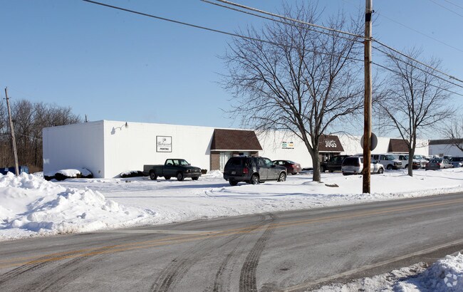


Property Detail
5102 E 65Th St
49-02-33-115-083.000-800
PT SE1/4 NW1/4 S33 T17 R4 1003.143FT W SE COR W504.387FT NE 373.488FT E 221.269FT S 234.962FT TOBEG 1.979AC
Warehouse
Marion
B and X Area of moderate flood hazard, usually the area between the limits of the 100-year and 500-year floods.
Indiana
2024
1.98 AC
2025
Keystone Crossing
320400
Indianapolis
16,639 SF
Indianapolis-Carmel-Greenwood, IN
NEARBY LISTINGS FOR SALE OR LEASE
DEMOGRAPHICS near 5102 E 65Th St
1 mile
3 mile
5 mile
2025 Total Population
7,040
64,419
198,463
2030 Population
7,060
64,651
201,278
Pop Growth 2025-2030
+ 0.28%
+ 0.36%
+ 1.42%
Average Age
39
40
39
2025 Total Households
2,821
30,162
88,268
HH Growth 2025-2030
+ 0.32%
+ 0.41%
+ 1.38%
Median Household Inc
$96,340
$76,288
$70,143
Avg Household Size
2.40
2.10
2.20
2025 Avg HH Vehicles
2.00
2.00
2.00
Median Home Value
$375,121
$325,449
$306,776
Median Year Built
1966
1970
1968
Nearby Places
Map Layers
Map Styles
 Street
 Aerial
Transit
 Traffic
 Biking
Places
Listings with unknown addresses are not visible on the map
- Restaurants
- Banks
- Shops
- Fitness
- Groceries
PUBLIC TRANSPORTATION
AIRPORT
Indianapolis International
Drive
Walk
Distance
Indianapolis International
42 min
23.8 mi
Nearby Properties
Address
Land Use
TOTAL SIZE
Lot Size
Zoning
Address
Land Use
TOTAL SIZE
Lot Size
Zoning
366,825 SF
26.60 AC
ZO01
Address
Land Use
TOTAL SIZE
Lot Size
Zoning
16,704 SF
109.83 AC
ZO01
Address
Land Use
TOTAL SIZE
Lot Size
Zoning
8,551 SF
45.92 AC
ZO01
Address
Land Use
TOTAL SIZE
Lot Size
Zoning
4,246 SF
89.83 AC
ZO01
Address
Land Use
TOTAL SIZE
Lot Size
Zoning
4,146 SF
45.91 AC
ZO01
Address
Land Use
TOTAL SIZE
Lot Size
Zoning
10,911 SF
11.56 AC
ZO01
Address
Land Use
TOTAL SIZE
Lot Size
Zoning
21,742 SF
39.35 AC
ZO01
Address
Land Use
TOTAL SIZE
Lot Size
Zoning
5,314 SF
13.92 AC
ZO01
Address
Land Use
TOTAL SIZE
Lot Size
Zoning
107,078 SF
15.66 AC
ZO01
Address
Land Use
TOTAL SIZE
Lot Size
Zoning
8,157 SF
113.93 AC
ZO01
Address
Land Use
TOTAL SIZE
Lot Size
Zoning
6,229 SF
36.20 AC
ZO01
Address
Land Use
TOTAL SIZE
Lot Size
Zoning
6,366 SF
19.32 AC
ZO01
Address
Land Use
TOTAL SIZE
Lot Size
Zoning
5,149 SF
10.56 AC
ZO01
Address
Land Use
TOTAL SIZE
Lot Size
Zoning
143,890 SF
37.81 AC
ZO01
Address
Land Use
TOTAL SIZE
Lot Size
Zoning
91,717 SF
37.30 AC
Address
Land Use
TOTAL SIZE
Lot Size
Zoning
76,657 SF
8.85 AC
ZO01
Address
Land Use
TOTAL SIZE
Lot Size
Zoning
23,452 SF
14.94 AC
ZO01
Address
Land Use
TOTAL SIZE
Lot Size
Zoning
24,112 SF
5.22 AC
ZO01
Address
Land Use
TOTAL SIZE
Lot Size
Zoning
272,688 SF
14.60 AC
ZO01
Address
Land Use
TOTAL SIZE
Lot Size
Zoning
138,637 SF
0.06 AC
Address
Land Use
TOTAL SIZE
Lot Size
Zoning
5,685 SF
5.53 AC
ZO01
Address
Land Use
TOTAL SIZE
Lot Size
Zoning
93,480 SF
3.40 AC
ZO01
Address
Land Use
TOTAL SIZE
Lot Size
Zoning
15,012 SF
4.43 AC
Address
Land Use
TOTAL SIZE
Lot Size
Zoning
131,443 SF
13.87 AC
ZO01
Address
Land Use
TOTAL SIZE
Lot Size
Zoning
1,120 SF
6.50 AC
ZO01
Address
Land Use
TOTAL SIZE
Lot Size
Zoning
6.73 AC
ZO01
Address
Land Use
TOTAL SIZE
Lot Size
Zoning
61,894 SF
2.96 AC
ZO01
Address
Land Use
TOTAL SIZE
Lot Size
Zoning
13,789 SF
3.93 AC
ZO01
Address
Land Use
TOTAL SIZE
Lot Size
Zoning
13,087 SF
57.88 AC
Address
Land Use
TOTAL SIZE
Lot Size
Zoning
2,313 SF
35.45 AC
ZO01
The World's #1 Commercial Real Estate Marketplace
Connect with us
© 2026 CoStar Group
The information above has been obtained from sources believed reliable. While we do not doubt its accuracy we have not verified it and make no guarantee, warranty or representation about it. It is your responsibility to independently confirm its accuracy and completeness. Any projections, opinions, assumptions, or estimates used are for example only and do not represent the current or future performance of the property. The value of this transaction to you depends on tax and other factors which should be evaluated by your tax, financial, and legal advisors. You and your advisors should conduct a careful, independent investigation of the property to determine to your satisfaction the suitability of the property for your needs.