Property Record
5102 Hixson Pike, Hixson, TN 37343

Property Detail
5102 Hixson Pike
Chattanooga, TN-GA
LT 2C NORTH-POINT SUB PB 116 PG 19 REV PB 127 PG 88 REV PB 129 PG 80 OUT OF 110B A 002.04 FOR 2019
110B-A-002.17
HAMILTON
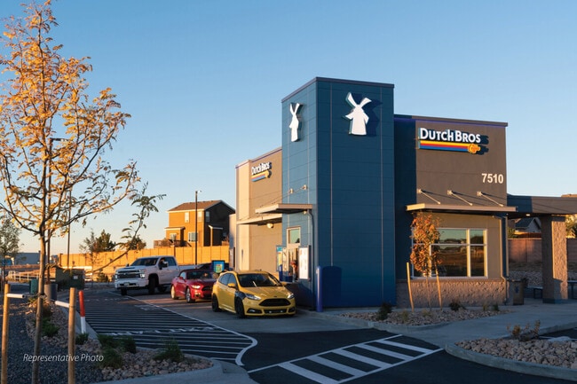
Restaurantbuilding
Tennessee
B and X Area of moderate flood hazard, usually the area between the limits of the 100-year and 500-year floods.
2c
2025
0.71 AC
2025
Outlying Hamilton County
010432
Chattanooga
965 SF
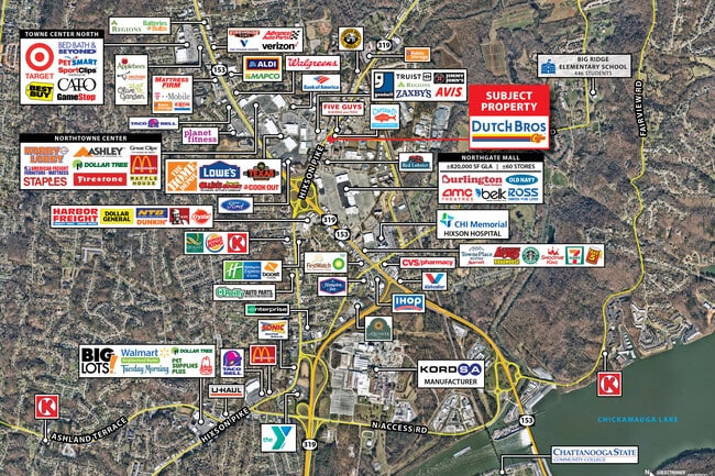
NEARBY LISTINGS FOR SALE OR LEASE
DEMOGRAPHICS near 5102 Hixson Pike
1 mile
3 mile
5 mile
2025 Total Population
5,329
35,245
84,919
2030 Population
5,583
36,923
89,228
Pop Growth 2025-2030
+ 4.77%
+ 4.76%
+ 5.07%
Average Age
42
42
42
2025 Total Households
2,354
15,100
36,215
HH Growth 2025-2030
+ 5.35%
+ 5.05%
+ 5.30%
Median Household Inc
$58,435
$73,169
$74,539
Avg Household Size
2.20
2.30
2.30
2025 Avg HH Vehicles
2.00
2.00
2.00
Median Home Value
$267,846
$300,344
$316,404
Median Year Built
1982
1976
1977
Nearby Places
Map Layers
Map Styles
 Street
 Aerial
Layers
 Traffic
 Biking
Places
Listings with unknown addresses are not visible on the map
- Restaurants
- Banks
- Shops
- Fitness
- Groceries
PUBLIC TRANSPORTATION
AIRPORT
Lovell Field
Drive
Walk
Distance
Lovell Field
20 min
11.6 mi
SALE & LEASE HISTORY
LISTING DATE
SALE/LEASE

May 17, 2023
For Sale
Jan 18, 2023
For Sale
Nearby Properties
Address
Land Use
TOTAL SIZE
Lot Size
Zoning
Address
Land Use
TOTAL SIZE
Lot Size
Zoning
103.37 AC
Address
Land Use
TOTAL SIZE
Lot Size
Zoning
197,214 SF
19.39 AC
R4
Address
Land Use
TOTAL SIZE
Lot Size
Zoning
309,974 SF
20.57 AC
R3
Address
Land Use
TOTAL SIZE
Lot Size
Zoning
292,937 SF
21.50 AC
R1
Address
Land Use
TOTAL SIZE
Lot Size
Zoning
48,465 SF
21.50 AC
Address
Land Use
TOTAL SIZE
Lot Size
Zoning
7,693 SF
115.99 AC
R1
Address
Land Use
TOTAL SIZE
Lot Size
Zoning
68,635 SF
44.47 AC
Address
Land Use
TOTAL SIZE
Lot Size
Zoning
139,820 SF
12.67 AC
R3
Address
Land Use
TOTAL SIZE
Lot Size
Zoning
51.50 AC
R1
Address
Land Use
TOTAL SIZE
Lot Size
Zoning
149,270 SF
9.25 AC
R4
Address
Land Use
TOTAL SIZE
Lot Size
Zoning
21,330 SF
15 AC
M1
Address
Land Use
TOTAL SIZE
Lot Size
Zoning
189,000 SF
10.39 AC
Address
Land Use
TOTAL SIZE
Lot Size
Zoning
182,466 SF
20.95 AC
R5
Address
Land Use
TOTAL SIZE
Lot Size
Zoning
341,649 SF
38.44 AC
C2
Address
Land Use
TOTAL SIZE
Lot Size
Zoning
186,480 SF
11.83 AC
Address
Land Use
TOTAL SIZE
Lot Size
Zoning
88,449 SF
4 AC
Address
Land Use
TOTAL SIZE
Lot Size
Zoning
20,880 SF
14.13 AC
R3
Address
Land Use
TOTAL SIZE
Lot Size
Zoning
479,004 SF
22.70 AC
Address
Land Use
TOTAL SIZE
Lot Size
Zoning
91,520 SF
10.99 AC
C2
Address
Land Use
TOTAL SIZE
Lot Size
Zoning
125,681 SF
5.55 AC
M3
Address
Land Use
TOTAL SIZE
Lot Size
Zoning
215,672 SF
21.28 AC
Address
Land Use
TOTAL SIZE
Lot Size
Zoning
7,440 SF
12.74 AC
Address
Land Use
TOTAL SIZE
Lot Size
Zoning
76,589 SF
9.71 AC
R4
Address
Land Use
TOTAL SIZE
Lot Size
Zoning
147,631 SF
21.20 AC
M1
Address
Land Use
TOTAL SIZE
Lot Size
Zoning
Address
Land Use
TOTAL SIZE
Lot Size
Zoning
31,511 SF
5.48 AC
Address
Land Use
TOTAL SIZE
Lot Size
Zoning
160,149 SF
12.89 AC
C2
Address
Land Use
TOTAL SIZE
Lot Size
Zoning
56 AC
9999
Address
Land Use
TOTAL SIZE
Lot Size
Zoning
47,343 SF
4.06 AC
Address
Land Use
TOTAL SIZE
Lot Size
Zoning
17,568 SF
8.12 AC
The World's #1 Commercial Real Estate Marketplace
Connect with us
© 2026 CoStar Group
The information above has been obtained from sources believed reliable. While we do not doubt its accuracy we have not verified it and make no guarantee, warranty or representation about it. It is your responsibility to independently confirm its accuracy and completeness. Any projections, opinions, assumptions, or estimates used are for example only and do not represent the current or future performance of the property. The value of this transaction to you depends on tax and other factors which should be evaluated by your tax, financial, and legal advisors. You and your advisors should conduct a careful, independent investigation of the property to determine to your satisfaction the suitability of the property for your needs.