Property Record
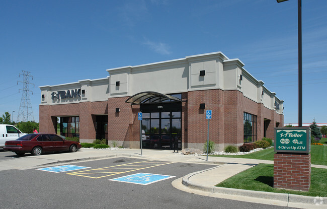
5105 Chambers Rd, Denver, CO 80239


Property Detail
5105 Chambers Rd
0184-00-028
T3 R66 S18 BEG SE COR OF S18 TH N 17D20M15S W 315.73FT TO TPOB N 183.7FT W 1.26FT CV/R 141FT SW 162.47FT CV/R 46.65FT S 124.29FT CV/R 10.02FT E 121.64FT SE 66.26FT E TO TPOB
Regionalshoppingcenterormallwithanchorstore
DENVER
S-CC-3
Colorado
B and X Area of moderate flood hazard, usually the area between the limits of the 100-year and 500-year floods.
1.30 AC
2024
Northeast
2025
Denver
008386
Denver-Aurora-Centennial, CO
5,212 SF
NEARBY LISTINGS FOR SALE OR LEASE
DEMOGRAPHICS near 5105 Chambers Rd
1 mile
3 mile
5 mile
2025 Total Population
25,084
83,948
215,397
2030 Population
25,356
86,371
222,509
Pop Growth 2025-2030
+ 1.08%
+ 2.89%
+ 3.30%
Average Age
34
34
35
2025 Total Households
7,595
25,041
69,379
HH Growth 2025-2030
+ 1.21%
+ 3.30%
+ 3.59%
Median Household Inc
$91,053
$88,294
$87,868
Avg Household Size
3.10
3.10
2.90
2025 Avg HH Vehicles
2.00
2.00
2.00
Median Home Value
$413,633
$430,871
$467,194
Median Year Built
1999
1999
1997
Nearby Places
Map Layers
Map Styles
 Street
 Aerial
Layers
 Traffic
 Biking
Places
Listings with unknown addresses are not visible on the map
- Restaurants
- Banks
- Shops
- Fitness
- Groceries
PUBLIC TRANSPORTATION
COMMUTER RAIL
40Th Ave & Airport Blvd - Gateway Park Station Track 2 (Union Station to Denver Airport Station - Regional Transportation District)
Drive
Walk
Distance
40Th Ave & Airport Blvd - Gateway Park Station Track 2 (Union Station to Denver Airport Station - Regional Transportation District)
7 min
2.8 mi
61St & Pena Station Track 2 (Union Station to Denver Airport Station - Regional Transportation District)
Drive
Walk
Distance
61St & Pena Station Track 2 (Union Station to Denver Airport Station - Regional Transportation District)
8 min
4.2 mi
AIRPORT
Denver International
Drive
Walk
Distance
Denver International
16 min
11.7 mi
Freight Ports
Tulsa Port Of Catoosa
Drive
Walk
Distance
Tulsa Port Of Catoosa
715 min
699.1 mi
SALE & LEASE HISTORY
LISTING DATE
SALE/LEASE

Sep 25, 2016
For Lease
Oct 28, 2025
For Lease
Jan 29, 2018
For Lease
Jan 11, 2019
For Lease
Nearby Properties
Address
Land Use
TOTAL SIZE
Lot Size
Zoning
Address
Land Use
TOTAL SIZE
Lot Size
Zoning
880,442 SF
67.95 AC
I-B
Address
Land Use
TOTAL SIZE
Lot Size
Zoning
258,315 SF
16.83 AC
Address
Land Use
TOTAL SIZE
Lot Size
Zoning
244,271 SF
15.30 AC
Address
Land Use
TOTAL SIZE
Lot Size
Zoning
169,941 SF
4.08 AC
I-B
Address
Land Use
TOTAL SIZE
Lot Size
Zoning
200,105 SF
34.54 AC
C-MU-20
Address
Land Use
TOTAL SIZE
Lot Size
Zoning
335,757 SF
36.88 AC
CMP-EI2
Address
Land Use
TOTAL SIZE
Lot Size
Zoning
102,444 SF
3.76 AC
GTWY
Address
Land Use
TOTAL SIZE
Lot Size
Zoning
691,200 SF
38.09 AC
Address
Land Use
TOTAL SIZE
Lot Size
Zoning
111,077 SF
3.06 AC
Address
Land Use
TOTAL SIZE
Lot Size
Zoning
550,031 SF
37.73 AC
Address
Land Use
TOTAL SIZE
Lot Size
Zoning
185,812 SF
20.93 AC
C-MU-20
Address
Land Use
TOTAL SIZE
Lot Size
Zoning
134,052 SF
6.77 AC
C-MX
Address
Land Use
TOTAL SIZE
Lot Size
Zoning
512,720 SF
42.32 AC
Address
Land Use
TOTAL SIZE
Lot Size
Zoning
55,590 SF
2.48 AC
GTWY
Address
Land Use
TOTAL SIZE
Lot Size
Zoning
500,358 SF
23.59 AC
Address
Land Use
TOTAL SIZE
Lot Size
Zoning
269,622 SF
12.90 AC
Address
Land Use
TOTAL SIZE
Lot Size
Zoning
419,630 SF
24.34 AC
Address
Land Use
TOTAL SIZE
Lot Size
Zoning
58,997 SF
2.05 AC
S-CC-5X
Address
Land Use
TOTAL SIZE
Lot Size
Zoning
217,995 SF
12.31 AC
S-SU-D
Address
Land Use
TOTAL SIZE
Lot Size
Zoning
400,000 SF
22.91 AC
I-0
Address
Land Use
TOTAL SIZE
Lot Size
Zoning
92,598 SF
2.78 AC
G-TW
Address
Land Use
TOTAL SIZE
Lot Size
Zoning
347,840 SF
19.95 AC
Address
Land Use
TOTAL SIZE
Lot Size
Zoning
331,923 SF
16.83 AC
Address
Land Use
TOTAL SIZE
Lot Size
Zoning
455,850 SF
18.65 AC
I-B
Address
Land Use
TOTAL SIZE
Lot Size
Zoning
121,970 SF
12.12 AC
C-MU-20
Address
Land Use
TOTAL SIZE
Lot Size
Zoning
111,358 SF
1.21 AC
Address
Land Use
TOTAL SIZE
Lot Size
Zoning
57,899 SF
2.52 AC
C-MU-20
Address
Land Use
TOTAL SIZE
Lot Size
Zoning
277,005 SF
16.37 AC
Address
Land Use
TOTAL SIZE
Lot Size
Zoning
328,104 SF
18.32 AC
Address
Land Use
TOTAL SIZE
Lot Size
Zoning
326,900 SF
16.21 AC
The World's #1 Commercial Real Estate Marketplace
Connect with us
© 2026 CoStar Group
The information above has been obtained from sources believed reliable. While we do not doubt its accuracy we have not verified it and make no guarantee, warranty or representation about it. It is your responsibility to independently confirm its accuracy and completeness. Any projections, opinions, assumptions, or estimates used are for example only and do not represent the current or future performance of the property. The value of this transaction to you depends on tax and other factors which should be evaluated by your tax, financial, and legal advisors. You and your advisors should conduct a careful, independent investigation of the property to determine to your satisfaction the suitability of the property for your needs.