Property Record
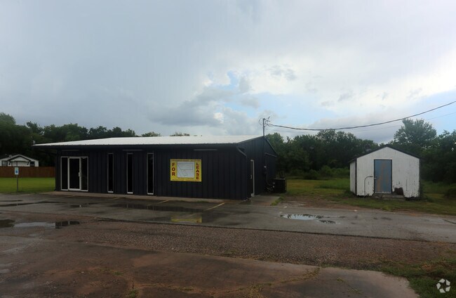
5109 Main St, Alvin, TX 77511


Property Detail
5109 Main St
0292-0002-000
A0292 H T & B R R TRACT 50 ACRES .5
Commercialnec
BRAZORIA
0002
Texas
B and X Area of moderate flood hazard, usually the area between the limits of the 100-year and 500-year floods.
0.50 AC
2024
NASA/Clear Lake
2025
Houston
660200
Houston-Pasadena-The Woodlands, TX
1,704 SF
NEARBY LISTINGS FOR SALE OR LEASE
DEMOGRAPHICS near 5109 Main St
1 mile
3 mile
5 mile
2025 Total Population
388
32,911
121,329
2030 Population
432
35,261
129,865
Pop Growth 2025-2030
+ 11.34%
+ 7.14%
+ 7.04%
Average Age
39
38
39
2025 Total Households
129
10,942
41,035
HH Growth 2025-2030
+ 11.63%
+ 7.22%
+ 7.16%
Median Household Inc
$111,607
$118,250
$116,433
Avg Household Size
2.80
2.90
2.90
2025 Avg HH Vehicles
2.00
2.00
2.00
Median Home Value
$450,000
$339,656
$349,084
Median Year Built
1993
1995
1996
Nearby Places
Map Layers
Map Styles
 Street
 Aerial
Layers
 Traffic
 Biking
Places
Listings with unknown addresses are not visible on the map
- Restaurants
- Banks
- Shops
- Fitness
- Groceries
PUBLIC TRANSPORTATION
AIRPORT
William P Hobby
Drive
Walk
Distance
William P Hobby
20 min
10.5 mi
Freight Ports
Port of Houston
Drive
Walk
Distance
Port of Houston
32 min
18.7 mi
SALE & LEASE HISTORY
LISTING DATE
SALE/LEASE

Jul 28, 2017
For Lease
Nearby Properties
Address
Land Use
TOTAL SIZE
Lot Size
Zoning
Address
Land Use
TOTAL SIZE
Lot Size
Zoning
40.52 AC
0017
Address
Land Use
TOTAL SIZE
Lot Size
Zoning
83.37 AC
0004
Address
Land Use
TOTAL SIZE
Lot Size
Zoning
7.42 AC
Address
Land Use
TOTAL SIZE
Lot Size
Zoning
142,155 SF
19.16 AC
SP
Address
Land Use
TOTAL SIZE
Lot Size
Zoning
65,935 SF
81.27 AC
Address
Land Use
TOTAL SIZE
Lot Size
Zoning
161,803 SF
54.82 AC
Address
Land Use
TOTAL SIZE
Lot Size
Zoning
84,272 SF
16.93 AC
Address
Land Use
TOTAL SIZE
Lot Size
Zoning
113,376 SF
9.80 AC
Address
Land Use
TOTAL SIZE
Lot Size
Zoning
229,097 SF
22.66 AC
Address
Land Use
TOTAL SIZE
Lot Size
Zoning
54,802 SF
12.63 AC
0014
Address
Land Use
TOTAL SIZE
Lot Size
Zoning
6,948 SF
54.94 AC
2080
Address
Land Use
TOTAL SIZE
Lot Size
Zoning
110,923 SF
6.97 AC
Address
Land Use
TOTAL SIZE
Lot Size
Zoning
112,720 SF
8.21 AC
Address
Land Use
TOTAL SIZE
Lot Size
Zoning
108,250 SF
9.89 AC
Address
Land Use
TOTAL SIZE
Lot Size
Zoning
77,997 SF
19 AC
0065
Address
Land Use
TOTAL SIZE
Lot Size
Zoning
56,905 SF
7 AC
Address
Land Use
TOTAL SIZE
Lot Size
Zoning
Address
Land Use
TOTAL SIZE
Lot Size
Zoning
98,005 SF
4.64 AC
Address
Land Use
TOTAL SIZE
Lot Size
Zoning
22,144 SF
9.27 AC
Address
Land Use
TOTAL SIZE
Lot Size
Zoning
83,221 SF
5.96 AC
Address
Land Use
TOTAL SIZE
Lot Size
Zoning
15.68 AC
Address
Land Use
TOTAL SIZE
Lot Size
Zoning
1,920 SF
14.94 AC
Address
Land Use
TOTAL SIZE
Lot Size
Zoning
18,800 SF
1.08 AC
Address
Land Use
TOTAL SIZE
Lot Size
Zoning
24,000 SF
3.53 AC
0001
Address
Land Use
TOTAL SIZE
Lot Size
Zoning
39,208 SF
8.03 AC
0060
Address
Land Use
TOTAL SIZE
Lot Size
Zoning
55,152 SF
7.29 AC
0070
Address
Land Use
TOTAL SIZE
Lot Size
Zoning
14.09 AC
Address
Land Use
TOTAL SIZE
Lot Size
Zoning
12,868 SF
1.65 AC
Address
Land Use
TOTAL SIZE
Lot Size
Zoning
60,440 SF
5 AC
7010
Address
Land Use
TOTAL SIZE
Lot Size
Zoning
94,300 SF
5 AC
The World's #1 Commercial Real Estate Marketplace
Connect with us
© 2026 CoStar Group
The information above has been obtained from sources believed reliable. While we do not doubt its accuracy we have not verified it and make no guarantee, warranty or representation about it. It is your responsibility to independently confirm its accuracy and completeness. Any projections, opinions, assumptions, or estimates used are for example only and do not represent the current or future performance of the property. The value of this transaction to you depends on tax and other factors which should be evaluated by your tax, financial, and legal advisors. You and your advisors should conduct a careful, independent investigation of the property to determine to your satisfaction the suitability of the property for your needs.