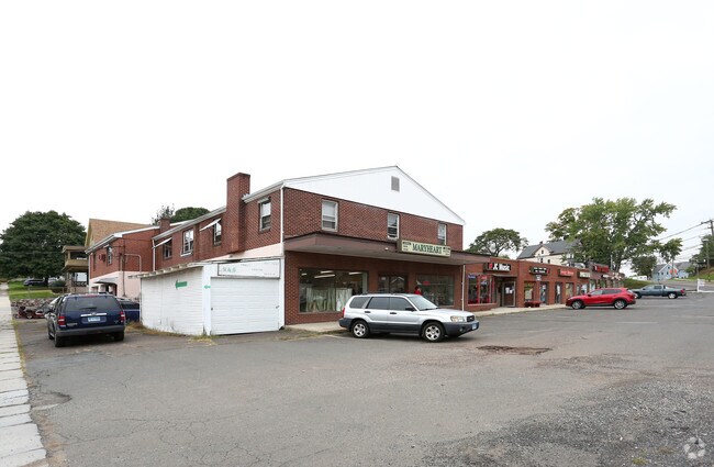
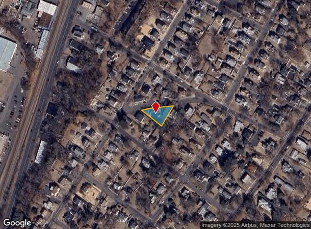
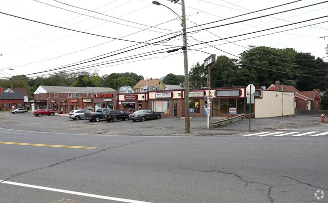
Property Record
511 W Main St, Meriden, CT 06451
NEARBY LISTINGS FOR SALE OR LEASE
Property Detail
511 W Main St
MERI-000620-000214-000003-000004
New Haven
Commercialbuilding
Connecticut
X
3-4
09009C0162H
0.27 AC
2024
Meriden
2025
Westchester/So Connecticut
170400
New Haven-Milford, CT
3,844 SF
DEMOGRAPHICS near 511 W Main St
1 Mile
3 Mile
5 Mile
2024 Total Population
13,084
60,805
106,162
2029 Population
12,924
60,551
105,691
Pop Growth 2024-2029
(1.22%)
(0.42%)
(0.44%)
Average Age
38
39
41
2024 Total Households
5,186
23,871
41,464
HH Growth 2024-2029
(1.14%)
(0.45%)
(0.52%)
Median Household Inc
$51,346
$63,817
$79,182
Avg Household Size
2.40
2.40
2.40
2024 Avg HH Vehicles
1.00
2.00
2.00
Median Home Value
$177,374
$198,850
$255,144
Median Year Built
1951
1959
1964
Nearby Places
Map Layers
Map Styles
 Street
 Aerial
- Restaurants
- Banks
- Shops
- Fitness
- Groceries
PUBLIC TRANSPORTATION
COMMUTER RAIL
Wallingford Amtrak (Amtrak Hartford Line - Amtrak, Hartford Line - Amtrak, Northeast Regional - Amtrak, Valley Flyer - Amtrak)
DRIVE
WALK
Distance
Wallingford Amtrak (Amtrak Hartford Line - Amtrak, Hartford Line - Amtrak, Northeast Regional - Amtrak, Valley Flyer - Amtrak)
1 min
15 min
0.8 mi
Wallingford (Hartford Line - CONN DOT)
DRIVE
WALK
Distance
Wallingford (Hartford Line - CONN DOT)
3 min
1.2 mi
AIRPORT
Tweed/New Haven
DRIVE
WALK
Distance
Tweed/New Haven
25 min
15.2 mi
Freight Ports
Port of New Haven
DRIVE
WALK
Distance
Port of New Haven
21 min
12.9 mi
SALE & LEASE HISTORY
LISTING DATE
SALE/LEASE

Jan 16, 2019
For Lease
Nearby Properties
Address
Land Use
TOTAL SIZE
Lot Size
Zoning
Address
Land Use
TOTAL SIZE
Lot Size
Zoning
100 AC
LO15
Address
Land Use
TOTAL SIZE
Lot Size
Zoning
855,000 SF
142.06 AC
IL80
Address
Land Use
TOTAL SIZE
Lot Size
Zoning
63,356 SF
154.26 AC
RM40
Address
Land Use
TOTAL SIZE
Lot Size
Zoning
52 AC
R18
Address
Land Use
TOTAL SIZE
Lot Size
Zoning
41.91 AC
RU40
Address
Land Use
TOTAL SIZE
Lot Size
Zoning
32.85 AC
RU40
Address
Land Use
TOTAL SIZE
Lot Size
Zoning
105,252 SF
9.13 AC
I40
Address
Land Use
TOTAL SIZE
Lot Size
Zoning
36,520 SF
4.64 AC
IL30
Address
Land Use
TOTAL SIZE
Lot Size
Zoning
85.08 AC
I40
Address
Land Use
TOTAL SIZE
Lot Size
Zoning
44.46 AC
R18
Address
Land Use
TOTAL SIZE
Lot Size
Zoning
128,346 SF
15 AC
R18
Address
Land Use
TOTAL SIZE
Lot Size
Zoning
3.84 AC
CB40
Address
Land Use
TOTAL SIZE
Lot Size
Zoning
23,920 SF
137.43 AC
R18
Address
Land Use
TOTAL SIZE
Lot Size
Zoning
172,027 SF
18.04 AC
RF40
Address
Land Use
TOTAL SIZE
Lot Size
Zoning
15,432 SF
5.67 AC
CB40
Address
Land Use
TOTAL SIZE
Lot Size
Zoning
72,256 SF
R18
Address
Land Use
TOTAL SIZE
Lot Size
Zoning
13.42 AC
RM6
Address
Land Use
TOTAL SIZE
Lot Size
Zoning
38,735 SF
Address
Land Use
TOTAL SIZE
Lot Size
Zoning
123,730 SF
40.31 AC
R18
Address
Land Use
TOTAL SIZE
Lot Size
Zoning
22,284 SF
128.20 AC
RU40
Address
Land Use
TOTAL SIZE
Lot Size
Zoning
12 AC
RU40
Address
Land Use
TOTAL SIZE
Lot Size
Zoning
8,984 SF
22.75 AC
RM11
Address
Land Use
TOTAL SIZE
Lot Size
Zoning
9.75 AC
RF40
Address
Land Use
TOTAL SIZE
Lot Size
Zoning
7.21 AC
IL30
Address
Land Use
TOTAL SIZE
Lot Size
Zoning
12.36 AC
I40
Address
Land Use
TOTAL SIZE
Lot Size
Zoning
48,942 SF
6.74 AC
RF40
Address
Land Use
TOTAL SIZE
Lot Size
Zoning
60,834 SF
3.61 AC
CLB
Address
Land Use
TOTAL SIZE
Lot Size
Zoning
34,021 SF
R18
Address
Land Use
TOTAL SIZE
Lot Size
Zoning
6.64 AC
CB40
Address
Land Use
TOTAL SIZE
Lot Size
Zoning
71,501 SF
6.84 AC
R18
The World's #1 Commercial Real Estate Marketplace
Connect with us
© 2025 CoStar Group
The information above has been obtained from sources believed reliable. While we do not doubt its accuracy we have not verified it and make no guarantee, warranty or representation about it. It is your responsibility to independently confirm its accuracy and completeness. Any projections, opinions, assumptions, or estimates used are for example only and do not represent the current or future performance of the property. The value of this transaction to you depends on tax and other factors which should be evaluated by your tax, financial, and legal advisors. You and your advisors should conduct a careful, independent investigation of the property to determine to your satisfaction the suitability of the property for your needs.