Property Record
511 E Main St, Luray, VA 22835
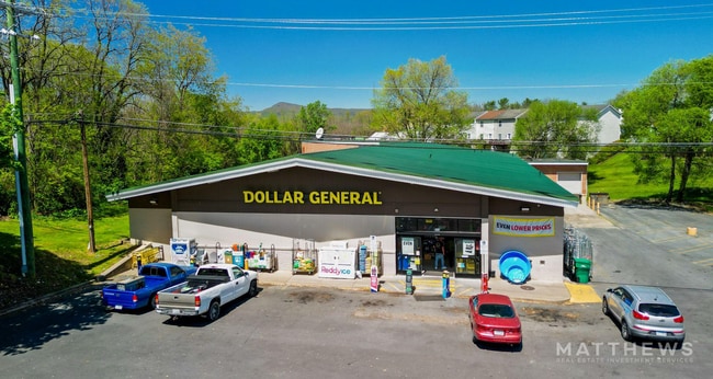


Property Detail
511 E Main St
42A11-A-75
DB 590-856 *PT ZONED R3 INST14-1368 INST#13-0500 INST#14-1366 INST#24-2358
Commercialnec
Page
B-1
Virginia
B and X Area of moderate flood hazard, usually the area between the limits of the 100-year and 500-year floods.
75
2024
1.64 AC
2025
Virginia Shenandoah Valley Regional
030100
Other Market Areas
11,184 SF
NEARBY LISTINGS FOR SALE OR LEASE
-
-
View all Luray listings for sale on LoopNet.com
DEMOGRAPHICS near 511 E Main St
1 mile
3 mile
5 mile
2024 Total Population
3,093
6,738
9,707
2029 Population
3,022
6,642
9,641
Pop Growth 2024-2029
(2.30%)
(1.42%)
(0.68%)
Average Age
45
45
45
2024 Total Households
1,366
2,864
4,098
HH Growth 2024-2029
(2.27%)
(1.43%)
(0.66%)
Median Household Inc
$53,211
$56,237
$59,170
Avg Household Size
2.20
2.30
2.30
2024 Avg HH Vehicles
2.00
2.00
2.00
Median Home Value
$275,620
$286,063
$281,467
Median Year Built
1957
1962
1969
Nearby Places
Map Layers
Map Styles
 Street
 Aerial
Transit
 Traffic
 Biking
Places
Listings with unknown addresses are not visible on the map
- Restaurants
- Banks
- Shops
- Fitness
- Groceries
SALE & LEASE HISTORY
LISTING DATE
SALE/LEASE

May 15, 2024
For Sale
Nearby Properties
Address
Land Use
TOTAL SIZE
Lot Size
Zoning
Address
Land Use
TOTAL SIZE
Lot Size
Zoning
115,763 SF
15.29 AC
B-1
Address
Land Use
TOTAL SIZE
Lot Size
Zoning
123,000 SF
90.75 AC
R/B-1
Address
Land Use
TOTAL SIZE
Lot Size
Zoning
52,021 SF
95.01 AC
B-1
Address
Land Use
TOTAL SIZE
Lot Size
Zoning
19.93 AC
A-1
Address
Land Use
TOTAL SIZE
Lot Size
Zoning
198,099 SF
0.16 AC
R-2
Address
Land Use
TOTAL SIZE
Lot Size
Zoning
70,765 SF
0.16 AC
R-4
Address
Land Use
TOTAL SIZE
Lot Size
Zoning
274,250 SF
12.59 AC
B-1/M-1
Address
Land Use
TOTAL SIZE
Lot Size
Zoning
109,824 SF
7.79 AC
B-1
Address
Land Use
TOTAL SIZE
Lot Size
Zoning
87,917 SF
8.76 AC
R-3
Address
Land Use
TOTAL SIZE
Lot Size
Zoning
25,786 SF
1.17 AC
B-1
Address
Land Use
TOTAL SIZE
Lot Size
Zoning
89,316 SF
10.10 AC
B-1
Address
Land Use
TOTAL SIZE
Lot Size
Zoning
150,360 SF
14.96 AC
M-1
Address
Land Use
TOTAL SIZE
Lot Size
Zoning
64,613 SF
8.93 AC
B-1
Address
Land Use
TOTAL SIZE
Lot Size
Zoning
1,128 SF
42.03 AC
C-1
Address
Land Use
TOTAL SIZE
Lot Size
Zoning
4.20 AC
M-1
Address
Land Use
TOTAL SIZE
Lot Size
Zoning
75,692 SF
9.13 AC
R-5
Address
Land Use
TOTAL SIZE
Lot Size
Zoning
113,682 SF
8.31 AC
B-1
Address
Land Use
TOTAL SIZE
Lot Size
Zoning
14,120 SF
8.30 AC
B-1
Address
Land Use
TOTAL SIZE
Lot Size
Zoning
43,490 SF
5 AC
A-1
Address
Land Use
TOTAL SIZE
Lot Size
Zoning
7,560 SF
5.20 AC
B-1
Address
Land Use
TOTAL SIZE
Lot Size
Zoning
34,630 SF
3.26 AC
R
Address
Land Use
TOTAL SIZE
Lot Size
Zoning
24,342 SF
1.35 AC
B-1
Address
Land Use
TOTAL SIZE
Lot Size
Zoning
127,596 SF
9.42 AC
M-1
Address
Land Use
TOTAL SIZE
Lot Size
Zoning
13.78 AC
A-1
Address
Land Use
TOTAL SIZE
Lot Size
Zoning
159,478 SF
17.01 AC
M-1
Address
Land Use
TOTAL SIZE
Lot Size
Zoning
43,360 SF
6.12 AC
R-1/R-5
Address
Land Use
TOTAL SIZE
Lot Size
Zoning
13,360 SF
0.13 AC
B-1
Address
Land Use
TOTAL SIZE
Lot Size
Zoning
21,444 SF
0.56 AC
B-1
Address
Land Use
TOTAL SIZE
Lot Size
Zoning
37,426 SF
6.91 AC
R-1/R-5
Address
Land Use
TOTAL SIZE
Lot Size
Zoning
19,064 SF
1.10 AC
B-1
The World's #1 Commercial Real Estate Marketplace
Connect with us
© 2026 CoStar Group
The information above has been obtained from sources believed reliable. While we do not doubt its accuracy we have not verified it and make no guarantee, warranty or representation about it. It is your responsibility to independently confirm its accuracy and completeness. Any projections, opinions, assumptions, or estimates used are for example only and do not represent the current or future performance of the property. The value of this transaction to you depends on tax and other factors which should be evaluated by your tax, financial, and legal advisors. You and your advisors should conduct a careful, independent investigation of the property to determine to your satisfaction the suitability of the property for your needs.