Property Record
511 Marschall Rd, Shakopee, MN 55379

NEARBY LISTINGS FOR SALE OR LEASE
-
-
View all Shakopee listings for sale on LoopNet.com
Property Detail
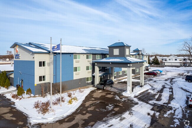
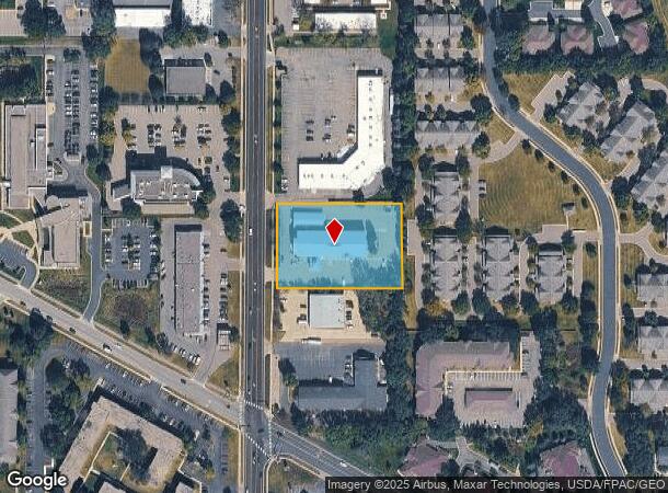
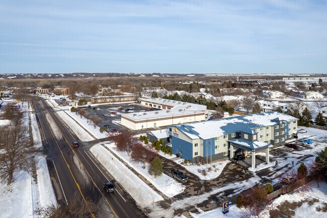
511 Marschall Rd
Minneapolis/St Paul
Century Plaza Square 3Rd Addn
Minneapolis-St. Paul-Bloomington, MN-WI
CENTURY PLAZA SQUARE 3RD ADDN LOT 002 BLOCK 001 & N 20.45' OF LOT 3
27-120-002-0
Scott
Commercialnec
Minnesota
2025
2
2025
1.58 AC
080303
Minneapolis South Area
14,113 SF
DEMOGRAPHICS near 511 Marschall Rd
1 mile
3 mile
5 mile
2024 Total Population
12,123
45,918
104,635
2029 Population
13,076
48,687
109,570
Pop Growth 2024-2029
+ 7.86%
+ 6.03%
+ 4.72%
Average Age
37
37
38
2024 Total Households
4,803
15,854
37,772
HH Growth 2024-2029
+ 8.37%
+ 6.43%
+ 4.86%
Median Household Inc
$64,962
$97,365
$104,521
Avg Household Size
2.40
2.80
2.70
2024 Avg HH Vehicles
2.00
2.00
2.00
Median Home Value
$251,872
$326,549
$377,455
Median Year Built
1990
1998
1994
Nearby Places
Map Layers
Map Styles
 Street
 Aerial
Transit
 Traffic
 Biking
Places
Listings with unknown addresses are not visible on the map
- Restaurants
- Banks
- Shops
- Fitness
- Groceries
PUBLIC TRANSPORTATION
AIRPORT
Minneapolis-St Paul International/Wold-Chamberlain
Drive
Walk
Distance
Minneapolis-St Paul International/Wold-Chamberlain
31 min
21.3 mi
Nearby Properties
Address
Land Use
TOTAL SIZE
Lot Size
Zoning
Address
Land Use
TOTAL SIZE
Lot Size
Zoning
625,426 SF
40.47 AC
Address
Land Use
TOTAL SIZE
Lot Size
Zoning
66.08 AC
Address
Land Use
TOTAL SIZE
Lot Size
Zoning
475,471 SF
12.90 AC
Address
Land Use
TOTAL SIZE
Lot Size
Zoning
10.02 AC
Address
Land Use
TOTAL SIZE
Lot Size
Zoning
151,074 SF
17.27 AC
Address
Land Use
TOTAL SIZE
Lot Size
Zoning
1,008,768 SF
93.90 AC
Address
Land Use
TOTAL SIZE
Lot Size
Zoning
33.02 AC
Address
Land Use
TOTAL SIZE
Lot Size
Zoning
Address
Land Use
TOTAL SIZE
Lot Size
Zoning
600,000 SF
31.21 AC
Address
Land Use
TOTAL SIZE
Lot Size
Zoning
26.13 AC
Address
Land Use
TOTAL SIZE
Lot Size
Zoning
397,347 SF
28.62 AC
Address
Land Use
TOTAL SIZE
Lot Size
Zoning
691,276 SF
28.74 AC
Address
Land Use
TOTAL SIZE
Lot Size
Zoning
374,700 SF
24.09 AC
Address
Land Use
TOTAL SIZE
Lot Size
Zoning
16.08 AC
Address
Land Use
TOTAL SIZE
Lot Size
Zoning
Address
Land Use
TOTAL SIZE
Lot Size
Zoning
51,272 SF
2.11 AC
Address
Land Use
TOTAL SIZE
Lot Size
Zoning
1.80 AC
Address
Land Use
TOTAL SIZE
Lot Size
Zoning
164,809 SF
7.28 AC
Address
Land Use
TOTAL SIZE
Lot Size
Zoning
198,754 SF
27.50 AC
Address
Land Use
TOTAL SIZE
Lot Size
Zoning
52,280 SF
12.15 AC
Address
Land Use
TOTAL SIZE
Lot Size
Zoning
302,500 SF
23.79 AC
Address
Land Use
TOTAL SIZE
Lot Size
Zoning
Address
Land Use
TOTAL SIZE
Lot Size
Zoning
216,960 SF
19.58 AC
Address
Land Use
TOTAL SIZE
Lot Size
Zoning
191,395 SF
5.16 AC
Address
Land Use
TOTAL SIZE
Lot Size
Zoning
369,867 SF
22.19 AC
Address
Land Use
TOTAL SIZE
Lot Size
Zoning
299,600 SF
16.48 AC
Address
Land Use
TOTAL SIZE
Lot Size
Zoning
217,495 SF
22.77 AC
Address
Land Use
TOTAL SIZE
Lot Size
Zoning
109,720 SF
10.65 AC
Address
Land Use
TOTAL SIZE
Lot Size
Zoning
242,004 SF
16.54 AC
Address
Land Use
TOTAL SIZE
Lot Size
Zoning
231,842 SF
21.61 AC
The World's #1 Commercial Real Estate Marketplace
Connect with us
© 2026 CoStar Group
The information above has been obtained from sources believed reliable. While we do not doubt its accuracy we have not verified it and make no guarantee, warranty or representation about it. It is your responsibility to independently confirm its accuracy and completeness. Any projections, opinions, assumptions, or estimates used are for example only and do not represent the current or future performance of the property. The value of this transaction to you depends on tax and other factors which should be evaluated by your tax, financial, and legal advisors. You and your advisors should conduct a careful, independent investigation of the property to determine to your satisfaction the suitability of the property for your needs.