Property Record
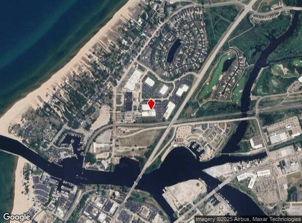
511 Renaissance Dr, Saint Joseph, MI 49085
This Property Is For Sale
Current Lease Availabilities
NEARBY LISTINGS FOR SALE OR LEASE
Property Detail
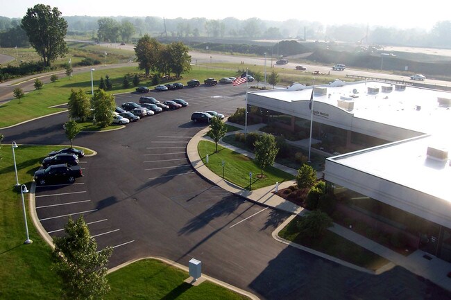
511 Renaissance Dr
Niles-Benton Harbor, MI
Edgewater
11-76-2255-0005-01-0
BERRIEN COUNTY CONDO SUB PLAN #153
Officebuilding
Berrien
X
Michigan
26021C0101D
6.12 AC
2024
Michigan Southwest Area
2025
Other Market Areas
000801
DEMOGRAPHICS near 511 Renaissance Dr
1 Mile
3 Mile
5 Mile
2024 Total Population
2,283
26,952
41,519
2029 Population
2,300
26,719
40,963
Pop Growth 2024-2029
+ 0.74%
(0.86%)
(1.34%)
Average Age
43
39
40
2024 Total Households
1,093
11,423
17,399
HH Growth 2024-2029
+ 0.37%
(1.30%)
(1.67%)
Median Household Inc
$95,833
$39,802
$45,471
Avg Household Size
2.10
2.30
2.30
2024 Avg HH Vehicles
2.00
1.00
2.00
Median Home Value
$373,599
$171,922
$186,647
Median Year Built
1955
1957
1961
Nearby Places
- Restaurants
- Banks
- Shops
- Fitness
- Groceries
PUBLIC TRANSPORTATION
COMMUTER RAIL
St. Joseph-Benton Harbor Amtrak Station (Pere Marquette - Amtrak)
DRIVE
WALK
Distance
St. Joseph-Benton Harbor Amtrak Station (Pere Marquette - Amtrak)
4 min
1.4 mi
AIRPORT
South Bend International
DRIVE
WALK
Distance
South Bend International
55 min
38.8 mi
Freight Ports
Port Milwaukee
DRIVE
WALK
Distance
Port Milwaukee
222 min
182.2 mi
Nearby Properties
Address
Land Use
TOTAL SIZE
Lot Size
Zoning
Address
Land Use
TOTAL SIZE
Lot Size
Zoning
313,588 SF
11.48 AC
DISTRICT A
Address
Land Use
TOTAL SIZE
Lot Size
Zoning
365,903 SF
95.25 AC
Address
Land Use
TOTAL SIZE
Lot Size
Zoning
216,232 SF
Address
Land Use
TOTAL SIZE
Lot Size
Zoning
Address
Land Use
TOTAL SIZE
Lot Size
Zoning
89,062 SF
1.60 AC
W
Address
Land Use
TOTAL SIZE
Lot Size
Zoning
99,468 SF
10.07 AC
DISTRICT G
Address
Land Use
TOTAL SIZE
Lot Size
Zoning
73,680 SF
CO-A
Address
Land Use
TOTAL SIZE
Lot Size
Zoning
202,713 SF
14.23 AC
CO-A
Address
Land Use
TOTAL SIZE
Lot Size
Zoning
30,889 SF
2.83 AC
CO-A
Address
Land Use
TOTAL SIZE
Lot Size
Zoning
258,549 SF
17.20 AC
C MULTI
Address
Land Use
TOTAL SIZE
Lot Size
Zoning
69,750 SF
0.47 AC
D
Address
Land Use
TOTAL SIZE
Lot Size
Zoning
86,000 SF
22.38 AC
D1 COMM
Address
Land Use
TOTAL SIZE
Lot Size
Zoning
28,312 SF
4.30 AC
C
Address
Land Use
TOTAL SIZE
Lot Size
Zoning
93,032 SF
0.51 AC
D
Address
Land Use
TOTAL SIZE
Lot Size
Zoning
75,050 SF
5.33 AC
NONE
Address
Land Use
TOTAL SIZE
Lot Size
Zoning
82,567 SF
1.74 AC
D
Address
Land Use
TOTAL SIZE
Lot Size
Zoning
90,000 SF
7.62 AC
W
Address
Land Use
TOTAL SIZE
Lot Size
Zoning
519,203 SF
25.57 AC
C
Address
Land Use
TOTAL SIZE
Lot Size
Zoning
65,584 SF
6.52 AC
CO-A
Address
Land Use
TOTAL SIZE
Lot Size
Zoning
40,063 SF
9.78 AC
DISTRICT G
Address
Land Use
TOTAL SIZE
Lot Size
Zoning
25,080 SF
I-1
Address
Land Use
TOTAL SIZE
Lot Size
Zoning
70,617 SF
12 AC
E RESTRICT
Address
Land Use
TOTAL SIZE
Lot Size
Zoning
69,484 SF
8.08 AC
C MULTI
Address
Land Use
TOTAL SIZE
Lot Size
Zoning
151,462 SF
9.96 AC
DISTRICT F
Address
Land Use
TOTAL SIZE
Lot Size
Zoning
71,755 SF
11.06 AC
Address
Land Use
TOTAL SIZE
Lot Size
Zoning
55,753 SF
6 AC
DISTRICT D
Address
Land Use
TOTAL SIZE
Lot Size
Zoning
142,200 SF
18 AC
DISTRICT G
Address
Land Use
TOTAL SIZE
Lot Size
Zoning
34,384 SF
2.76 AC
DISTRICT D
Address
Land Use
TOTAL SIZE
Lot Size
Zoning
21,600 SF
Address
Land Use
TOTAL SIZE
Lot Size
Zoning
70,321 SF
14.71 AC
C MULTI
The World's #1 Commercial Real Estate Marketplace
Connect with us
© 2025 CoStar Group
The information above has been obtained from sources believed reliable. While we do not doubt its accuracy we have not verified it and make no guarantee, warranty or representation about it. It is your responsibility to independently confirm its accuracy and completeness. Any projections, opinions, assumptions, or estimates used are for example only and do not represent the current or future performance of the property. The value of this transaction to you depends on tax and other factors which should be evaluated by your tax, financial, and legal advisors. You and your advisors should conduct a careful, independent investigation of the property to determine to your satisfaction the suitability of the property for your needs.