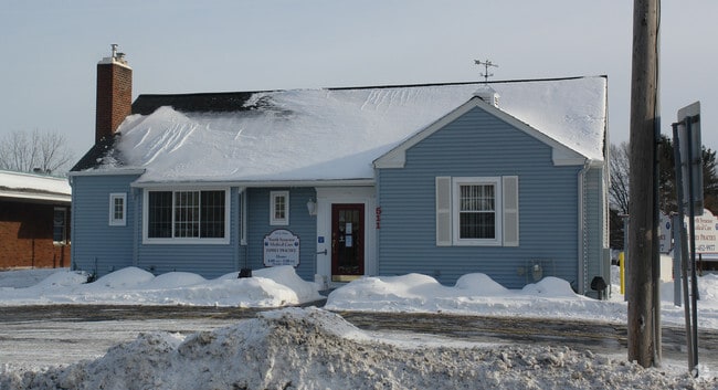
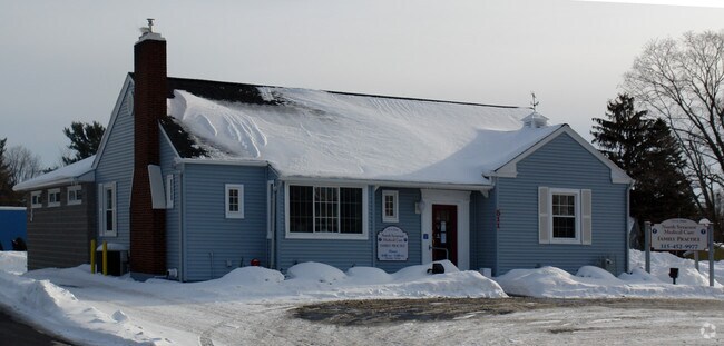
Property Record
511 S Main St, Syracuse, NY 13212

Property Detail
511 S Main St
312401-008-000-0001-005-000-0000
FL 91 1139257
Commercialofficeresidentialmixeduse
Onondaga
07 - MIXED
New York
B and X Area of moderate flood hazard, usually the area between the limits of the 100-year and 500-year floods.
5.000
2025
0.37 AC
2024
NE Outer Onondaga County
010800
Syracuse
2,206 SF
Syracuse, NY
NEARBY LISTINGS FOR SALE OR LEASE
DEMOGRAPHICS near 511 S Main St
1 mile
3 mile
5 mile
2025 Total Population
8,004
48,527
143,729
2030 Population
7,858
47,657
141,477
Pop Growth 2025-2030
(1.82%)
(1.79%)
(1.57%)
Average Age
44
43
41
2025 Total Households
3,709
21,002
61,590
HH Growth 2025-2030
(1.94%)
(1.90%)
(1.60%)
Median Household Inc
$67,514
$78,156
$69,745
Avg Household Size
2.10
2.20
2.20
2025 Avg HH Vehicles
2.00
2.00
2.00
Median Home Value
$161,234
$174,813
$172,670
Median Year Built
1956
1965
1960
Nearby Places
Map Layers
Map Styles
 Street
 Aerial
Transit
 Traffic
 Biking
Places
Listings with unknown addresses are not visible on the map
- Restaurants
- Banks
- Shops
- Fitness
- Groceries
PUBLIC TRANSPORTATION
COMMUTER RAIL
Drive
Walk
Distance
10 min
5.2 mi
AIRPORT
Syracuse Hancock International
Drive
Walk
Distance
Syracuse Hancock International
7 min
2.5 mi
Nearby Properties
Address
Land Use
TOTAL SIZE
Lot Size
Zoning
Address
Land Use
TOTAL SIZE
Lot Size
Zoning
439,670 SF
74.73 AC
C-G
Address
Land Use
TOTAL SIZE
Lot Size
Zoning
432,246 SF
37.21 AC
05 - COMME
Address
Land Use
TOTAL SIZE
Lot Size
Zoning
22.16 AC
06 - INDUS
Address
Land Use
TOTAL SIZE
Lot Size
Zoning
11,484 SF
16.36 AC
03 - MULTI
Address
Land Use
TOTAL SIZE
Lot Size
Zoning
110,105 SF
26.68 AC
06 - INDUS
Address
Land Use
TOTAL SIZE
Lot Size
Zoning
218,439 SF
18.85 AC
Address
Land Use
TOTAL SIZE
Lot Size
Zoning
77,150 SF
159.25 AC
06 - INDUS
Address
Land Use
TOTAL SIZE
Lot Size
Zoning
2,025 SF
267.94 AC
06 - INDUS
Address
Land Use
TOTAL SIZE
Lot Size
Zoning
246,172 SF
16.65 AC
Address
Land Use
TOTAL SIZE
Lot Size
Zoning
203,345 SF
18.17 AC
Address
Land Use
TOTAL SIZE
Lot Size
Zoning
84,048 SF
19.42 AC
Address
Land Use
TOTAL SIZE
Lot Size
Zoning
125,400 SF
18.11 AC
GC
Address
Land Use
TOTAL SIZE
Lot Size
Zoning
125,684 SF
25.61 AC
06 - INDUS
Address
Land Use
TOTAL SIZE
Lot Size
Zoning
3.59 AC
04 - FARM
Address
Land Use
TOTAL SIZE
Lot Size
Zoning
120,068 SF
9.26 AC
GCPLUS
Address
Land Use
TOTAL SIZE
Lot Size
Zoning
78,656 SF
9.14 AC
06 - INDUS
Address
Land Use
TOTAL SIZE
Lot Size
Zoning
141,472 SF
12.38 AC
C-G
Address
Land Use
TOTAL SIZE
Lot Size
Zoning
92,844 SF
14.26 AC
C-G
Address
Land Use
TOTAL SIZE
Lot Size
Zoning
296.49 AC
06 - INDUS
Address
Land Use
TOTAL SIZE
Lot Size
Zoning
118,651 SF
12.27 AC
02 - SINGL
Address
Land Use
TOTAL SIZE
Lot Size
Zoning
17,240 SF
6.49 AC
03 - MULTI
Address
Land Use
TOTAL SIZE
Lot Size
Zoning
103,005 SF
12.58 AC
Address
Land Use
TOTAL SIZE
Lot Size
Zoning
27,044 SF
25.20 AC
C-G
Address
Land Use
TOTAL SIZE
Lot Size
Zoning
63,140 SF
25.52 AC
Address
Land Use
TOTAL SIZE
Lot Size
Zoning
33,180 SF
23.85 AC
GCPLUS
Address
Land Use
TOTAL SIZE
Lot Size
Zoning
81,439 SF
15.48 AC
Address
Land Use
TOTAL SIZE
Lot Size
Zoning
109,642 SF
22.17 AC
06 - INDUS
Address
Land Use
TOTAL SIZE
Lot Size
Zoning
96,084 SF
8.74 AC
06 - INDUS
Address
Land Use
TOTAL SIZE
Lot Size
Zoning
11,059 SF
8.23 AC
06 - INDUS
The World's #1 Commercial Real Estate Marketplace
Connect with us
© 2026 CoStar Group
The information above has been obtained from sources believed reliable. While we do not doubt its accuracy we have not verified it and make no guarantee, warranty or representation about it. It is your responsibility to independently confirm its accuracy and completeness. Any projections, opinions, assumptions, or estimates used are for example only and do not represent the current or future performance of the property. The value of this transaction to you depends on tax and other factors which should be evaluated by your tax, financial, and legal advisors. You and your advisors should conduct a careful, independent investigation of the property to determine to your satisfaction the suitability of the property for your needs.