Property Record
5114 Grantwood St, Houston, TX 77004


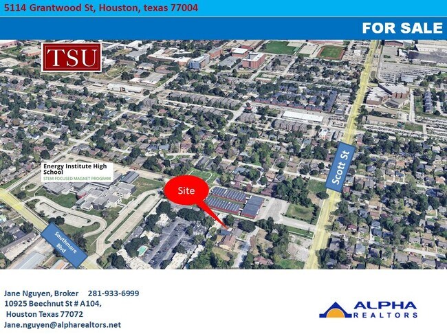
This Property Is For Sale
NEARBY LISTINGS FOR SALE OR LEASE
Property Detail
5114 Grantwood St
Houston-The Woodlands-Sugar Land, TX
Abst 75 H Tierwester
0410310340180
Harris
Sfr
Texas
X
0.21 AC
48201C0880M
South
2,400 SF
Houston
DEMOGRAPHICS near 5114 Grantwood St
1 Mile
3 Mile
5 Mile
2024 Total Population
25,904
179,710
470,206
2029 Population
26,910
188,218
489,827
Pop Growth 2024-2029
+ 3.88%
+ 4.73%
+ 4.17%
Average Age
32
37
37
2024 Total Households
7,408
77,248
201,601
HH Growth 2024-2029
+ 5.05%
+ 5.26%
+ 4.57%
Median Household Inc
$44,141
$56,683
$62,724
Avg Household Size
2.00
2.00
2.10
2024 Avg HH Vehicles
1.00
1.00
1.00
Median Home Value
$335,265
$295,168
$316,970
Median Year Built
1959
1987
1988
Nearby Places
Map Layers
Map Styles
 Street
 Aerial
- Restaurants
- Banks
- Shops
- Fitness
- Groceries
PUBLIC TRANSPORTATION
COMMUTER RAIL
DRIVE
WALK
Distance
10 min
5.4 mi
AIRPORT
William P Hobby
DRIVE
WALK
Distance
William P Hobby
22 min
9.5 mi
George Bush Intcntl/Houston
DRIVE
WALK
Distance
George Bush Intcntl/Houston
32 min
22.8 mi
Freight Ports
Port of Houston
DRIVE
WALK
Distance
Port of Houston
19 min
9.8 mi
Nearby Properties
Address
Land Use
TOTAL SIZE
Lot Size
Zoning
Address
Land Use
TOTAL SIZE
Lot Size
Zoning
899,279 SF
1.18 AC
Address
Land Use
TOTAL SIZE
Lot Size
Zoning
519,409 SF
1.52 AC
Address
Land Use
TOTAL SIZE
Lot Size
Zoning
1,252,274 SF
2.02 AC
Address
Land Use
TOTAL SIZE
Lot Size
Zoning
1,091,726 SF
2.60 AC
Address
Land Use
TOTAL SIZE
Lot Size
Zoning
1,232,364 SF
1.49 AC
Address
Land Use
TOTAL SIZE
Lot Size
Zoning
515,025 SF
1.50 AC
Address
Land Use
TOTAL SIZE
Lot Size
Zoning
1,311,133 SF
1.44 AC
Address
Land Use
TOTAL SIZE
Lot Size
Zoning
1,103,424 SF
1.44 AC
Address
Land Use
TOTAL SIZE
Lot Size
Zoning
1,359,194 SF
Address
Land Use
TOTAL SIZE
Lot Size
Zoning
1,365,801 SF
1.44 AC
Address
Land Use
TOTAL SIZE
Lot Size
Zoning
612,078 SF
1.44 AC
Address
Land Use
TOTAL SIZE
Lot Size
Zoning
1,102,279 SF
1.44 AC
Address
Land Use
TOTAL SIZE
Lot Size
Zoning
396,910 SF
0.44 AC
Address
Land Use
TOTAL SIZE
Lot Size
Zoning
1,008,419 SF
1.44 AC
Address
Land Use
TOTAL SIZE
Lot Size
Zoning
408,475 SF
1.05 AC
Address
Land Use
TOTAL SIZE
Lot Size
Zoning
1,087,974 SF
1.18 AC
Address
Land Use
TOTAL SIZE
Lot Size
Zoning
656,994 SF
4.01 AC
Address
Land Use
TOTAL SIZE
Lot Size
Zoning
332,908 SF
0.91 AC
Address
Land Use
TOTAL SIZE
Lot Size
Zoning
367,812 SF
1.14 AC
Address
Land Use
TOTAL SIZE
Lot Size
Zoning
633,358 SF
1.47 AC
Address
Land Use
TOTAL SIZE
Lot Size
Zoning
396,888 SF
2.02 AC
Address
Land Use
TOTAL SIZE
Lot Size
Zoning
766,950 SF
1.45 AC
Address
Land Use
TOTAL SIZE
Lot Size
Zoning
402,195 SF
1.16 AC
Address
Land Use
TOTAL SIZE
Lot Size
Zoning
171,997 SF
1.15 AC
Address
Land Use
TOTAL SIZE
Lot Size
Zoning
1,526,323 SF
2.87 AC
Address
Land Use
TOTAL SIZE
Lot Size
Zoning
486,076 SF
3.79 AC
Address
Land Use
TOTAL SIZE
Lot Size
Zoning
565,246 SF
1.14 AC
Address
Land Use
TOTAL SIZE
Lot Size
Zoning
290,097 SF
2.61 AC
Address
Land Use
TOTAL SIZE
Lot Size
Zoning
320,710 SF
1.19 AC
Address
Land Use
TOTAL SIZE
Lot Size
Zoning
503,490 SF
1.44 AC
The World's #1 Commercial Real Estate Marketplace
Connect with us
© 2026 CoStar Group
The information above has been obtained from sources believed reliable. While we do not doubt its accuracy we have not verified it and make no guarantee, warranty or representation about it. It is your responsibility to independently confirm its accuracy and completeness. Any projections, opinions, assumptions, or estimates used are for example only and do not represent the current or future performance of the property. The value of this transaction to you depends on tax and other factors which should be evaluated by your tax, financial, and legal advisors. You and your advisors should conduct a careful, independent investigation of the property to determine to your satisfaction the suitability of the property for your needs.