Property Record
5114 Mann Dr, Ringwood, IL 60072


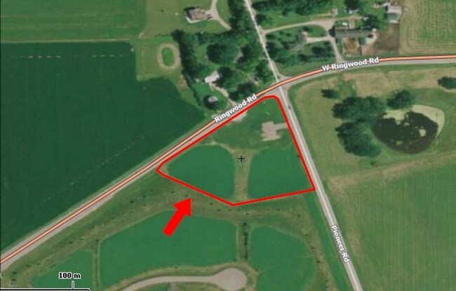

Property Detail
5114 Mann Dr
Chicago-Naperville-Elgin, IL-IN
DOC 2020R0042380 LT 71 PIONEER OAKS OF RINGWOOD
09-03-452-007
MCHENRY
Farms
Illinois
B and X Area of moderate flood hazard, usually the area between the limits of the 100-year and 500-year floods.
71
2024
2.58 AC
2024
Far Northwest
870703
Chicago
NEARBY LISTINGS FOR SALE OR LEASE
-
-
SWC Route 31 & Alexander Drive @ Alexander Drive
Johnsburg, IL 60050
Rent Upon Request
16 AC Lots
Land
-
-
-
View all Ringwood listings for sale on LoopNet.com
DEMOGRAPHICS near 5114 Mann Dr
1 mile
3 mile
5 mile
2025 Total Population
510
11,674
57,937
2030 Population
543
12,067
59,502
Pop Growth 2025-2030
+ 6.47%
+ 3.37%
+ 2.70%
Average Age
44
43
43
2025 Total Households
183
4,418
22,892
HH Growth 2025-2030
+ 6.56%
+ 3.46%
+ 2.74%
Median Household Inc
$153,125
$102,841
$91,360
Avg Household Size
2.70
2.60
2.50
2025 Avg HH Vehicles
3.00
2.00
2.00
Median Home Value
$406,731
$322,234
$286,048
Median Year Built
2003
1990
1978
Nearby Places
Map Layers
Map Styles
 Street
 Aerial
Transit
 Traffic
 Biking
Places
Listings with unknown addresses are not visible on the map
- Restaurants
- Banks
- Shops
- Fitness
- Groceries
PUBLIC TRANSPORTATION
COMMUTER RAIL
Mchenry Station (Union Pacific Northwest Line - Northeast Illinois Regional Commuter Railroad (Metra))
Drive
Walk
Distance
Mchenry Station (Union Pacific Northwest Line - Northeast Illinois Regional Commuter Railroad (Metra))
10 min
5.7 mi
Fox Lake Station (Milwaukee District North Line - Northeast Illinois Regional Commuter Railroad (Metra))
Drive
Walk
Distance
Fox Lake Station (Milwaukee District North Line - Northeast Illinois Regional Commuter Railroad (Metra))
18 min
8.5 mi
Freight Ports
Port Milwaukee
Drive
Walk
Distance
Port Milwaukee
79 min
62.1 mi
SALE & LEASE HISTORY
LISTING DATE
SALE/LEASE

Sep 24, 2016
For Sale
Nearby Properties
Address
Land Use
TOTAL SIZE
Lot Size
Zoning
Address
Land Use
TOTAL SIZE
Lot Size
Zoning
185,809 SF
21 AC
Address
Land Use
TOTAL SIZE
Lot Size
Zoning
206,452 SF
29.36 AC
Address
Land Use
TOTAL SIZE
Lot Size
Zoning
Address
Land Use
TOTAL SIZE
Lot Size
Zoning
164,700 SF
13.89 AC
Address
Land Use
TOTAL SIZE
Lot Size
Zoning
3,000 SF
4.71 AC
Address
Land Use
TOTAL SIZE
Lot Size
Zoning
0.90 AC
Address
Land Use
TOTAL SIZE
Lot Size
Zoning
1.48 AC
Address
Land Use
TOTAL SIZE
Lot Size
Zoning
8,386 SF
3.87 AC
Address
Land Use
TOTAL SIZE
Lot Size
Zoning
21.53 AC
Address
Land Use
TOTAL SIZE
Lot Size
Zoning
17,640 SF
2 AC
Address
Land Use
TOTAL SIZE
Lot Size
Zoning
2.83 AC
Address
Land Use
TOTAL SIZE
Lot Size
Zoning
1,500 SF
6.81 AC
Address
Land Use
TOTAL SIZE
Lot Size
Zoning
1.23 AC
Address
Land Use
TOTAL SIZE
Lot Size
Zoning
1.12 AC
Address
Land Use
TOTAL SIZE
Lot Size
Zoning
95,760 SF
10.46 AC
Address
Land Use
TOTAL SIZE
Lot Size
Zoning
6,520 SF
2.80 AC
Address
Land Use
TOTAL SIZE
Lot Size
Zoning
8,627 SF
1 AC
Address
Land Use
TOTAL SIZE
Lot Size
Zoning
1,600 SF
0.90 AC
Address
Land Use
TOTAL SIZE
Lot Size
Zoning
11,842 SF
2.43 AC
Address
Land Use
TOTAL SIZE
Lot Size
Zoning
14,302 SF
1 AC
Address
Land Use
TOTAL SIZE
Lot Size
Zoning
13,248 SF
1.21 AC
Address
Land Use
TOTAL SIZE
Lot Size
Zoning
14,025 SF
2.25 AC
Address
Land Use
TOTAL SIZE
Lot Size
Zoning
51,513 SF
4.10 AC
Address
Land Use
TOTAL SIZE
Lot Size
Zoning
35,575 SF
3.34 AC
Address
Land Use
TOTAL SIZE
Lot Size
Zoning
12,900 SF
0.52 AC
Address
Land Use
TOTAL SIZE
Lot Size
Zoning
16,710 SF
1 AC
Address
Land Use
TOTAL SIZE
Lot Size
Zoning
18,480 SF
2 AC
Address
Land Use
TOTAL SIZE
Lot Size
Zoning
15,300 SF
2 AC
Address
Land Use
TOTAL SIZE
Lot Size
Zoning
0.76 AC
Address
Land Use
TOTAL SIZE
Lot Size
Zoning
15,912 SF
2.01 AC
The World's #1 Commercial Real Estate Marketplace
Connect with us
© 2026 CoStar Group
The information above has been obtained from sources believed reliable. While we do not doubt its accuracy we have not verified it and make no guarantee, warranty or representation about it. It is your responsibility to independently confirm its accuracy and completeness. Any projections, opinions, assumptions, or estimates used are for example only and do not represent the current or future performance of the property. The value of this transaction to you depends on tax and other factors which should be evaluated by your tax, financial, and legal advisors. You and your advisors should conduct a careful, independent investigation of the property to determine to your satisfaction the suitability of the property for your needs.