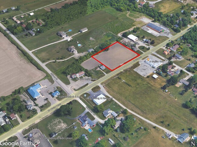
Property Record
5115 N Dixie Hwy, Newport, MI 48166
NEARBY LISTINGS FOR SALE OR LEASE
Property Detail
5115 N Dixie Hwy
07-531-001-30
F-128 SEC 24 T6S R9E & PC 531 1.087 AMOL COM 395.34 FT N 52 DEG 12'E FR INT CLS WILLIAMS ST & DIXIE HWYTO THE POB, TH N 37
Residentialacreage
Monroe
X
Michigan
26115C0258F
1.03 AC
2024
Monroe County
2025
Detroit
831202
Monroe, MI
DEMOGRAPHICS near 5115 N Dixie Hwy
1 Mile
3 Mile
5 Mile
2024 Total Population
2,064
9,438
28,722
2029 Population
2,082
9,623
29,264
Pop Growth 2024-2029
+ 0.87%
+ 1.96%
+ 1.89%
Average Age
43
42
40
2024 Total Households
822
3,710
11,275
HH Growth 2024-2029
+ 0.85%
+ 1.91%
+ 1.83%
Median Household Inc
$69,282
$69,338
$67,653
Avg Household Size
2.40
2.50
2.50
2024 Avg HH Vehicles
2.00
2.00
2.00
Median Home Value
$240,178
$188,813
$170,760
Median Year Built
1980
1964
1976
Nearby Places
Map Layers
Map Styles
 Street
 Aerial
- Restaurants
- Banks
- Shops
- Fitness
- Groceries
PUBLIC TRANSPORTATION
AIRPORT
Detroit Metro Wayne County
DRIVE
WALK
Distance
Detroit Metro Wayne County
32 min
22.9 mi
Windsor International
DRIVE
WALK
Distance
Windsor International
63 min
42.8 mi
Freight Ports
Port of Toledo
DRIVE
WALK
Distance
Port of Toledo
41 min
28.7 mi
SALE & LEASE HISTORY
LISTING DATE
SALE/LEASE

Feb 29, 2024
For Sale
Nearby Properties
Address
Land Use
TOTAL SIZE
Lot Size
Zoning
Address
Land Use
TOTAL SIZE
Lot Size
Zoning
90.57 AC
PS PUBLIC
Address
Land Use
TOTAL SIZE
Lot Size
Zoning
Address
Land Use
TOTAL SIZE
Lot Size
Zoning
720,420 SF
71.34 AC
LM-LIGHT M
Address
Land Use
TOTAL SIZE
Lot Size
Zoning
315,000 SF
24.47 AC
Address
Land Use
TOTAL SIZE
Lot Size
Zoning
134,464 SF
34.35 AC
Address
Land Use
TOTAL SIZE
Lot Size
Zoning
291,322 SF
55.05 AC
Address
Land Use
TOTAL SIZE
Lot Size
Zoning
290,248 SF
52.03 AC
Address
Land Use
TOTAL SIZE
Lot Size
Zoning
43,127 SF
8.10 AC
Address
Land Use
TOTAL SIZE
Lot Size
Zoning
220,500 SF
31.81 AC
Address
Land Use
TOTAL SIZE
Lot Size
Zoning
19,364 SF
30.80 AC
Address
Land Use
TOTAL SIZE
Lot Size
Zoning
17.91 AC
A-AGRICULT
Address
Land Use
TOTAL SIZE
Lot Size
Zoning
44,352 SF
3.40 AC
Address
Land Use
TOTAL SIZE
Lot Size
Zoning
45,792 SF
6.28 AC
Address
Land Use
TOTAL SIZE
Lot Size
Zoning
49,176 SF
3.90 AC
PUD-PLANUN
Address
Land Use
TOTAL SIZE
Lot Size
Zoning
1,584 SF
23.04 AC
MHP
Address
Land Use
TOTAL SIZE
Lot Size
Zoning
41,600 SF
2.29 AC
Address
Land Use
TOTAL SIZE
Lot Size
Zoning
13,763 SF
2.30 AC
PUD-PLANUN
Address
Land Use
TOTAL SIZE
Lot Size
Zoning
Address
Land Use
TOTAL SIZE
Lot Size
Zoning
3,218 SF
1.59 AC
Address
Land Use
TOTAL SIZE
Lot Size
Zoning
27,332 SF
4.50 AC
Address
Land Use
TOTAL SIZE
Lot Size
Zoning
13,730 SF
2.43 AC
Address
Land Use
TOTAL SIZE
Lot Size
Zoning
24,848 SF
15.21 AC
Address
Land Use
TOTAL SIZE
Lot Size
Zoning
787 AC
PS PUBLIC
Address
Land Use
TOTAL SIZE
Lot Size
Zoning
4,139 SF
102.10 AC
A-AGRICULT
Address
Land Use
TOTAL SIZE
Lot Size
Zoning
7,453 SF
11.39 AC
Address
Land Use
TOTAL SIZE
Lot Size
Zoning
Address
Land Use
TOTAL SIZE
Lot Size
Zoning
11,181 SF
11.05 AC
Address
Land Use
TOTAL SIZE
Lot Size
Zoning
3.47 AC
PUD-PLANUN
Address
Land Use
TOTAL SIZE
Lot Size
Zoning
2,397 SF
113.18 AC
A-AGRICULT
Address
Land Use
TOTAL SIZE
Lot Size
Zoning
2.43 AC
The World's #1 Commercial Real Estate Marketplace
Connect with us
© 2025 CoStar Group
The information above has been obtained from sources believed reliable. While we do not doubt its accuracy we have not verified it and make no guarantee, warranty or representation about it. It is your responsibility to independently confirm its accuracy and completeness. Any projections, opinions, assumptions, or estimates used are for example only and do not represent the current or future performance of the property. The value of this transaction to you depends on tax and other factors which should be evaluated by your tax, financial, and legal advisors. You and your advisors should conduct a careful, independent investigation of the property to determine to your satisfaction the suitability of the property for your needs.