Property Record
5115 Ne 63Rd Ave, Gainesville, FL 32609
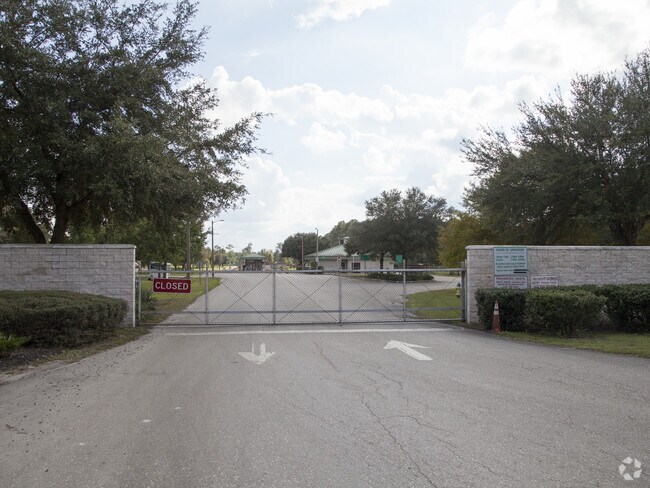

Property Detail
5115 Ne 63Rd Ave
07872-003-003
COM SW COR SEC N 1714.19 FT N 80.61 FT E 2591.32 FT POB N 1721.12 FT W 1146.61 FT S 210 FT W 210 FT N 210 FT W 500 FT TO E R/W ABANDONED CSX RR R/W NE ALG R/W 114.98 FT E 2698.81 FT S 1811.67 FT W 900 FT N 80.67 FT POB ALSO LIFT STATION OR 2218/2945)
Countyproperty
Alachua
PD
Florida
A Areas with a 1% annual chance of flooding and a 26% chance of flooding over the life of a 30-year mortgage.
44.26 AC
0
Gainesville
2025
Other Market Areas
001907
Gainesville, FL
66,014 SF
NEARBY LISTINGS FOR SALE OR LEASE
DEMOGRAPHICS near 5115 Ne 63Rd Ave
1 mile
3 mile
5 mile
2025 Total Population
294
4,678
27,463
2030 Population
310
4,895
28,686
Pop Growth 2025-2030
+ 5.44%
+ 4.64%
+ 4.45%
Average Age
41
41
39
2025 Total Households
110
1,447
10,647
HH Growth 2025-2030
+ 6.36%
+ 5.11%
+ 4.86%
Median Household Inc
$69,078
$50,566
$47,864
Avg Household Size
2.50
2.40
2.30
2025 Avg HH Vehicles
2.00
1.00
1.00
Median Home Value
$206,410
$136,270
$170,966
Median Year Built
1987
1986
1973
Nearby Places
Map Layers
Map Styles
 Street
 Aerial
Layers
 Traffic
 Biking
Places
Listings with unknown addresses are not visible on the map
- Restaurants
- Banks
- Shops
- Fitness
- Groceries
PUBLIC TRANSPORTATION
AIRPORT
Gainesville Regional
Drive
Walk
Distance
Gainesville Regional
11 min
4.1 mi
Freight Ports
Jacksonville Port
Drive
Walk
Distance
Jacksonville Port
90 min
69.5 mi
Nearby Properties
Address
Land Use
TOTAL SIZE
Lot Size
Zoning
Address
Land Use
TOTAL SIZE
Lot Size
Zoning
25.64 AC
PS
Address
Land Use
TOTAL SIZE
Lot Size
Zoning
308,599 SF
639 AC
A
Address
Land Use
TOTAL SIZE
Lot Size
Zoning
341,625 SF
1,093.63 AC
AF
Address
Land Use
TOTAL SIZE
Lot Size
Zoning
85,476 SF
17.92 AC
MP
Address
Land Use
TOTAL SIZE
Lot Size
Zoning
177,604 SF
41.41 AC
I2
Address
Land Use
TOTAL SIZE
Lot Size
Zoning
64,138 SF
8.43 AC
I2
Address
Land Use
TOTAL SIZE
Lot Size
Zoning
118,740 SF
11.16 AC
I1
Address
Land Use
TOTAL SIZE
Lot Size
Zoning
154,130 SF
24.65 AC
I2
Address
Land Use
TOTAL SIZE
Lot Size
Zoning
123,764 SF
10.13 AC
PD
Address
Land Use
TOTAL SIZE
Lot Size
Zoning
241,937 SF
16.93 AC
I2
Address
Land Use
TOTAL SIZE
Lot Size
Zoning
26,552 SF
70.03 AC
MH
Address
Land Use
TOTAL SIZE
Lot Size
Zoning
82,394 SF
13.93 AC
I2
Address
Land Use
TOTAL SIZE
Lot Size
Zoning
88,104 SF
60.24 AC
PS
Address
Land Use
TOTAL SIZE
Lot Size
Zoning
2,030 SF
34.88 AC
RM
Address
Land Use
TOTAL SIZE
Lot Size
Zoning
23 AC
PS
Address
Land Use
TOTAL SIZE
Lot Size
Zoning
2,540 SF
13.84 AC
I1
Address
Land Use
TOTAL SIZE
Lot Size
Zoning
63,475 SF
9.42 AC
I2
Address
Land Use
TOTAL SIZE
Lot Size
Zoning
77,500 SF
36.72 AC
MP
Address
Land Use
TOTAL SIZE
Lot Size
Zoning
66.89 AC
PS
Address
Land Use
TOTAL SIZE
Lot Size
Zoning
98.47 AC
CON
Address
Land Use
TOTAL SIZE
Lot Size
Zoning
237.10 AC
PS
Address
Land Use
TOTAL SIZE
Lot Size
Zoning
68,218 SF
14.46 AC
I1
Address
Land Use
TOTAL SIZE
Lot Size
Zoning
45,975 SF
5 AC
I2
Address
Land Use
TOTAL SIZE
Lot Size
Zoning
50,000 SF
13 AC
MP
Address
Land Use
TOTAL SIZE
Lot Size
Zoning
10,842 SF
8.45 AC
I2
Address
Land Use
TOTAL SIZE
Lot Size
Zoning
32,316 SF
5.23 AC
I2
Address
Land Use
TOTAL SIZE
Lot Size
Zoning
24,730 SF
2.84 AC
BI
Address
Land Use
TOTAL SIZE
Lot Size
Zoning
12,431 SF
134.53 AC
PS
Address
Land Use
TOTAL SIZE
Lot Size
Zoning
94,347 SF
9 AC
I1
The World's #1 Commercial Real Estate Marketplace
Connect with us
© 2026 CoStar Group
The information above has been obtained from sources believed reliable. While we do not doubt its accuracy we have not verified it and make no guarantee, warranty or representation about it. It is your responsibility to independently confirm its accuracy and completeness. Any projections, opinions, assumptions, or estimates used are for example only and do not represent the current or future performance of the property. The value of this transaction to you depends on tax and other factors which should be evaluated by your tax, financial, and legal advisors. You and your advisors should conduct a careful, independent investigation of the property to determine to your satisfaction the suitability of the property for your needs.