Property Record
5118 S Interstate 35, Pearsall, TX 78061
NEARBY LISTINGS FOR SALE OR LEASE
-
-
View all Pearsall listings for lease on LoopNet.com
Property Detail
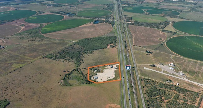
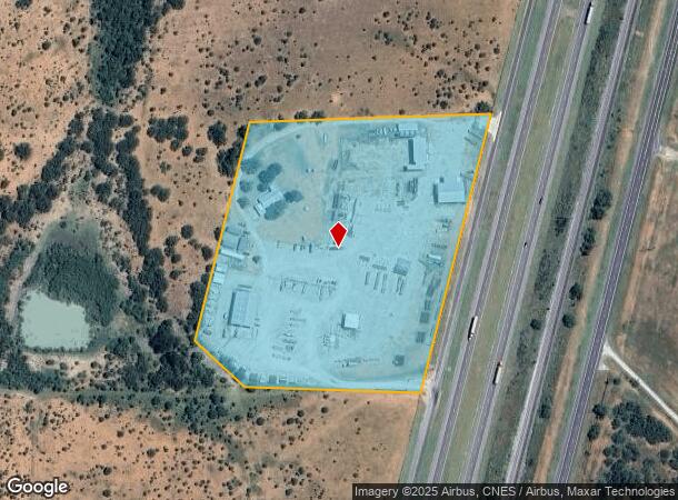
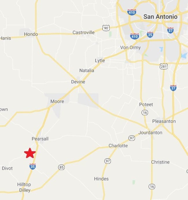
5118 S Interstate 35
00300-00102-00400-000000
102 5 B S & F 3 MOB HMS ON ACC #600-2020-400
Industrialgeneral
Frio
2025
Texas
2025
3 AC
950201
Texas South Area
15,180 SF
Other Market Areas
DEMOGRAPHICS near 5118 S Interstate 35
1 Mile
3 Mile
5 Mile
2024 Total Population
24
103
6,860
2029 Population
24
105
7,219
Pop Growth 2024-2029
0.00%
+ 1.94%
+ 5.23%
Average Age
34
36
37
2024 Total Households
4
19
2,016
HH Growth 2024-2029
0.00%
+ 5.26%
+ 6.30%
Median Household Inc
$112,500
$87,500
$51,952
Avg Household Size
2.00
3.00
2.80
2024 Avg HH Vehicles
2.00
2.00
2.00
Median Home Value
$99,999
$99,999
$72,368
Median Year Built
1979
1987
1981
Nearby Places
- Restaurants
- Banks
- Shops
- Fitness
- Groceries
SALE & LEASE HISTORY
LISTING DATE
SALE/LEASE

Sep 23, 2016
For Sale
Sep 18, 2017
For Sale
Jun 18, 2019
For Lease
Nearby Properties
Address
Land Use
TOTAL SIZE
Lot Size
Zoning
Address
Land Use
TOTAL SIZE
Lot Size
Zoning
10,400 SF
58.79 AC
Address
Land Use
TOTAL SIZE
Lot Size
Zoning
8,520 SF
3.37 AC
Address
Land Use
TOTAL SIZE
Lot Size
Zoning
18,665 SF
13 AC
Address
Land Use
TOTAL SIZE
Lot Size
Zoning
26,838 SF
165.10 AC
Address
Land Use
TOTAL SIZE
Lot Size
Zoning
63,247 SF
8.13 AC
Address
Land Use
TOTAL SIZE
Lot Size
Zoning
6,032 SF
4.17 AC
Address
Land Use
TOTAL SIZE
Lot Size
Zoning
12,156 SF
5 AC
Address
Land Use
TOTAL SIZE
Lot Size
Zoning
5,620 SF
8.52 AC
Address
Land Use
TOTAL SIZE
Lot Size
Zoning
3,418 SF
1 AC
Address
Land Use
TOTAL SIZE
Lot Size
Zoning
12,019 SF
1 AC
Address
Land Use
TOTAL SIZE
Lot Size
Zoning
9,584 SF
10.83 AC
Address
Land Use
TOTAL SIZE
Lot Size
Zoning
20,012 SF
5.61 AC
Address
Land Use
TOTAL SIZE
Lot Size
Zoning
41.44 AC
Address
Land Use
TOTAL SIZE
Lot Size
Zoning
2,250 SF
340.24 AC
Address
Land Use
TOTAL SIZE
Lot Size
Zoning
7,988 SF
641.41 AC
Address
Land Use
TOTAL SIZE
Lot Size
Zoning
341.83 AC
Address
Land Use
TOTAL SIZE
Lot Size
Zoning
5,050 SF
1.50 AC
Address
Land Use
TOTAL SIZE
Lot Size
Zoning
5,428 SF
210.56 AC
Address
Land Use
TOTAL SIZE
Lot Size
Zoning
Address
Land Use
TOTAL SIZE
Lot Size
Zoning
4,656 SF
2 AC
Address
Land Use
TOTAL SIZE
Lot Size
Zoning
3,140 SF
2 AC
Address
Land Use
TOTAL SIZE
Lot Size
Zoning
329.88 AC
Address
Land Use
TOTAL SIZE
Lot Size
Zoning
281.50 AC
Address
Land Use
TOTAL SIZE
Lot Size
Zoning
105.77 AC
Address
Land Use
TOTAL SIZE
Lot Size
Zoning
105.57 AC
Address
Land Use
TOTAL SIZE
Lot Size
Zoning
4,173 SF
2.27 AC
Address
Land Use
TOTAL SIZE
Lot Size
Zoning
306.48 AC
Address
Land Use
TOTAL SIZE
Lot Size
Zoning
5,000 SF
181.83 AC
Address
Land Use
TOTAL SIZE
Lot Size
Zoning
20.72 AC
The World's #1 Commercial Real Estate Marketplace
Connect with us
© 2025 CoStar Group
The information above has been obtained from sources believed reliable. While we do not doubt its accuracy we have not verified it and make no guarantee, warranty or representation about it. It is your responsibility to independently confirm its accuracy and completeness. Any projections, opinions, assumptions, or estimates used are for example only and do not represent the current or future performance of the property. The value of this transaction to you depends on tax and other factors which should be evaluated by your tax, financial, and legal advisors. You and your advisors should conduct a careful, independent investigation of the property to determine to your satisfaction the suitability of the property for your needs.