Property Record
512 E Main St, Marlow, OK 73055


Save to a Folder
{{folder.Name}}
{{folder.ListingIds.length}} Properties
{{folder.ListingIds.length}} Property
Create a New Folder
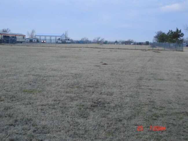
Property Detail
512 E Main St
Duncan, OK
16-2N-7W ADD TR BEG 607E FROM QUARTER SEC CORNER BETWEEN SEC 16 & 17 TH S90 E136.7 N750 W136.7 S660 TO BEG (BEING TR 136.7 BY 750) (512 E MAIN)
3099-16-02N-07W-2-017-00
STEPHENS
Commercialacreage
Oklahoma
R1
7w
B and X Area of moderate flood hazard, usually the area between the limits of the 100-year and 500-year floods.
2.50 AC
2025
Oklahoma West Area
2025
Other Market Areas
000902
NEARBY LISTINGS FOR SALE OR LEASE
-
-
View all Marlow listings for sale on LoopNet.com
DEMOGRAPHICS near 512 E Main St
1 mile
3 mile
5 mile
2025 Total Population
2,668
5,517
7,126
2030 Population
2,751
5,682
7,331
Pop Growth 2025-2030
+ 3.11%
+ 2.99%
+ 2.88%
Average Age
41
42
42
2025 Total Households
1,076
2,200
2,835
HH Growth 2025-2030
+ 3.16%
+ 3.05%
+ 2.89%
Median Household Inc
$58,671
$59,551
$61,490
Avg Household Size
2.40
2.50
2.50
2025 Avg HH Vehicles
2.00
2.00
2.00
Median Home Value
$150,000
$158,988
$167,046
Median Year Built
1973
1975
1976
Nearby Places
Map Layers
Map Styles
 Street
 Aerial
Layers
 Traffic
 Biking
Places
Listings with unknown addresses are not visible on the map
- Restaurants
- Banks
- Shops
- Fitness
- Groceries
PUBLIC TRANSPORTATION
AIRPORT
Lawton-Fort Sill Regional
Drive
Walk
Distance
Lawton-Fort Sill Regional
46 min
32.7 mi
SALE & LEASE HISTORY
LISTING DATE
SALE/LEASE

Mar 04, 2021
For Sale
Nearby Properties
Address
Land Use
TOTAL SIZE
Lot Size
Zoning
Address
Land Use
TOTAL SIZE
Lot Size
Zoning
3,375 SF
0.86 AC
C2
Address
Land Use
TOTAL SIZE
Lot Size
Zoning
54,046 SF
2.82 AC
R1
Address
Land Use
TOTAL SIZE
Lot Size
Zoning
1,200 SF
35 AC
Address
Land Use
TOTAL SIZE
Lot Size
Zoning
13,058 SF
2.67 AC
R1
Address
Land Use
TOTAL SIZE
Lot Size
Zoning
34,908 SF
1.45 AC
R1
Address
Land Use
TOTAL SIZE
Lot Size
Zoning
1,584 SF
2.83 AC
Address
Land Use
TOTAL SIZE
Lot Size
Zoning
2,664 SF
11.89 AC
R1
Address
Land Use
TOTAL SIZE
Lot Size
Zoning
28,000 SF
0.34 AC
R1
Address
Land Use
TOTAL SIZE
Lot Size
Zoning
15,000 SF
5.78 AC
C2
Address
Land Use
TOTAL SIZE
Lot Size
Zoning
12,500 SF
1.22 AC
Address
Land Use
TOTAL SIZE
Lot Size
Zoning
306 SF
0.66 AC
C2
Address
Land Use
TOTAL SIZE
Lot Size
Zoning
11,800 SF
2.10 AC
C1
Address
Land Use
TOTAL SIZE
Lot Size
Zoning
10,836 SF
0.57 AC
R1
Address
Land Use
TOTAL SIZE
Lot Size
Zoning
10,679 SF
0.63 AC
C1
Address
Land Use
TOTAL SIZE
Lot Size
Zoning
3,073 SF
0.57 AC
R1
Address
Land Use
TOTAL SIZE
Lot Size
Zoning
1,200 SF
20 AC
Address
Land Use
TOTAL SIZE
Lot Size
Zoning
1,440 SF
25 AC
Address
Land Use
TOTAL SIZE
Lot Size
Zoning
10,796 SF
0.99 AC
R1
Address
Land Use
TOTAL SIZE
Lot Size
Zoning
560 SF
2.83 AC
Address
Land Use
TOTAL SIZE
Lot Size
Zoning
6,000 SF
5.22 AC
R1
Address
Land Use
TOTAL SIZE
Lot Size
Zoning
984 SF
7.06 AC
C1
Address
Land Use
TOTAL SIZE
Lot Size
Zoning
18,180 SF
4.59 AC
C1
Address
Land Use
TOTAL SIZE
Lot Size
Zoning
3,000 SF
5.35 AC
R1
Address
Land Use
TOTAL SIZE
Lot Size
Zoning
5,000 SF
0.73 AC
R1
Address
Land Use
TOTAL SIZE
Lot Size
Zoning
1,088 SF
1.30 AC
R1
Address
Land Use
TOTAL SIZE
Lot Size
Zoning
7,380 SF
8.61 AC
R1
Address
Land Use
TOTAL SIZE
Lot Size
Zoning
8,748 SF
0.63 AC
C2
Address
Land Use
TOTAL SIZE
Lot Size
Zoning
3,731 SF
0.38 AC
C1
Address
Land Use
TOTAL SIZE
Lot Size
Zoning
3,300 SF
1.33 AC
R1
The World's #1 Commercial Real Estate Marketplace
Connect with us
© 2026 CoStar Group
The information above has been obtained from sources believed reliable. While we do not doubt its accuracy we have not verified it and make no guarantee, warranty or representation about it. It is your responsibility to independently confirm its accuracy and completeness. Any projections, opinions, assumptions, or estimates used are for example only and do not represent the current or future performance of the property. The value of this transaction to you depends on tax and other factors which should be evaluated by your tax, financial, and legal advisors. You and your advisors should conduct a careful, independent investigation of the property to determine to your satisfaction the suitability of the property for your needs.