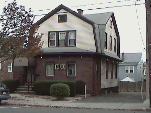
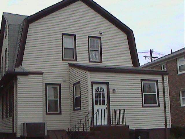
Property Record
512 Franklin Ave, Nutley, NJ 07110


NEARBY LISTINGS FOR SALE OR LEASE
Property Detail
512 Franklin Ave
16-03107-0000-00006
50X111 IRR
Storebuilding
Essex
X
New Jersey
34031C0259G
6
2023
0.13 AC
2025
Bloomfield/GSP
013500
Northern New Jersey
1,893 SF
Newark, NJ
DEMOGRAPHICS near 512 Franklin Ave
1 Mile
3 Mile
5 Mile
2024 Total Population
23,845
244,760
648,668
2029 Population
23,467
239,075
630,436
Pop Growth 2024-2029
(1.59%)
(2.32%)
(2.81%)
Average Age
42
40
39
2024 Total Households
9,096
90,805
235,654
HH Growth 2024-2029
(1.90%)
(2.49%)
(2.91%)
Median Household Inc
$113,076
$90,262
$78,038
Avg Household Size
2.60
2.60
2.60
2024 Avg HH Vehicles
2.00
2.00
2.00
Median Home Value
$446,277
$436,947
$432,284
Median Year Built
1949
1951
1952
Nearby Places
Map Layers
Map Styles
 Street
 Aerial
- Restaurants
- Banks
- Shops
- Fitness
- Groceries
PUBLIC TRANSPORTATION
COMMUTER RAIL
Delawanna (Main/Port Jervis Line - NJ Transit Commuter Rail (NJ Transit))
DRIVE
WALK
Distance
Delawanna (Main/Port Jervis Line - NJ Transit Commuter Rail (NJ Transit))
4 min
1.9 mi
Passaic (Main/Port Jervis Line - NJ Transit Commuter Rail (NJ Transit))
DRIVE
WALK
Distance
Passaic (Main/Port Jervis Line - NJ Transit Commuter Rail (NJ Transit))
6 min
2.8 mi
AIRPORT
Newark Liberty International
DRIVE
WALK
Distance
Newark Liberty International
18 min
14.6 mi
LaGuardia
DRIVE
WALK
Distance
LaGuardia
39 min
21.1 mi
John F Kennedy International
DRIVE
WALK
Distance
John F Kennedy International
47 min
29.1 mi
Freight Ports
Maher Terminal
DRIVE
WALK
Distance
Maher Terminal
25 min
13.1 mi
Nearby Properties
Address
Land Use
TOTAL SIZE
Lot Size
Zoning
Address
Land Use
TOTAL SIZE
Lot Size
Zoning
Address
Land Use
TOTAL SIZE
Lot Size
Zoning
4,014 SF
21 AC
Address
Land Use
TOTAL SIZE
Lot Size
Zoning
612 AC
SEA
Address
Land Use
TOTAL SIZE
Lot Size
Zoning
3,956 SF
250 AC
C2
Address
Land Use
TOTAL SIZE
Lot Size
Zoning
Address
Land Use
TOTAL SIZE
Lot Size
Zoning
5 AC
H
Address
Land Use
TOTAL SIZE
Lot Size
Zoning
17.97 AC
Address
Land Use
TOTAL SIZE
Lot Size
Zoning
8.88 AC
ORD
Address
Land Use
TOTAL SIZE
Lot Size
Zoning
1,218 SF
41.30 AC
RB
Address
Land Use
TOTAL SIZE
Lot Size
Zoning
12.54 AC
OPRP
Address
Land Use
TOTAL SIZE
Lot Size
Zoning
100,014 SF
8.80 AC
M2
Address
Land Use
TOTAL SIZE
Lot Size
Zoning
1.12 AC
M-O
Address
Land Use
TOTAL SIZE
Lot Size
Zoning
4.80 AC
Address
Land Use
TOTAL SIZE
Lot Size
Zoning
Address
Land Use
TOTAL SIZE
Lot Size
Zoning
144,024 SF
1 AC
LM
Address
Land Use
TOTAL SIZE
Lot Size
Zoning
3.26 AC
PR
Address
Land Use
TOTAL SIZE
Lot Size
Zoning
24.29 AC
Address
Land Use
TOTAL SIZE
Lot Size
Zoning
71,634 SF
12.31 AC
M1
Address
Land Use
TOTAL SIZE
Lot Size
Zoning
860 SF
0.96 AC
R100
Address
Land Use
TOTAL SIZE
Lot Size
Zoning
267,069 SF
6.15 AC
Address
Land Use
TOTAL SIZE
Lot Size
Zoning
Address
Land Use
TOTAL SIZE
Lot Size
Zoning
9.98 AC
R-1
Address
Land Use
TOTAL SIZE
Lot Size
Zoning
0.22 AC
Address
Land Use
TOTAL SIZE
Lot Size
Zoning
7.22 AC
M-3
Address
Land Use
TOTAL SIZE
Lot Size
Zoning
9.38 AC
B-A
Address
Land Use
TOTAL SIZE
Lot Size
Zoning
4.09 AC
M-O
Address
Land Use
TOTAL SIZE
Lot Size
Zoning
17.90 AC
R-G
Address
Land Use
TOTAL SIZE
Lot Size
Zoning
12.52 AC
Address
Land Use
TOTAL SIZE
Lot Size
Zoning
53,100 SF
6.60 AC
Address
Land Use
TOTAL SIZE
Lot Size
Zoning
17.50 AC
The World's #1 Commercial Real Estate Marketplace
Connect with us
© 2026 CoStar Group
The information above has been obtained from sources believed reliable. While we do not doubt its accuracy we have not verified it and make no guarantee, warranty or representation about it. It is your responsibility to independently confirm its accuracy and completeness. Any projections, opinions, assumptions, or estimates used are for example only and do not represent the current or future performance of the property. The value of this transaction to you depends on tax and other factors which should be evaluated by your tax, financial, and legal advisors. You and your advisors should conduct a careful, independent investigation of the property to determine to your satisfaction the suitability of the property for your needs.