Property Record
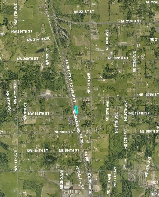
512 Ne 194Th St, Ridgefield, WA 98642


NEARBY LISTINGS FOR SALE OR LEASE
Property Detail
512 Ne 194Th St
Portland
Delfel Acres
Portland-Vancouver-Hillsboro, OR-WA
DELFEL ACRES LOT 100, 1/99 4.53A FOR ASSESSOR USE ONLY SEE SURVEY 23-102
117470-000
Clark
Shipyard
Washington
2025
100,1
2025
1.31 AC
040905
Clark County Outlying
73,992 SF
DEMOGRAPHICS near 512 Ne 194Th St
1 Mile
3 Mile
5 Mile
2024 Total Population
1,217
21,372
81,039
2029 Population
1,317
23,137
88,018
Pop Growth 2024-2029
+ 8.22%
+ 8.26%
+ 8.61%
Average Age
44
42
42
2024 Total Households
423
7,849
29,489
HH Growth 2024-2029
+ 8.27%
+ 8.41%
+ 8.73%
Median Household Inc
$111,956
$103,691
$105,400
Avg Household Size
2.90
2.70
2.70
2024 Avg HH Vehicles
3.00
2.00
2.00
Median Home Value
$733,871
$567,808
$565,789
Median Year Built
1979
1996
1995
Nearby Places
Map Layers
Map Styles
 Street
 Aerial
- Restaurants
- Banks
- Shops
- Fitness
- Groceries
PUBLIC TRANSPORTATION
AIRPORT
Portland International
DRIVE
WALK
Distance
Portland International
30 min
20.5 mi
SALE & LEASE HISTORY
LISTING DATE
SALE/LEASE

Sep 24, 2016
For Sale
Nearby Properties
Address
Land Use
TOTAL SIZE
Lot Size
Zoning
Address
Land Use
TOTAL SIZE
Lot Size
Zoning
540,669 SF
272.10 AC
U
Address
Land Use
TOTAL SIZE
Lot Size
Zoning
262,710 SF
14.99 AC
R-22
Address
Land Use
TOTAL SIZE
Lot Size
Zoning
275,000 SF
67.54 AC
R1-7.5
Address
Land Use
TOTAL SIZE
Lot Size
Zoning
173,174 SF
7.18 AC
OR-22
Address
Land Use
TOTAL SIZE
Lot Size
Zoning
145,300 SF
31.34 AC
PF
Address
Land Use
TOTAL SIZE
Lot Size
Zoning
477,314 SF
57.47 AC
PF
Address
Land Use
TOTAL SIZE
Lot Size
Zoning
107,064 SF
38.66 AC
U
Address
Land Use
TOTAL SIZE
Lot Size
Zoning
357,176 SF
9.82 AC
R-22
Address
Land Use
TOTAL SIZE
Lot Size
Zoning
93,616 SF
41.61 AC
PF
Address
Land Use
TOTAL SIZE
Lot Size
Zoning
141,175 SF
9.83 AC
R-18
Address
Land Use
TOTAL SIZE
Lot Size
Zoning
244,012 SF
2.83 AC
R-18
Address
Land Use
TOTAL SIZE
Lot Size
Zoning
163,716 SF
4.55 AC
R-12
Address
Land Use
TOTAL SIZE
Lot Size
Zoning
166,620 SF
14.85 AC
CC
Address
Land Use
TOTAL SIZE
Lot Size
Zoning
107,881 SF
5.19 AC
R-22
Address
Land Use
TOTAL SIZE
Lot Size
Zoning
87,654 SF
0.92 AC
CC
Address
Land Use
TOTAL SIZE
Lot Size
Zoning
138,825 SF
5.92 AC
OR-22
Address
Land Use
TOTAL SIZE
Lot Size
Zoning
80,818 SF
5.39 AC
R-18
Address
Land Use
TOTAL SIZE
Lot Size
Zoning
149,792 SF
15.92 AC
R1-7.5
Address
Land Use
TOTAL SIZE
Lot Size
Zoning
69,424 SF
9.39 AC
IL
Address
Land Use
TOTAL SIZE
Lot Size
Zoning
32,553 SF
11.84 AC
BP
Address
Land Use
TOTAL SIZE
Lot Size
Zoning
6,664 SF
4.92 AC
GC
Address
Land Use
TOTAL SIZE
Lot Size
Zoning
21,970 SF
1.73 AC
CC
Address
Land Use
TOTAL SIZE
Lot Size
Zoning
28,946 SF
1.93 AC
CC
Address
Land Use
TOTAL SIZE
Lot Size
Zoning
64,029 SF
16.42 AC
R-5
Address
Land Use
TOTAL SIZE
Lot Size
Zoning
36,419 SF
1.19 AC
CC
Address
Land Use
TOTAL SIZE
Lot Size
Zoning
56,217 SF
4.67 AC
IL
Address
Land Use
TOTAL SIZE
Lot Size
Zoning
68.61 AC
PF
Address
Land Use
TOTAL SIZE
Lot Size
Zoning
33,714 SF
2.62 AC
CC
Address
Land Use
TOTAL SIZE
Lot Size
Zoning
44.87 AC
R1-20
Address
Land Use
TOTAL SIZE
Lot Size
Zoning
74,264 SF
4.92 AC
IL
The World's #1 Commercial Real Estate Marketplace
Connect with us
© 2026 CoStar Group
The information above has been obtained from sources believed reliable. While we do not doubt its accuracy we have not verified it and make no guarantee, warranty or representation about it. It is your responsibility to independently confirm its accuracy and completeness. Any projections, opinions, assumptions, or estimates used are for example only and do not represent the current or future performance of the property. The value of this transaction to you depends on tax and other factors which should be evaluated by your tax, financial, and legal advisors. You and your advisors should conduct a careful, independent investigation of the property to determine to your satisfaction the suitability of the property for your needs.