Property Record
510 S Newburgh Rd, Westland, MI 48186

This Property Is For Sale
NEARBY LISTINGS FOR SALE OR LEASE
Property Detail
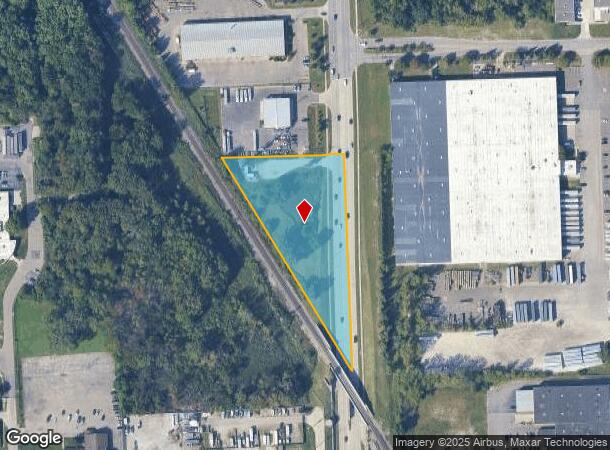
510 S Newburgh Rd
56-053-99-0006-000
19A30 A31 PT OF NE 1/4 SEC 19 T2S R9E BEG S 1619FT FROM NE COR OF SEC 19 TH S 608.06FT TH N29DEG 39M W 695.55FT TH N89DEG 15M E 343.76FT POB 2.40 AC
Commercialacreage
Wayne
X
Michigan
26163C0216E
0006
0
2.40 AC
2025
Southern I-275 Corridor
568400
Detroit
210 SF
Detroit-Warren-Dearborn, MI
DEMOGRAPHICS near 510 S Newburgh Rd
1 Mile
3 Mile
5 Mile
2024 Total Population
10,485
90,236
224,541
2029 Population
10,232
88,247
220,224
Pop Growth 2024-2029
(2.41%)
(2.20%)
(1.92%)
Average Age
42
41
41
2024 Total Households
4,330
38,531
92,624
HH Growth 2024-2029
(2.33%)
(2.23%)
(1.98%)
Median Household Inc
$76,732
$68,168
$74,634
Avg Household Size
2.40
2.30
2.40
2024 Avg HH Vehicles
2.00
2.00
2.00
Median Home Value
$203,885
$194,820
$224,258
Median Year Built
1970
1972
1971
Nearby Places
- Restaurants
- Banks
- Shops
- Fitness
- Groceries
PUBLIC TRANSPORTATION
AIRPORT
Detroit Metro Wayne County
DRIVE
WALK
Distance
Detroit Metro Wayne County
20 min
14.4 mi
Windsor International
DRIVE
WALK
Distance
Windsor International
56 min
36.3 mi
Freight Ports
Port of Toledo
DRIVE
WALK
Distance
Port of Toledo
70 min
56.1 mi
Nearby Properties
Address
Land Use
TOTAL SIZE
Lot Size
Zoning
Address
Land Use
TOTAL SIZE
Lot Size
Zoning
741,173 SF
63.81 AC
Address
Land Use
TOTAL SIZE
Lot Size
Zoning
400,857 SF
27.44 AC
RP
Address
Land Use
TOTAL SIZE
Lot Size
Zoning
39.50 AC
MR
Address
Land Use
TOTAL SIZE
Lot Size
Zoning
176,796 SF
17.08 AC
C-2
Address
Land Use
TOTAL SIZE
Lot Size
Zoning
167,491 SF
18.59 AC
Address
Land Use
TOTAL SIZE
Lot Size
Zoning
311,556 SF
23.17 AC
C-3
Address
Land Use
TOTAL SIZE
Lot Size
Zoning
1,789,755 SF
138.32 AC
IND-2 HVY
Address
Land Use
TOTAL SIZE
Lot Size
Zoning
20.91 AC
Address
Land Use
TOTAL SIZE
Lot Size
Zoning
395,148 SF
9.67 AC
Address
Land Use
TOTAL SIZE
Lot Size
Zoning
169,489 SF
14.51 AC
R-6
Address
Land Use
TOTAL SIZE
Lot Size
Zoning
489,500 SF
58.51 AC
M2-GEN
Address
Land Use
TOTAL SIZE
Lot Size
Zoning
Address
Land Use
TOTAL SIZE
Lot Size
Zoning
169,968 SF
12.46 AC
MR
Address
Land Use
TOTAL SIZE
Lot Size
Zoning
286,188 SF
40.21 AC
Address
Land Use
TOTAL SIZE
Lot Size
Zoning
16.03 AC
MR
Address
Land Use
TOTAL SIZE
Lot Size
Zoning
147,968 SF
16.68 AC
Address
Land Use
TOTAL SIZE
Lot Size
Zoning
66,670 SF
11.20 AC
C-3
Address
Land Use
TOTAL SIZE
Lot Size
Zoning
269,649 SF
18.27 AC
LI-1
Address
Land Use
TOTAL SIZE
Lot Size
Zoning
199,952 SF
13.06 AC
Address
Land Use
TOTAL SIZE
Lot Size
Zoning
76,430 SF
13.61 AC
C-3
Address
Land Use
TOTAL SIZE
Lot Size
Zoning
1,200,000 SF
71.38 AC
IND-2 HVY
Address
Land Use
TOTAL SIZE
Lot Size
Zoning
1,059,457 SF
23.05 AC
IND-2 HVY
Address
Land Use
TOTAL SIZE
Lot Size
Zoning
73,056 SF
7.44 AC
C-3
Address
Land Use
TOTAL SIZE
Lot Size
Zoning
177,268 SF
17.11 AC
Address
Land Use
TOTAL SIZE
Lot Size
Zoning
5.80 AC
MR
Address
Land Use
TOTAL SIZE
Lot Size
Zoning
204,978 SF
10.28 AC
LI-1
Address
Land Use
TOTAL SIZE
Lot Size
Zoning
113,622 SF
45.04 AC
RP
Address
Land Use
TOTAL SIZE
Lot Size
Zoning
232,858 SF
39.67 AC
Address
Land Use
TOTAL SIZE
Lot Size
Zoning
11.38 AC
MR
Address
Land Use
TOTAL SIZE
Lot Size
Zoning
170,275 SF
16.53 AC
The World's #1 Commercial Real Estate Marketplace
Connect with us
© 2025 CoStar Group
The information above has been obtained from sources believed reliable. While we do not doubt its accuracy we have not verified it and make no guarantee, warranty or representation about it. It is your responsibility to independently confirm its accuracy and completeness. Any projections, opinions, assumptions, or estimates used are for example only and do not represent the current or future performance of the property. The value of this transaction to you depends on tax and other factors which should be evaluated by your tax, financial, and legal advisors. You and your advisors should conduct a careful, independent investigation of the property to determine to your satisfaction the suitability of the property for your needs.