Property Record
5120 Cedar Port Pkwy, Beach City, TX 77523
NEARBY LISTINGS FOR SALE OR LEASE
Property Detail
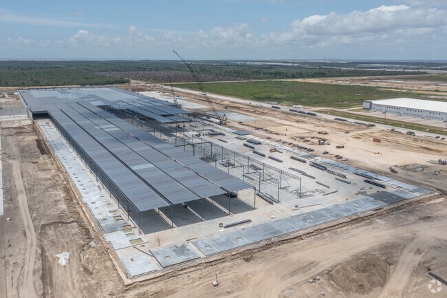
5120 Cedar Port Pkwy
Houston-The Woodlands-Sugar Land, TX
106 TR 0-3-5 J L HILL CAGI CARRIES IMPS FRONTS 2354 AND FISHER
00106-00000-00300-240500
Chambers
Industrialgeneral
Texas
2025
57.98 AC
2025
East-Southeast Far
710202
Houston
DEMOGRAPHICS near 5120 Cedar Port Pkwy
1 Mile
3 Mile
5 Mile
2024 Total Population
17
2,476
27,292
2029 Population
21
3,088
30,353
Pop Growth 2024-2029
+ 23.53%
+ 24.72%
+ 11.22%
Average Age
40
41
37
2024 Total Households
6
846
9,614
HH Growth 2024-2029
+ 16.67%
+ 24.70%
+ 10.84%
Median Household Inc
$175,000
$132,906
$62,845
Avg Household Size
2.40
3.00
2.80
2024 Avg HH Vehicles
2.00
3.00
2.00
Median Home Value
$450,000
$421,014
$237,111
Median Year Built
2005
2004
1989
Nearby Places
- Restaurants
- Banks
- Shops
- Fitness
- Groceries
PUBLIC TRANSPORTATION
AIRPORT
William P Hobby
DRIVE
WALK
Distance
William P Hobby
48 min
32.8 mi
Freight Ports
Port of Houston
DRIVE
WALK
Distance
Port of Houston
40 min
28.5 mi
SALE & LEASE HISTORY
LISTING DATE
SALE/LEASE

Oct 24, 2025
For Lease
Nearby Properties
Address
Land Use
TOTAL SIZE
Lot Size
Zoning
Address
Land Use
TOTAL SIZE
Lot Size
Zoning
238.70 AC
Address
Land Use
TOTAL SIZE
Lot Size
Zoning
58.76 AC
Address
Land Use
TOTAL SIZE
Lot Size
Zoning
198.13 AC
Address
Land Use
TOTAL SIZE
Lot Size
Zoning
198.54 AC
Address
Land Use
TOTAL SIZE
Lot Size
Zoning
46.85 AC
Address
Land Use
TOTAL SIZE
Lot Size
Zoning
46.04 AC
Address
Land Use
TOTAL SIZE
Lot Size
Zoning
45.18 AC
Address
Land Use
TOTAL SIZE
Lot Size
Zoning
45.13 AC
Address
Land Use
TOTAL SIZE
Lot Size
Zoning
88.37 AC
Address
Land Use
TOTAL SIZE
Lot Size
Zoning
773.19 AC
Address
Land Use
TOTAL SIZE
Lot Size
Zoning
43.14 AC
Address
Land Use
TOTAL SIZE
Lot Size
Zoning
Address
Land Use
TOTAL SIZE
Lot Size
Zoning
40 AC
Address
Land Use
TOTAL SIZE
Lot Size
Zoning
Address
Land Use
TOTAL SIZE
Lot Size
Zoning
39.97 AC
Address
Land Use
TOTAL SIZE
Lot Size
Zoning
Address
Land Use
TOTAL SIZE
Lot Size
Zoning
1,292 SF
257.08 AC
Address
Land Use
TOTAL SIZE
Lot Size
Zoning
36.03 AC
Address
Land Use
TOTAL SIZE
Lot Size
Zoning
33.38 AC
Address
Land Use
TOTAL SIZE
Lot Size
Zoning
Address
Land Use
TOTAL SIZE
Lot Size
Zoning
30.75 AC
Address
Land Use
TOTAL SIZE
Lot Size
Zoning
30.32 AC
Address
Land Use
TOTAL SIZE
Lot Size
Zoning
30.09 AC
Address
Land Use
TOTAL SIZE
Lot Size
Zoning
118.77 AC
Address
Land Use
TOTAL SIZE
Lot Size
Zoning
27.89 AC
Address
Land Use
TOTAL SIZE
Lot Size
Zoning
27.65 AC
The World's #1 Commercial Real Estate Marketplace
Connect with us
© 2025 CoStar Group
The information above has been obtained from sources believed reliable. While we do not doubt its accuracy we have not verified it and make no guarantee, warranty or representation about it. It is your responsibility to independently confirm its accuracy and completeness. Any projections, opinions, assumptions, or estimates used are for example only and do not represent the current or future performance of the property. The value of this transaction to you depends on tax and other factors which should be evaluated by your tax, financial, and legal advisors. You and your advisors should conduct a careful, independent investigation of the property to determine to your satisfaction the suitability of the property for your needs.