Property Record
51241 Highway 6, Glenwood Springs, CO 81601
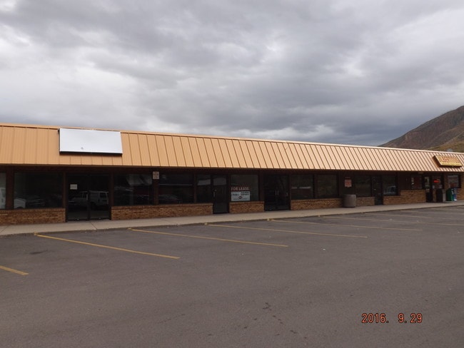


Property Detail
51241 Highway 6
Rifle, CO
SECTION: 6 TOWNSHIP: 6 RANGE: 89 TR IN NESE
R020407
Garfield
Commercialnec
Colorado
2025
1.48 AC
2025
Colorado Northwest Area
951600
Other Market Areas
10,200 SF
NEARBY LISTINGS FOR SALE OR LEASE
DEMOGRAPHICS near 51241 Highway 6
1 mile
3 mile
5 mile
2025 Total Population
3,314
8,197
12,120
2030 Population
3,371
8,328
12,318
Pop Growth 2025-2030
+ 1.72%
+ 1.60%
+ 1.63%
Average Age
38
39
39
2025 Total Households
1,206
3,241
4,707
HH Growth 2025-2030
+ 1.82%
+ 1.64%
+ 1.68%
Median Household Inc
$88,461
$84,953
$96,081
Avg Household Size
2.70
2.40
2.50
2025 Avg HH Vehicles
2.00
2.00
2.00
Median Home Value
$596,273
$629,310
$678,361
Median Year Built
1994
1975
1981
Nearby Places
Map Layers
Map Styles
 Street
 Aerial
Transit
 Traffic
 Biking
Places
Listings with unknown addresses are not visible on the map
- Restaurants
- Banks
- Shops
- Fitness
- Groceries
PUBLIC TRANSPORTATION
COMMUTER RAIL
Drive
Walk
Distance
6 min
2.9 mi
AIRPORT
Eagle County Regional
Drive
Walk
Distance
Eagle County Regional
37 min
28.9 mi
Aspen-Pitkin County/Sardy Field
Drive
Walk
Distance
Aspen-Pitkin County/Sardy Field
71 min
42.1 mi
SALE & LEASE HISTORY
LISTING DATE
SALE/LEASE

Oct 05, 2016
For Lease
Nearby Properties
Address
Land Use
TOTAL SIZE
Lot Size
Zoning
Address
Land Use
TOTAL SIZE
Lot Size
Zoning
58,900 SF
8.72 AC
Address
Land Use
TOTAL SIZE
Lot Size
Zoning
7,000 SF
10.25 AC
Address
Land Use
TOTAL SIZE
Lot Size
Zoning
39,655 SF
37.08 AC
Address
Land Use
TOTAL SIZE
Lot Size
Zoning
Address
Land Use
TOTAL SIZE
Lot Size
Zoning
45,110 SF
4.45 AC
Address
Land Use
TOTAL SIZE
Lot Size
Zoning
52,977 SF
0.60 AC
Address
Land Use
TOTAL SIZE
Lot Size
Zoning
36,321 SF
1.31 AC
Address
Land Use
TOTAL SIZE
Lot Size
Zoning
89,560 SF
2.71 AC
Address
Land Use
TOTAL SIZE
Lot Size
Zoning
125,579 SF
10.64 AC
Address
Land Use
TOTAL SIZE
Lot Size
Zoning
5,310 SF
4.85 AC
Address
Land Use
TOTAL SIZE
Lot Size
Zoning
61,845 SF
2.02 AC
Address
Land Use
TOTAL SIZE
Lot Size
Zoning
54,329 SF
2.71 AC
Address
Land Use
TOTAL SIZE
Lot Size
Zoning
42,256 SF
1.43 AC
Address
Land Use
TOTAL SIZE
Lot Size
Zoning
45,855 SF
1.81 AC
Address
Land Use
TOTAL SIZE
Lot Size
Zoning
5,340 SF
1.55 AC
CL
Address
Land Use
TOTAL SIZE
Lot Size
Zoning
42,546 SF
4.19 AC
Address
Land Use
TOTAL SIZE
Lot Size
Zoning
17,004 SF
5.65 AC
Address
Land Use
TOTAL SIZE
Lot Size
Zoning
22,053 SF
2.07 AC
Address
Land Use
TOTAL SIZE
Lot Size
Zoning
10,559 SF
3.23 AC
Address
Land Use
TOTAL SIZE
Lot Size
Zoning
7,786 SF
2.92 AC
Address
Land Use
TOTAL SIZE
Lot Size
Zoning
13,181 SF
4.09 AC
Address
Land Use
TOTAL SIZE
Lot Size
Zoning
10,782 SF
2.44 AC
Address
Land Use
TOTAL SIZE
Lot Size
Zoning
9,166 SF
81.76 AC
R
Address
Land Use
TOTAL SIZE
Lot Size
Zoning
32,072 SF
1.84 AC
Address
Land Use
TOTAL SIZE
Lot Size
Zoning
56,897 SF
3.26 AC
Address
Land Use
TOTAL SIZE
Lot Size
Zoning
20,137 SF
0.40 AC
Address
Land Use
TOTAL SIZE
Lot Size
Zoning
Address
Land Use
TOTAL SIZE
Lot Size
Zoning
8,486 SF
3.85 AC
Address
Land Use
TOTAL SIZE
Lot Size
Zoning
5.03 AC
ROW
The World's #1 Commercial Real Estate Marketplace
Connect with us
© 2026 CoStar Group
The information above has been obtained from sources believed reliable. While we do not doubt its accuracy we have not verified it and make no guarantee, warranty or representation about it. It is your responsibility to independently confirm its accuracy and completeness. Any projections, opinions, assumptions, or estimates used are for example only and do not represent the current or future performance of the property. The value of this transaction to you depends on tax and other factors which should be evaluated by your tax, financial, and legal advisors. You and your advisors should conduct a careful, independent investigation of the property to determine to your satisfaction the suitability of the property for your needs.