Property Record
5125 W 10Th St, Indianapolis, IN 46224
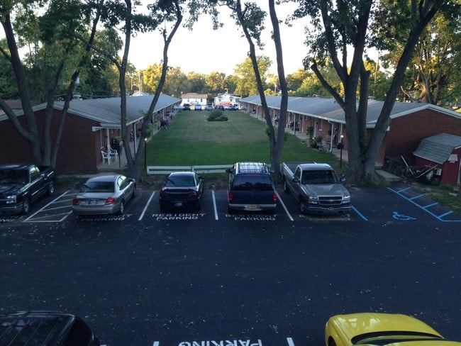

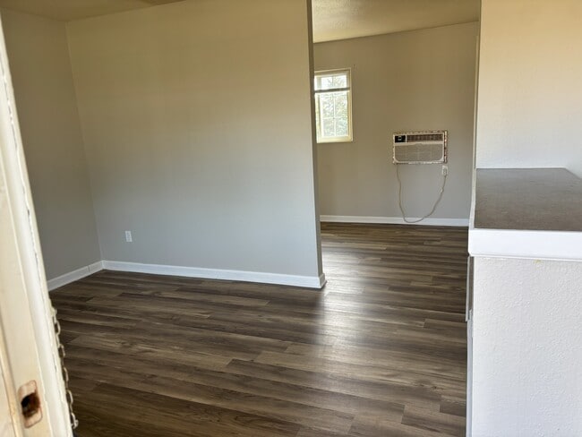

This Property Is For Sale
NEARBY LISTINGS FOR SALE OR LEASE
-
-
View all Indianapolis listings for sale on LoopNet.com
Property Detail
5125 W 10Th St
Indianapolis
Ruflis West 10Th Street Add
Indianapolis-Carmel-Anderson, IN
RUFLIS WEST 10TH STREET ADD L11 & L12 ALSO PT NW1/4 S6 T15 R3 BEG 969.30FT E OF NW COR P.O.B. S520 E10.11 N521.33 W10 0.12 AC
49-11-06-100-025.000-914
Marion
Apartment
Indiana
2023
11,12
2024
1.69 AC
341702
Speedway
5,200 SF
DEMOGRAPHICS near 5125 W 10Th St
1 Mile
3 Mile
5 Mile
2024 Total Population
9,943
103,138
227,663
2029 Population
9,819
102,168
226,982
Pop Growth 2024-2029
(1.25%)
(0.94%)
(0.30%)
Average Age
37
35
36
2024 Total Households
4,330
39,636
91,320
HH Growth 2024-2029
(1.39%)
(1.03%)
(0.27%)
Median Household Inc
$50,515
$48,591
$52,456
Avg Household Size
2.30
2.50
2.40
2024 Avg HH Vehicles
2.00
2.00
2.00
Median Home Value
$163,157
$125,217
$143,602
Median Year Built
1968
1963
1972
Nearby Places
- Restaurants
- Banks
- Shops
- Fitness
- Groceries
PUBLIC TRANSPORTATION
COMMUTER RAIL
Indianapolis (Cardinal - Amtrak)
DRIVE
WALK
Distance
Indianapolis (Cardinal - Amtrak)
11 min
5.7 mi
AIRPORT
Indianapolis International
DRIVE
WALK
Distance
Indianapolis International
22 min
11.9 mi
Freight Ports
Port of Toledo
DRIVE
WALK
Distance
Port of Toledo
278 min
229.0 mi
Nearby Properties
Address
Land Use
TOTAL SIZE
Lot Size
Zoning
Address
Land Use
TOTAL SIZE
Lot Size
Zoning
1,340,481 SF
63.99 AC
ZO01
Address
Land Use
TOTAL SIZE
Lot Size
Zoning
80,249 SF
71.96 AC
ZO01
Address
Land Use
TOTAL SIZE
Lot Size
Zoning
5,280 SF
97.87 AC
ZO01
Address
Land Use
TOTAL SIZE
Lot Size
Zoning
415,877 SF
55.83 AC
ZO01
Address
Land Use
TOTAL SIZE
Lot Size
Zoning
578,964 SF
35.50 AC
ZO01
Address
Land Use
TOTAL SIZE
Lot Size
Zoning
1,889,477 SF
89.82 AC
ZO01
Address
Land Use
TOTAL SIZE
Lot Size
Zoning
19,314 SF
32.88 AC
ZO01
Address
Land Use
TOTAL SIZE
Lot Size
Zoning
4,663 SF
7.98 AC
ZO01
Address
Land Use
TOTAL SIZE
Lot Size
Zoning
600,000 SF
41.64 AC
ZO01
Address
Land Use
TOTAL SIZE
Lot Size
Zoning
18,154 SF
9.40 AC
ZO01
Address
Land Use
TOTAL SIZE
Lot Size
Zoning
3,878 SF
17.76 AC
Address
Land Use
TOTAL SIZE
Lot Size
Zoning
438,643 SF
43.63 AC
ZO01
Address
Land Use
TOTAL SIZE
Lot Size
Zoning
7,364 SF
9.20 AC
Address
Land Use
TOTAL SIZE
Lot Size
Zoning
19,930 SF
3.92 AC
ZO01
Address
Land Use
TOTAL SIZE
Lot Size
Zoning
3,618 SF
31.13 AC
ZO01
Address
Land Use
TOTAL SIZE
Lot Size
Zoning
30,545 SF
3.41 AC
ZO01
Address
Land Use
TOTAL SIZE
Lot Size
Zoning
3,706 SF
30.57 AC
ZO01
Address
Land Use
TOTAL SIZE
Lot Size
Zoning
1.88 AC
ZO01
Address
Land Use
TOTAL SIZE
Lot Size
Zoning
1,868 SF
14.50 AC
ZO01
Address
Land Use
TOTAL SIZE
Lot Size
Zoning
28,400 SF
22.04 AC
ZO01
Address
Land Use
TOTAL SIZE
Lot Size
Zoning
73,528 SF
80 AC
ZO01
Address
Land Use
TOTAL SIZE
Lot Size
Zoning
101,718 SF
49.77 AC
ZO01
Address
Land Use
TOTAL SIZE
Lot Size
Zoning
2,000 SF
57.60 AC
ZO01
Address
Land Use
TOTAL SIZE
Lot Size
Zoning
1,700 SF
40.37 AC
ZO01
Address
Land Use
TOTAL SIZE
Lot Size
Zoning
5,616 SF
9.34 AC
Address
Land Use
TOTAL SIZE
Lot Size
Zoning
2,288 SF
21.42 AC
Address
Land Use
TOTAL SIZE
Lot Size
Zoning
3,802 SF
12.25 AC
Address
Land Use
TOTAL SIZE
Lot Size
Zoning
120,734 SF
21.48 AC
Address
Land Use
TOTAL SIZE
Lot Size
Zoning
9,094 SF
6.22 AC
ZO01
Address
Land Use
TOTAL SIZE
Lot Size
Zoning
150,376 SF
7.30 AC
ZO01
The World's #1 Commercial Real Estate Marketplace
Connect with us
© 2025 CoStar Group
The information above has been obtained from sources believed reliable. While we do not doubt its accuracy we have not verified it and make no guarantee, warranty or representation about it. It is your responsibility to independently confirm its accuracy and completeness. Any projections, opinions, assumptions, or estimates used are for example only and do not represent the current or future performance of the property. The value of this transaction to you depends on tax and other factors which should be evaluated by your tax, financial, and legal advisors. You and your advisors should conduct a careful, independent investigation of the property to determine to your satisfaction the suitability of the property for your needs.