Property Record
5126 Sandidge Rd, Olive Branch, MS 38654
NEARBY LISTINGS FOR SALE OR LEASE
Property Detail
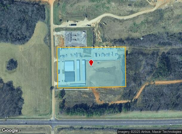
5126 Sandidge Rd
Memphis, TN-MS-AR
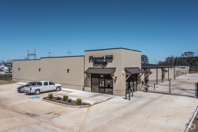
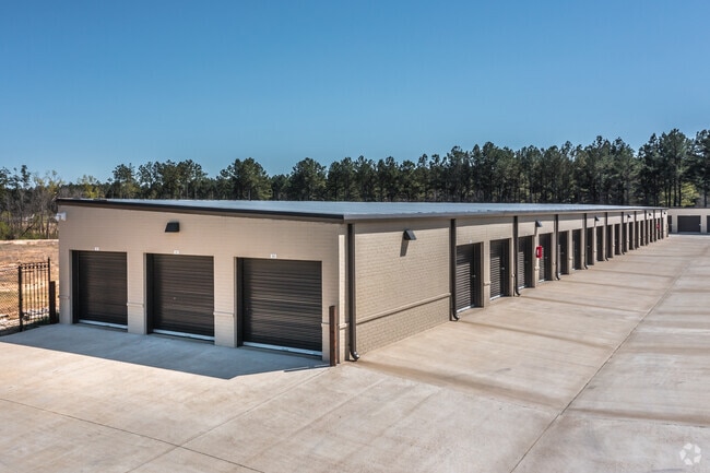
Funderburk Mini Storage
2071010200000100
FUNDERBURK MINI STORAGE LOT 1
Realpropertynec
DeSoto
X
Mississippi
28033C0103H
1
2025
7.26 AC
2025
DeSoto County
070721
Memphis
30,295 SF
DEMOGRAPHICS near 5126 Sandidge Rd
1 Mile
3 Mile
5 Mile
2024 Total Population
1,173
21,544
67,755
2029 Population
1,286
23,596
74,471
Pop Growth 2024-2029
+ 9.63%
+ 9.52%
+ 9.91%
Average Age
41
41
40
2024 Total Households
406
7,671
23,980
HH Growth 2024-2029
+ 9.61%
+ 9.52%
+ 9.88%
Median Household Inc
$103,214
$98,622
$90,881
Avg Household Size
2.90
2.80
2.80
2024 Avg HH Vehicles
2.00
2.00
2.00
Median Home Value
$283,625
$272,337
$261,634
Median Year Built
1999
2002
2001
Nearby Places
Map Layers
Map Styles
 Street
 Aerial
- Restaurants
- Banks
- Shops
- Fitness
- Groceries
PUBLIC TRANSPORTATION
AIRPORT
Memphis International
DRIVE
WALK
Distance
Memphis International
22 min
13.4 mi
Freight Ports
Port of Shreveport
DRIVE
WALK
Distance
Port of Shreveport
426 min
389.5 mi
Nearby Properties
Address
Land Use
TOTAL SIZE
Lot Size
Zoning
Address
Land Use
TOTAL SIZE
Lot Size
Zoning
864,054 SF
72.19 AC
M-1
Address
Land Use
TOTAL SIZE
Lot Size
Zoning
693,680 SF
47.15 AC
M-1
Address
Land Use
TOTAL SIZE
Lot Size
Zoning
390,874 SF
122.03 AC
M-1
Address
Land Use
TOTAL SIZE
Lot Size
Zoning
445,114 SF
32.34 AC
M-1
Address
Land Use
TOTAL SIZE
Lot Size
Zoning
5,189 SF
9.62 AC
C-4
Address
Land Use
TOTAL SIZE
Lot Size
Zoning
329,096 SF
21.64 AC
M-1
Address
Land Use
TOTAL SIZE
Lot Size
Zoning
250,364 SF
13.72 AC
M-1
Address
Land Use
TOTAL SIZE
Lot Size
Zoning
217,448 SF
19.07 AC
M-1
Address
Land Use
TOTAL SIZE
Lot Size
Zoning
5,384 SF
7.92 AC
PUD
Address
Land Use
TOTAL SIZE
Lot Size
Zoning
218,400 SF
14.52 AC
M-1
Address
Land Use
TOTAL SIZE
Lot Size
Zoning
64,571 SF
11.09 AC
C-4
Address
Land Use
TOTAL SIZE
Lot Size
Zoning
193,842 SF
11.29 AC
M-1
Address
Land Use
TOTAL SIZE
Lot Size
Zoning
30,223 SF
12.41 AC
C-4
Address
Land Use
TOTAL SIZE
Lot Size
Zoning
127,150 SF
11.17 AC
C-4
Address
Land Use
TOTAL SIZE
Lot Size
Zoning
83,020 SF
13.19 AC
C-4
Address
Land Use
TOTAL SIZE
Lot Size
Zoning
12,770 SF
Address
Land Use
TOTAL SIZE
Lot Size
Zoning
46,297 SF
12.93 AC
PUD
Address
Land Use
TOTAL SIZE
Lot Size
Zoning
19,576 SF
2.65 AC
PUD
Address
Land Use
TOTAL SIZE
Lot Size
Zoning
34,542 SF
8.41 AC
C-4
Address
Land Use
TOTAL SIZE
Lot Size
Zoning
78,000 SF
9.97 AC
M-1
Address
Land Use
TOTAL SIZE
Lot Size
Zoning
59,864 SF
6.10 AC
R-3
Address
Land Use
TOTAL SIZE
Lot Size
Zoning
61,948 SF
4.37 AC
PUD
Address
Land Use
TOTAL SIZE
Lot Size
Zoning
40,287 SF
10.74 AC
C-4
Address
Land Use
TOTAL SIZE
Lot Size
Zoning
41,935 SF
7.77 AC
C-4
Address
Land Use
TOTAL SIZE
Lot Size
Zoning
37,358 SF
2.51 AC
PUD
Address
Land Use
TOTAL SIZE
Lot Size
Zoning
30,240 SF
23.98 AC
M-1
Address
Land Use
TOTAL SIZE
Lot Size
Zoning
62,208 SF
6.68 AC
PUD
Address
Land Use
TOTAL SIZE
Lot Size
Zoning
96,508 SF
11.11 AC
M-1
Address
Land Use
TOTAL SIZE
Lot Size
Zoning
28,520 SF
10.01 AC
C-4
Address
Land Use
TOTAL SIZE
Lot Size
Zoning
32,285 SF
12.39 AC
C-2
The World's #1 Commercial Real Estate Marketplace
Connect with us
© 2025 CoStar Group
The information above has been obtained from sources believed reliable. While we do not doubt its accuracy we have not verified it and make no guarantee, warranty or representation about it. It is your responsibility to independently confirm its accuracy and completeness. Any projections, opinions, assumptions, or estimates used are for example only and do not represent the current or future performance of the property. The value of this transaction to you depends on tax and other factors which should be evaluated by your tax, financial, and legal advisors. You and your advisors should conduct a careful, independent investigation of the property to determine to your satisfaction the suitability of the property for your needs.