Property Record
5127 State Route 140, Bethalto, IL 62010

NEARBY LISTINGS FOR SALE OR LEASE
-
-
View all Bethalto listings for sale on LoopNet.com
Property Detail
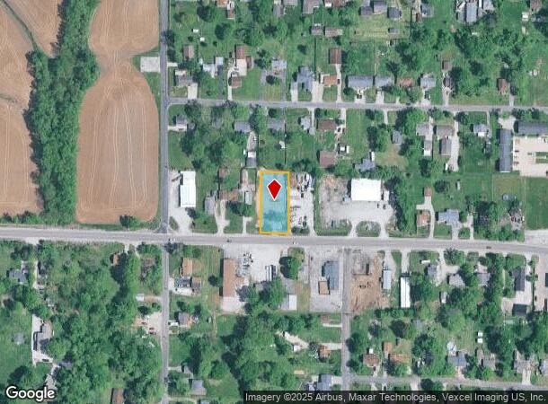
5127 State Route 140
St. Louis
East Meadowbrook
St. Louis, MO-IL
W2 NE4 T05N R8W
15-2-09-08-02-206-026
Madison
Residentialacreage
Illinois
2024
4
2024
0.46 AC
402805
Illinois
1,094 SF
DEMOGRAPHICS near 5127 State Route 140
1 Mile
3 Mile
5 Mile
2024 Total Population
1,355
12,013
33,586
2029 Population
1,354
11,862
33,108
Pop Growth 2024-2029
(0.07%)
(1.26%)
(1.42%)
Average Age
42
42
42
2024 Total Households
620
5,176
14,024
HH Growth 2024-2029
0.00%
(1.24%)
(1.46%)
Median Household Inc
$62,586
$68,692
$71,919
Avg Household Size
2.20
2.30
2.40
2024 Avg HH Vehicles
2.00
2.00
2.00
Median Home Value
$174,482
$164,252
$152,476
Median Year Built
1981
1974
1967
Nearby Places
Map Layers
Map Styles
 Street
 Aerial
- Restaurants
- Banks
- Shops
- Fitness
- Groceries
PUBLIC TRANSPORTATION
COMMUTER RAIL
Alton Amtrak Station (Lincoln Service - Amtrak, Lincoln Service Missouri River Runner - Amtrak, Texas Eagle - Amtrak)
DRIVE
WALK
Distance
Alton Amtrak Station (Lincoln Service - Amtrak, Lincoln Service Missouri River Runner - Amtrak, Texas Eagle - Amtrak)
17 min
9.1 mi
AIRPORT
St Louis Lambert International
DRIVE
WALK
Distance
St Louis Lambert International
43 min
29.3 mi
Scott AFB/Midamerica St Louis
DRIVE
WALK
Distance
Scott AFB/Midamerica St Louis
60 min
42.2 mi
Freight Ports
Port Milwaukee
DRIVE
WALK
Distance
Port Milwaukee
395 min
348.9 mi
SALE & LEASE HISTORY
LISTING DATE
SALE/LEASE

Aug 04, 2020
For Sale
Nearby Properties
Address
Land Use
TOTAL SIZE
Lot Size
Zoning
Address
Land Use
TOTAL SIZE
Lot Size
Zoning
147,365 SF
1.91 AC
Address
Land Use
TOTAL SIZE
Lot Size
Zoning
66,140 SF
9.79 AC
Address
Land Use
TOTAL SIZE
Lot Size
Zoning
62,859 SF
12 AC
Address
Land Use
TOTAL SIZE
Lot Size
Zoning
58,900 SF
2.05 AC
Address
Land Use
TOTAL SIZE
Lot Size
Zoning
55,020 SF
2.85 AC
Address
Land Use
TOTAL SIZE
Lot Size
Zoning
21,200 SF
4 AC
Address
Land Use
TOTAL SIZE
Lot Size
Zoning
21,614 SF
0.62 AC
Address
Land Use
TOTAL SIZE
Lot Size
Zoning
111,616 SF
10 AC
Address
Land Use
TOTAL SIZE
Lot Size
Zoning
41,203 SF
Address
Land Use
TOTAL SIZE
Lot Size
Zoning
27,000 SF
10 AC
Address
Land Use
TOTAL SIZE
Lot Size
Zoning
8,992 SF
2 AC
Address
Land Use
TOTAL SIZE
Lot Size
Zoning
6,000 SF
5.78 AC
Address
Land Use
TOTAL SIZE
Lot Size
Zoning
24,080 SF
10.70 AC
Address
Land Use
TOTAL SIZE
Lot Size
Zoning
24,148 SF
2.39 AC
Address
Land Use
TOTAL SIZE
Lot Size
Zoning
4,636 SF
0.79 AC
Address
Land Use
TOTAL SIZE
Lot Size
Zoning
3,002 SF
1.85 AC
Address
Land Use
TOTAL SIZE
Lot Size
Zoning
13,809 SF
1.91 AC
Address
Land Use
TOTAL SIZE
Lot Size
Zoning
2,584 SF
1.66 AC
Address
Land Use
TOTAL SIZE
Lot Size
Zoning
10,080 SF
2.11 AC
Address
Land Use
TOTAL SIZE
Lot Size
Zoning
9,450 SF
5.92 AC
Address
Land Use
TOTAL SIZE
Lot Size
Zoning
24,945 SF
2.91 AC
Address
Land Use
TOTAL SIZE
Lot Size
Zoning
8,855 SF
1.66 AC
Address
Land Use
TOTAL SIZE
Lot Size
Zoning
4,020 SF
1.39 AC
Address
Land Use
TOTAL SIZE
Lot Size
Zoning
39,256 SF
6.20 AC
Address
Land Use
TOTAL SIZE
Lot Size
Zoning
31,428 SF
2.06 AC
Address
Land Use
TOTAL SIZE
Lot Size
Zoning
2,584 SF
1.89 AC
Address
Land Use
TOTAL SIZE
Lot Size
Zoning
2,584 SF
1.56 AC
Address
Land Use
TOTAL SIZE
Lot Size
Zoning
2,584 SF
2.16 AC
Address
Land Use
TOTAL SIZE
Lot Size
Zoning
8,960 SF
1.18 AC
Address
Land Use
TOTAL SIZE
Lot Size
Zoning
6,960 SF
2 AC
The World's #1 Commercial Real Estate Marketplace
Connect with us
© 2025 CoStar Group
The information above has been obtained from sources believed reliable. While we do not doubt its accuracy we have not verified it and make no guarantee, warranty or representation about it. It is your responsibility to independently confirm its accuracy and completeness. Any projections, opinions, assumptions, or estimates used are for example only and do not represent the current or future performance of the property. The value of this transaction to you depends on tax and other factors which should be evaluated by your tax, financial, and legal advisors. You and your advisors should conduct a careful, independent investigation of the property to determine to your satisfaction the suitability of the property for your needs.