Property Record
513 Mill St, Marion, MA 02738
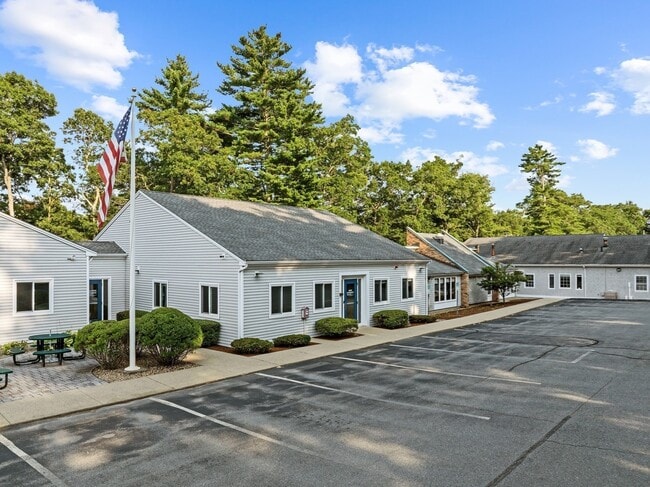
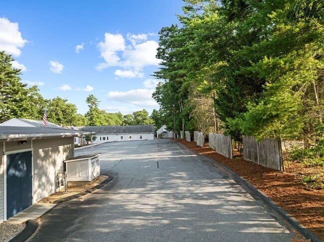
This Property Is For Sale
NEARBY LISTINGS FOR SALE OR LEASE
-
-
View all Marion listings for sale on LoopNet.com
Property Detail
513 Mill St
Scientificpharmaceuticalmedicalresearchfacility
Plymouth
X
Massachusetts
25023C0559L
0.82 AC
2025
Route 3 South
2025
Boston
561100
Boston-Cambridge-Newton, MA-NH
12,742 SF
MARI-000024-000049
DEMOGRAPHICS near 513 Mill St
1 mile
3 mile
5 mile
2024 Total Population
1,732
8,808
26,611
2029 Population
1,790
9,222
27,921
Pop Growth 2024-2029
+ 3.35%
+ 4.70%
+ 4.92%
Average Age
46
46
46
2024 Total Households
676
3,510
11,020
HH Growth 2024-2029
+ 3.55%
+ 4.73%
+ 5.06%
Median Household Inc
$137,884
$119,121
$105,037
Avg Household Size
2.30
2.40
2.30
2024 Avg HH Vehicles
2.00
2.00
2.00
Median Home Value
$704,651
$672,131
$589,825
Median Year Built
1948
1968
1969
Nearby Places
Map Layers
Map Styles
 Street
 Aerial
Transit
 Traffic
 Biking
Places
Listings with unknown addresses are not visible on the map
- Restaurants
- Banks
- Shops
- Fitness
- Groceries
PUBLIC TRANSPORTATION
COMMUTER RAIL
Wareham Village (CapeFLYER - Cape Cod Regional Transit Authority)
Drive
Walk
Distance
Wareham Village (CapeFLYER - Cape Cod Regional Transit Authority)
8 min
5.1 mi
AIRPORT
Martha's Vineyard
Drive
Walk
Distance
Martha's Vineyard
109 min
47.5 mi
Freight Ports
Port of New Bedford Harbor
Drive
Walk
Distance
Port of New Bedford Harbor
19 min
13.6 mi
Nearby Properties
Address
Land Use
TOTAL SIZE
Lot Size
Zoning
Address
Land Use
TOTAL SIZE
Lot Size
Zoning
93.69 AC
RR3
Address
Land Use
TOTAL SIZE
Lot Size
Zoning
142,119 SF
9.44 AC
Address
Land Use
TOTAL SIZE
Lot Size
Zoning
58,742 SF
10.84 AC
Address
Land Use
TOTAL SIZE
Lot Size
Zoning
160,186 SF
5.14 AC
Address
Land Use
TOTAL SIZE
Lot Size
Zoning
45,509 SF
9.72 AC
Address
Land Use
TOTAL SIZE
Lot Size
Zoning
8,578 SF
17.79 AC
Address
Land Use
TOTAL SIZE
Lot Size
Zoning
312.32 AC
Address
Land Use
TOTAL SIZE
Lot Size
Zoning
12,086 SF
4 AC
Address
Land Use
TOTAL SIZE
Lot Size
Zoning
12,832 SF
3.45 AC
Address
Land Use
TOTAL SIZE
Lot Size
Zoning
1,280 SF
11.12 AC
Address
Land Use
TOTAL SIZE
Lot Size
Zoning
862.79 AC
A/R
Address
Land Use
TOTAL SIZE
Lot Size
Zoning
7,420 SF
1.10 AC
Address
Land Use
TOTAL SIZE
Lot Size
Zoning
8,394 SF
3.43 AC
Address
Land Use
TOTAL SIZE
Lot Size
Zoning
10,398 SF
5.93 AC
Address
Land Use
TOTAL SIZE
Lot Size
Zoning
6,943 SF
2.50 AC
Address
Land Use
TOTAL SIZE
Lot Size
Zoning
6,865 SF
1.63 AC
Address
Land Use
TOTAL SIZE
Lot Size
Zoning
7,031 SF
1.95 AC
Address
Land Use
TOTAL SIZE
Lot Size
Zoning
8,498 SF
8.28 AC
Address
Land Use
TOTAL SIZE
Lot Size
Zoning
73,442 SF
22.50 AC
Address
Land Use
TOTAL SIZE
Lot Size
Zoning
8,603 SF
2.27 AC
Address
Land Use
TOTAL SIZE
Lot Size
Zoning
6,519 SF
2.87 AC
Address
Land Use
TOTAL SIZE
Lot Size
Zoning
7,081 SF
2.41 AC
Address
Land Use
TOTAL SIZE
Lot Size
Zoning
8,296 SF
1.60 AC
Address
Land Use
TOTAL SIZE
Lot Size
Zoning
9,139 SF
1.46 AC
Address
Land Use
TOTAL SIZE
Lot Size
Zoning
69.44 AC
Address
Land Use
TOTAL SIZE
Lot Size
Zoning
7,822 SF
2.76 AC
Address
Land Use
TOTAL SIZE
Lot Size
Zoning
5,748 SF
3.18 AC
Address
Land Use
TOTAL SIZE
Lot Size
Zoning
4,382 SF
6.66 AC
Address
Land Use
TOTAL SIZE
Lot Size
Zoning
5,907 SF
2.31 AC
Address
Land Use
TOTAL SIZE
Lot Size
Zoning
6,649 SF
13.25 AC
The World's #1 Commercial Real Estate Marketplace
Connect with us
© 2026 CoStar Group
The information above has been obtained from sources believed reliable. While we do not doubt its accuracy we have not verified it and make no guarantee, warranty or representation about it. It is your responsibility to independently confirm its accuracy and completeness. Any projections, opinions, assumptions, or estimates used are for example only and do not represent the current or future performance of the property. The value of this transaction to you depends on tax and other factors which should be evaluated by your tax, financial, and legal advisors. You and your advisors should conduct a careful, independent investigation of the property to determine to your satisfaction the suitability of the property for your needs.