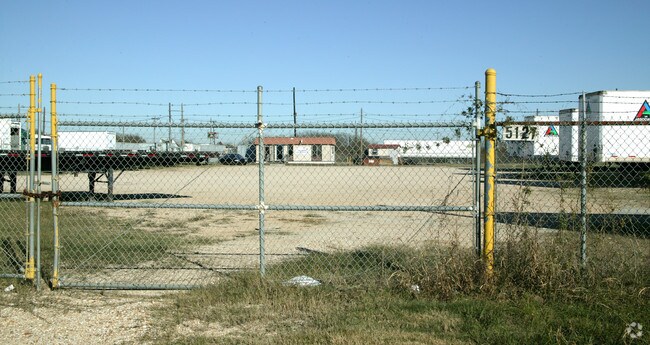
Property Record
5131 Port Entry, San Antonio, TX 78222

NEARBY LISTINGS FOR SALE OR LEASE
Property Detail
5131 Port Entry
San Antonio-New Braunfels, TX
Ncb 17057 (Empire Land-2)
17057-001-0050
NCB 17057 BLK 1 LOT 5 (EMPIRE LAND-2) 2025-MERGE PER CR67767 2020 NEW PER PLAT 20001/1681 FILED 12-20-19 CR 48674. JA/GIS/4-29-20
Officebuilding
Bexar
X
Texas
48029C0420G
5
2024
26.26 AC
2025
South
131401
San Antonio
11,932 SF
DEMOGRAPHICS near 5131 Port Entry
1 Mile
3 Mile
5 Mile
2024 Total Population
9,892
55,790
142,213
2029 Population
10,591
59,778
152,583
Pop Growth 2024-2029
+ 7.07%
+ 7.15%
+ 7.29%
Average Age
35
37
37
2024 Total Households
3,216
19,022
49,517
HH Growth 2024-2029
+ 7.18%
+ 7.31%
+ 7.39%
Median Household Inc
$65,393
$50,703
$44,035
Avg Household Size
3.00
2.90
2.80
2024 Avg HH Vehicles
2.00
2.00
2.00
Median Home Value
$147,029
$160,293
$148,252
Median Year Built
1995
1979
1973
Nearby Places
Map Layers
Map Styles
 Street
 Aerial
- Restaurants
- Banks
- Shops
- Fitness
- Groceries
PUBLIC TRANSPORTATION
COMMUTER RAIL
DRIVE
WALK
Distance
16 min
8.6 mi
AIRPORT
San Antonio International
DRIVE
WALK
Distance
San Antonio International
22 min
15.9 mi
Nearby Properties
Address
Land Use
TOTAL SIZE
Lot Size
Zoning
Address
Land Use
TOTAL SIZE
Lot Size
Zoning
122,130 SF
541.40 AC
Address
Land Use
TOTAL SIZE
Lot Size
Zoning
348,974 SF
20.98 AC
Address
Land Use
TOTAL SIZE
Lot Size
Zoning
397,806 SF
15.08 AC
Address
Land Use
TOTAL SIZE
Lot Size
Zoning
359,459 SF
15.81 AC
Address
Land Use
TOTAL SIZE
Lot Size
Zoning
380,949 SF
146.39 AC
Address
Land Use
TOTAL SIZE
Lot Size
Zoning
380,949 SF
135.47 AC
Address
Land Use
TOTAL SIZE
Lot Size
Zoning
35.76 AC
Address
Land Use
TOTAL SIZE
Lot Size
Zoning
273,370 SF
11.93 AC
Address
Land Use
TOTAL SIZE
Lot Size
Zoning
41.63 AC
Address
Land Use
TOTAL SIZE
Lot Size
Zoning
33.77 AC
Address
Land Use
TOTAL SIZE
Lot Size
Zoning
193,243 SF
9.03 AC
Address
Land Use
TOTAL SIZE
Lot Size
Zoning
4,920 SF
860.60 AC
Address
Land Use
TOTAL SIZE
Lot Size
Zoning
101,517 SF
13.04 AC
Address
Land Use
TOTAL SIZE
Lot Size
Zoning
18.35 AC
Address
Land Use
TOTAL SIZE
Lot Size
Zoning
95,486 SF
12.54 AC
Address
Land Use
TOTAL SIZE
Lot Size
Zoning
332,148 SF
17.75 AC
Address
Land Use
TOTAL SIZE
Lot Size
Zoning
141,955 SF
121.60 AC
Address
Land Use
TOTAL SIZE
Lot Size
Zoning
1,859 SF
60.40 AC
Address
Land Use
TOTAL SIZE
Lot Size
Zoning
296,542 SF
26.32 AC
Address
Land Use
TOTAL SIZE
Lot Size
Zoning
44,800 SF
61.44 AC
Address
Land Use
TOTAL SIZE
Lot Size
Zoning
3,131 SF
291.90 AC
Address
Land Use
TOTAL SIZE
Lot Size
Zoning
204,166 SF
23.69 AC
Address
Land Use
TOTAL SIZE
Lot Size
Zoning
177,692 SF
9.16 AC
Address
Land Use
TOTAL SIZE
Lot Size
Zoning
259,779 SF
14.85 AC
Address
Land Use
TOTAL SIZE
Lot Size
Zoning
163,255 SF
10.43 AC
Address
Land Use
TOTAL SIZE
Lot Size
Zoning
35,612 SF
7.15 AC
Address
Land Use
TOTAL SIZE
Lot Size
Zoning
188,176 SF
12.51 AC
Address
Land Use
TOTAL SIZE
Lot Size
Zoning
171,734 SF
40.14 AC
Address
Land Use
TOTAL SIZE
Lot Size
Zoning
178,572 SF
7.76 AC
Address
Land Use
TOTAL SIZE
Lot Size
Zoning
2,497 SF
28 AC
The World's #1 Commercial Real Estate Marketplace
Connect with us
© 2026 CoStar Group
The information above has been obtained from sources believed reliable. While we do not doubt its accuracy we have not verified it and make no guarantee, warranty or representation about it. It is your responsibility to independently confirm its accuracy and completeness. Any projections, opinions, assumptions, or estimates used are for example only and do not represent the current or future performance of the property. The value of this transaction to you depends on tax and other factors which should be evaluated by your tax, financial, and legal advisors. You and your advisors should conduct a careful, independent investigation of the property to determine to your satisfaction the suitability of the property for your needs.