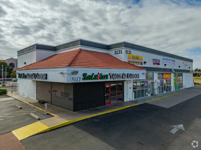
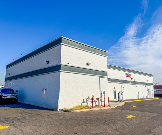
Property Record
5131 W Mcdowell Rd, Phoenix, AZ 85035

Current Lease Availabilities
NEARBY LISTINGS FOR SALE OR LEASE
Property Detail
5131 W Mcdowell Rd
Phoenix-Mesa-Chandler, AZ
Interchange Square Unit 2
103-30-312
INTERCHANGE SQUARE UNIT 2 MCR 431-07
Storebuilding
Maricopa
X
Arizona
04013C2185L
1
2025
0.94 AC
2025
West Phoenix/Maryvale
112507
Phoenix
7,408 SF
DEMOGRAPHICS near 5131 W Mcdowell Rd
1 Mile
3 Mile
5 Mile
2024 Total Population
18,885
143,587
399,931
2029 Population
20,241
153,957
429,729
Pop Growth 2024-2029
+ 7.18%
+ 7.22%
+ 7.45%
Average Age
32
32
32
2024 Total Households
5,320
38,945
113,375
HH Growth 2024-2029
+ 7.29%
+ 7.40%
+ 7.67%
Median Household Inc
$47,149
$49,151
$50,968
Avg Household Size
3.40
3.50
3.30
2024 Avg HH Vehicles
2.00
2.00
2.00
Median Home Value
$195,444
$194,392
$234,053
Median Year Built
1975
1973
1975
Nearby Places
Map Layers
Map Styles
 Street
 Aerial
- Restaurants
- Banks
- Shops
- Fitness
- Groceries
PUBLIC TRANSPORTATION
AIRPORT
Phoenix Sky Harbor International
DRIVE
WALK
Distance
Phoenix Sky Harbor International
19 min
12.0 mi
Phoenix-Mesa Gateway
DRIVE
WALK
Distance
Phoenix-Mesa Gateway
52 min
39.2 mi
Nearby Properties
Address
Land Use
TOTAL SIZE
Lot Size
Zoning
Address
Land Use
TOTAL SIZE
Lot Size
Zoning
569,517 SF
33.38 AC
PUD
Address
Land Use
TOTAL SIZE
Lot Size
Zoning
270,000 SF
12.90 AC
I-1
Address
Land Use
TOTAL SIZE
Lot Size
Zoning
91,000 SF
7.57 AC
I-1
Address
Land Use
TOTAL SIZE
Lot Size
Zoning
86,350 SF
25.82 AC
I-1
Address
Land Use
TOTAL SIZE
Lot Size
Zoning
1,539,348 SF
143.97 AC
A-1
Address
Land Use
TOTAL SIZE
Lot Size
Zoning
61,508 SF
23.76 AC
I-1
Address
Land Use
TOTAL SIZE
Lot Size
Zoning
69,542 SF
4.92 AC
I-P
Address
Land Use
TOTAL SIZE
Lot Size
Zoning
377,037 SF
35.46 AC
R1-6
Address
Land Use
TOTAL SIZE
Lot Size
Zoning
1,205,743 SF
59.34 AC
I-1
Address
Land Use
TOTAL SIZE
Lot Size
Zoning
1,063,188 SF
59.94 AC
Address
Land Use
TOTAL SIZE
Lot Size
Zoning
4,900 SF
12.05 AC
R1-6
Address
Land Use
TOTAL SIZE
Lot Size
Zoning
42,631 SF
2.90 AC
A-2
Address
Land Use
TOTAL SIZE
Lot Size
Zoning
281,038 SF
7.71 AC
Address
Land Use
TOTAL SIZE
Lot Size
Zoning
659,834 SF
42.04 AC
R-6
Address
Land Use
TOTAL SIZE
Lot Size
Zoning
449,802 SF
27.08 AC
A-1
Address
Land Use
TOTAL SIZE
Lot Size
Zoning
436,817 SF
23.21 AC
I-P
Address
Land Use
TOTAL SIZE
Lot Size
Zoning
316,386 SF
45.04 AC
R16
Address
Land Use
TOTAL SIZE
Lot Size
Zoning
592,330 SF
36.89 AC
I-2
Address
Land Use
TOTAL SIZE
Lot Size
Zoning
25.91 AC
A1
Address
Land Use
TOTAL SIZE
Lot Size
Zoning
350,874 SF
28.66 AC
C-C
Address
Land Use
TOTAL SIZE
Lot Size
Zoning
554,011 SF
26.10 AC
I-P
Address
Land Use
TOTAL SIZE
Lot Size
Zoning
489,284 SF
28.64 AC
I-1
Address
Land Use
TOTAL SIZE
Lot Size
Zoning
662,796 SF
42.11 AC
I-1
Address
Land Use
TOTAL SIZE
Lot Size
Zoning
169,155 SF
32.84 AC
R-35
Address
Land Use
TOTAL SIZE
Lot Size
Zoning
532,713 SF
27.31 AC
Address
Land Use
TOTAL SIZE
Lot Size
Zoning
347,565 SF
21.44 AC
A1
Address
Land Use
TOTAL SIZE
Lot Size
Zoning
603,910 SF
30.70 AC
I-1
Address
Land Use
TOTAL SIZE
Lot Size
Zoning
874,407 SF
38.57 AC
I-P
Address
Land Use
TOTAL SIZE
Lot Size
Zoning
587,158 SF
36.23 AC
I-P
Address
Land Use
TOTAL SIZE
Lot Size
Zoning
18,522 SF
1.69 AC
R-6
The World's #1 Commercial Real Estate Marketplace
Connect with us
© 2026 CoStar Group
The information above has been obtained from sources believed reliable. While we do not doubt its accuracy we have not verified it and make no guarantee, warranty or representation about it. It is your responsibility to independently confirm its accuracy and completeness. Any projections, opinions, assumptions, or estimates used are for example only and do not represent the current or future performance of the property. The value of this transaction to you depends on tax and other factors which should be evaluated by your tax, financial, and legal advisors. You and your advisors should conduct a careful, independent investigation of the property to determine to your satisfaction the suitability of the property for your needs.