Property Record
5137 E Main Street Rd, Batavia, NY 14020


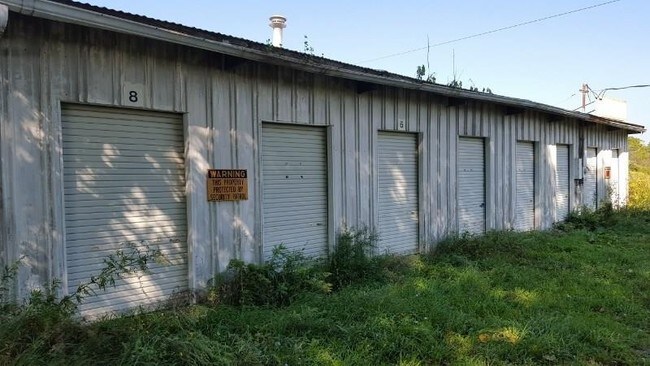
Property Detail
5137 E Main Street Rd
182400-013-000-0001-020-002
Genesee
Apartment
New York
08
20.021
2025
9.60 AC
2025
Rochester Other Areas
950401
Other Market Areas
1,200 SF
Batavia, NY
NEARBY LISTINGS FOR SALE OR LEASE
-
-
View all Batavia listings for sale on LoopNet.com
DEMOGRAPHICS near 5137 E Main Street Rd
1 mile
3 mile
5 mile
2025 Total Population
1,781
16,420
22,385
2030 Population
1,823
16,237
22,204
Pop Growth 2025-2030
+ 2.36%
(1.11%)
(0.81%)
Average Age
43
43
43
2025 Total Households
757
7,064
9,593
HH Growth 2025-2030
+ 2.51%
(1.20%)
(0.87%)
Median Household Inc
$72,304
$59,461
$62,198
Avg Household Size
2.10
2.10
2.20
2025 Avg HH Vehicles
2.00
2.00
2.00
Median Home Value
$178,666
$156,284
$161,741
Median Year Built
1984
1951
1954
Nearby Places
Map Layers
Map Styles
 Street
 Aerial
Layers
 Traffic
 Biking
Places
Listings with unknown addresses are not visible on the map
- Restaurants
- Banks
- Shops
- Fitness
- Groceries
PUBLIC TRANSPORTATION
AIRPORT
Frederick Douglass/Greater Rochester International
Drive
Walk
Distance
Frederick Douglass/Greater Rochester International
42 min
30.1 mi
Freight Ports
Albany, NY Port
Drive
Walk
Distance
Albany, NY Port
297 min
251.6 mi
SALE & LEASE HISTORY
LISTING DATE
SALE/LEASE

May 24, 2017
For Sale
Nearby Properties
Address
Land Use
TOTAL SIZE
Lot Size
Zoning
Address
Land Use
TOTAL SIZE
Lot Size
Zoning
341,981 SF
81 AC
Address
Land Use
TOTAL SIZE
Lot Size
Zoning
254,672 SF
204.30 AC
Address
Land Use
TOTAL SIZE
Lot Size
Zoning
54,661 SF
28.30 AC
Address
Land Use
TOTAL SIZE
Lot Size
Zoning
147,117 SF
6.49 AC
Address
Land Use
TOTAL SIZE
Lot Size
Zoning
3.12 AC
Address
Land Use
TOTAL SIZE
Lot Size
Zoning
136,728 SF
7.20 AC
Address
Land Use
TOTAL SIZE
Lot Size
Zoning
156,578 SF
28.60 AC
Address
Land Use
TOTAL SIZE
Lot Size
Zoning
83,131 SF
1.40 AC
Address
Land Use
TOTAL SIZE
Lot Size
Zoning
79,235 SF
23.40 AC
Address
Land Use
TOTAL SIZE
Lot Size
Zoning
3,731 SF
67.10 AC
A-R
Address
Land Use
TOTAL SIZE
Lot Size
Zoning
Address
Land Use
TOTAL SIZE
Lot Size
Zoning
97,450 SF
23.60 AC
Address
Land Use
TOTAL SIZE
Lot Size
Zoning
643,014 SF
33.50 AC
Address
Land Use
TOTAL SIZE
Lot Size
Zoning
111,230 SF
2.70 AC
Address
Land Use
TOTAL SIZE
Lot Size
Zoning
98,577 SF
3.80 AC
Address
Land Use
TOTAL SIZE
Lot Size
Zoning
76.11 AC
Address
Land Use
TOTAL SIZE
Lot Size
Zoning
25,514 SF
11.30 AC
Address
Land Use
TOTAL SIZE
Lot Size
Zoning
44,559 SF
27.70 AC
Address
Land Use
TOTAL SIZE
Lot Size
Zoning
41,042 SF
10 AC
Address
Land Use
TOTAL SIZE
Lot Size
Zoning
3.29 AC
C
Address
Land Use
TOTAL SIZE
Lot Size
Zoning
128,620 SF
9.82 AC
Address
Land Use
TOTAL SIZE
Lot Size
Zoning
52,732 SF
3.20 AC
Address
Land Use
TOTAL SIZE
Lot Size
Zoning
696 SF
63.20 AC
Address
Land Use
TOTAL SIZE
Lot Size
Zoning
20,091 SF
2.18 AC
Address
Land Use
TOTAL SIZE
Lot Size
Zoning
79,576 SF
9.60 AC
Address
Land Use
TOTAL SIZE
Lot Size
Zoning
Address
Land Use
TOTAL SIZE
Lot Size
Zoning
Address
Land Use
TOTAL SIZE
Lot Size
Zoning
24,339 SF
5.08 AC
Address
Land Use
TOTAL SIZE
Lot Size
Zoning
Address
Land Use
TOTAL SIZE
Lot Size
Zoning
The World's #1 Commercial Real Estate Marketplace
Connect with us
© 2026 CoStar Group
The information above has been obtained from sources believed reliable. While we do not doubt its accuracy we have not verified it and make no guarantee, warranty or representation about it. It is your responsibility to independently confirm its accuracy and completeness. Any projections, opinions, assumptions, or estimates used are for example only and do not represent the current or future performance of the property. The value of this transaction to you depends on tax and other factors which should be evaluated by your tax, financial, and legal advisors. You and your advisors should conduct a careful, independent investigation of the property to determine to your satisfaction the suitability of the property for your needs.