Property Record
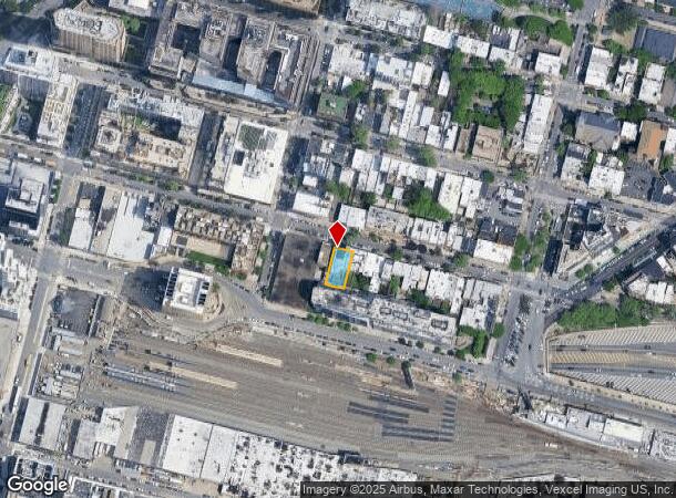
514 51St Ave, Long Island City, NY 11101
NEARBY LISTINGS FOR SALE OR LEASE
Property Detail
514 51St Ave
00034-0030
Hunter & Van Alst Farms
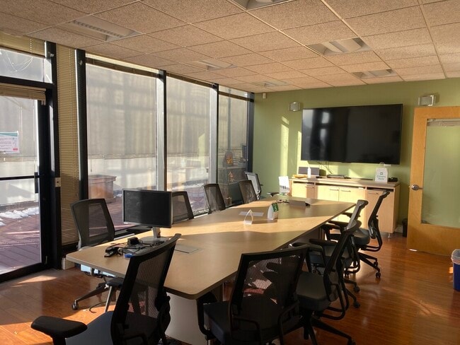
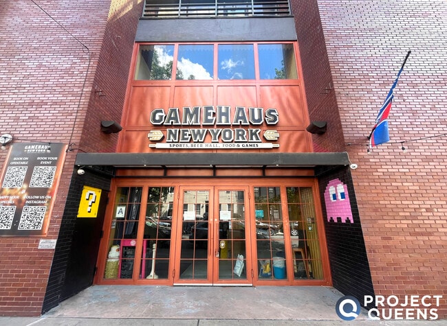
Storebuilding
Queens
AE
New York
3604970202F
30
2024
0.12 AC
2025
Northwest Queens
000701
Long Island (New York)
19,580 SF
New York-Jersey City-White Plains, NY-NJ
DEMOGRAPHICS near 514 51St Ave
1 Mile
3 Mile
5 Mile
2024 Total Population
83,688
1,345,122
3,184,984
2029 Population
80,858
1,262,216
2,991,539
Pop Growth 2024-2029
(3.38%)
(6.16%)
(6.07%)
Average Age
38
40
39
2024 Total Households
43,503
659,644
1,396,169
HH Growth 2024-2029
(3.81%)
(6.49%)
(6.38%)
Median Household Inc
$127,020
$99,046
$90,321
Avg Household Size
1.90
1.90
2.20
2024 Avg HH Vehicles
.00
.00
.00
Median Home Value
$948,176
$953,810
$888,465
Median Year Built
1986
1957
1954
Nearby Places
Map Layers
Map Styles
 Street
 Aerial
- Restaurants
- Banks
- Shops
- Fitness
- Groceries
PUBLIC TRANSPORTATION
TRANSIT/SUBWAY
Vernon Boulevard-Jackson Avenue (7 - New York MTA Subway (The Subway))
DRIVE
WALK
Distance
Vernon Boulevard-Jackson Avenue (7 - New York MTA Subway (The Subway))
2 min
2 min
0.1 mi
21 Street (G - New York MTA Subway (The Subway))
DRIVE
WALK
Distance
21 Street (G - New York MTA Subway (The Subway))
2 min
7 min
0.4 mi
Hunters Point Avenue (7 - New York MTA Subway (The Subway))
DRIVE
WALK
Distance
Hunters Point Avenue (7 - New York MTA Subway (The Subway))
3 min
10 min
0.5 mi
45 Road-Court House Square (7 - New York MTA Subway (The Subway))
DRIVE
WALK
Distance
45 Road-Court House Square (7 - New York MTA Subway (The Subway))
12 min
0.7 mi
Long Island City-Court Square (G - New York MTA Subway (The Subway))
DRIVE
WALK
Distance
Long Island City-Court Square (G - New York MTA Subway (The Subway))
5 min
18 min
1.0 mi
COMMUTER RAIL
Long Island City Station (Hempstead Branch - Long Island Rail Road)
DRIVE
WALK
Distance
Long Island City Station (Hempstead Branch - Long Island Rail Road)
1 min
0.2 mi
Hunterspoint Avenue Station (Hempstead Branch - Long Island Rail Road, Oyster Bay Branch - Long Island Rail Road)
DRIVE
WALK
Distance
Hunterspoint Avenue Station (Hempstead Branch - Long Island Rail Road, Oyster Bay Branch - Long Island Rail Road)
3 min
10 min
0.5 mi
AIRPORT
LaGuardia
DRIVE
WALK
Distance
LaGuardia
11 min
7.2 mi
John F Kennedy International
DRIVE
WALK
Distance
John F Kennedy International
18 min
13.9 mi
Newark Liberty International
DRIVE
WALK
Distance
Newark Liberty International
28 min
18.8 mi
Freight Ports
NY - Red Hook Container Terminal
DRIVE
WALK
Distance
NY - Red Hook Container Terminal
1 min
4.7 mi
SALE & LEASE HISTORY
LISTING DATE
SALE/LEASE

Sep 13, 2024
For Lease
May 16, 2025
For Lease
Dec 04, 2018
For Lease
Dec 02, 2020
For Lease
Apr 05, 2019
For Lease
Nearby Properties
Address
Land Use
TOTAL SIZE
Lot Size
Zoning
Address
Land Use
TOTAL SIZE
Lot Size
Zoning
4,060,596 SF
22.09 AC
M2-3
Address
Land Use
TOTAL SIZE
Lot Size
Zoning
2,245,112 SF
2.02 AC
C6-6
Address
Land Use
TOTAL SIZE
Lot Size
Zoning
1,783,434 SF
1.94 AC
C5-3
Address
Land Use
TOTAL SIZE
Lot Size
Zoning
2,521,850 SF
1.59 AC
C6-4
Address
Land Use
TOTAL SIZE
Lot Size
Zoning
8,462,176 SF
61.41 AC
R7-2
Address
Land Use
TOTAL SIZE
Lot Size
Zoning
1,445,092 SF
3.10 AC
C6-4
Address
Land Use
TOTAL SIZE
Lot Size
Zoning
2,221,336 SF
1.55 AC
C6-4
Address
Land Use
TOTAL SIZE
Lot Size
Zoning
2,636,182 SF
2.35 AC
C65.5
Address
Land Use
TOTAL SIZE
Lot Size
Zoning
2,161,994 SF
3.79 AC
M1-5
Address
Land Use
TOTAL SIZE
Lot Size
Zoning
2,734,038 SF
4.24 AC
C52.5
Address
Land Use
TOTAL SIZE
Lot Size
Zoning
1,678,135 SF
1.01 AC
C5-3
Address
Land Use
TOTAL SIZE
Lot Size
Zoning
1,897,491 SF
2.06 AC
C52.5
Address
Land Use
TOTAL SIZE
Lot Size
Zoning
1,233,684 SF
16.94 AC
PARK
Address
Land Use
TOTAL SIZE
Lot Size
Zoning
1,638,259 SF
1.43 AC
C52.5
Address
Land Use
TOTAL SIZE
Lot Size
Zoning
2,812,739 SF
2.10 AC
C5-3
Address
Land Use
TOTAL SIZE
Lot Size
Zoning
2,360,627 SF
2.08 AC
C6-7
Address
Land Use
TOTAL SIZE
Lot Size
Zoning
1,642,675 SF
1.05 AC
C6-7
Address
Land Use
TOTAL SIZE
Lot Size
Zoning
1,984,228 SF
1.95 AC
C65.5
Address
Land Use
TOTAL SIZE
Lot Size
Zoning
1,048,620 SF
5.67 AC
C6-4
Address
Land Use
TOTAL SIZE
Lot Size
Zoning
1,586,876 SF
1.87 AC
C5-3
Address
Land Use
TOTAL SIZE
Lot Size
Zoning
1,962,900 SF
1.89 AC
C66.5
Address
Land Use
TOTAL SIZE
Lot Size
Zoning
1,946,157 SF
1.49 AC
C6-4
Address
Land Use
TOTAL SIZE
Lot Size
Zoning
1,842,991 SF
2.08 AC
C66.5
Address
Land Use
TOTAL SIZE
Lot Size
Zoning
2,535,958 SF
2.94 AC
C6-4
Address
Land Use
TOTAL SIZE
Lot Size
Zoning
1,178,640 SF
0.92 AC
C6-4
Address
Land Use
TOTAL SIZE
Lot Size
Zoning
1,751,641 SF
1.84 AC
C6-4
Address
Land Use
TOTAL SIZE
Lot Size
Zoning
1,613,847 SF
1.84 AC
C66.5
Address
Land Use
TOTAL SIZE
Lot Size
Zoning
1,596,521 SF
1.34 AC
C6-4
Address
Land Use
TOTAL SIZE
Lot Size
Zoning
2,344,406 SF
1.84 AC
C5-3
Address
Land Use
TOTAL SIZE
Lot Size
Zoning
1,805,894 SF
1.42 AC
C6-4
The World's #1 Commercial Real Estate Marketplace
Connect with us
© 2025 CoStar Group
The information above has been obtained from sources believed reliable. While we do not doubt its accuracy we have not verified it and make no guarantee, warranty or representation about it. It is your responsibility to independently confirm its accuracy and completeness. Any projections, opinions, assumptions, or estimates used are for example only and do not represent the current or future performance of the property. The value of this transaction to you depends on tax and other factors which should be evaluated by your tax, financial, and legal advisors. You and your advisors should conduct a careful, independent investigation of the property to determine to your satisfaction the suitability of the property for your needs.