Property Record
514 E Main St, Westfield, MA 01085
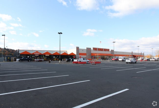

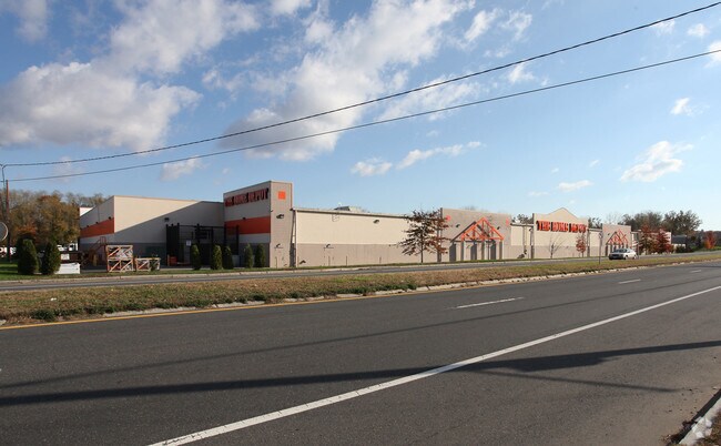
Property Detail
514 E Main St
WFLD-000111-000000-000012
Hampden
Departmentstore
Massachusetts
AE The base floodplain where base flood elevations are provided. AE Zones are now used on new format FIRMs instead of A1-A30 Zones.
12
2025
23.30 AC
2025
Hampden County
812702
Hartford
113,406 SF
Springfield, MA
NEARBY LISTINGS FOR SALE OR LEASE
DEMOGRAPHICS near 514 E Main St
1 mile
3 mile
5 mile
2025 Total Population
2,370
33,449
74,321
2030 Population
2,351
33,319
74,278
Pop Growth 2025-2030
(0.80%)
(0.39%)
(0.06%)
Average Age
44
42
42
2025 Total Households
924
13,660
29,782
HH Growth 2025-2030
(0.97%)
(0.42%)
(0.12%)
Median Household Inc
$103,226
$85,491
$84,833
Avg Household Size
2.40
2.40
2.40
2025 Avg HH Vehicles
2.00
2.00
2.00
Median Home Value
$364,173
$333,929
$337,549
Median Year Built
1966
1961
1964
Nearby Places
Map Layers
Map Styles
 Street
 Aerial
Transit
 Traffic
 Biking
Places
Listings with unknown addresses are not visible on the map
- Restaurants
- Banks
- Shops
- Fitness
- Groceries
PUBLIC TRANSPORTATION
COMMUTER RAIL
Drive
Walk
Distance
15 min
7.8 mi
AIRPORT
Bradley International
Drive
Walk
Distance
Bradley International
35 min
17.0 mi
Nearby Properties
Address
Land Use
TOTAL SIZE
Lot Size
Zoning
Address
Land Use
TOTAL SIZE
Lot Size
Zoning
Address
Land Use
TOTAL SIZE
Lot Size
Zoning
16.48 AC
Address
Land Use
TOTAL SIZE
Lot Size
Zoning
9.25 AC
Address
Land Use
TOTAL SIZE
Lot Size
Zoning
180,130 SF
90.75 AC
Address
Land Use
TOTAL SIZE
Lot Size
Zoning
1,992 SF
185 AC
Address
Land Use
TOTAL SIZE
Lot Size
Zoning
264,759 SF
51.70 AC
Address
Land Use
TOTAL SIZE
Lot Size
Zoning
25.35 AC
Address
Land Use
TOTAL SIZE
Lot Size
Zoning
2.60 AC
Address
Land Use
TOTAL SIZE
Lot Size
Zoning
215,179 SF
9.83 AC
Address
Land Use
TOTAL SIZE
Lot Size
Zoning
14.78 AC
Address
Land Use
TOTAL SIZE
Lot Size
Zoning
64,414 SF
6.62 AC
Address
Land Use
TOTAL SIZE
Lot Size
Zoning
28.81 AC
Address
Land Use
TOTAL SIZE
Lot Size
Zoning
17,428 SF
15.80 AC
Address
Land Use
TOTAL SIZE
Lot Size
Zoning
Address
Land Use
TOTAL SIZE
Lot Size
Zoning
9.99 AC
Address
Land Use
TOTAL SIZE
Lot Size
Zoning
50,911 SF
3.31 AC
Address
Land Use
TOTAL SIZE
Lot Size
Zoning
43,050 SF
11.60 AC
Address
Land Use
TOTAL SIZE
Lot Size
Zoning
Address
Land Use
TOTAL SIZE
Lot Size
Zoning
42.70 AC
Address
Land Use
TOTAL SIZE
Lot Size
Zoning
275,103 SF
23.28 AC
Address
Land Use
TOTAL SIZE
Lot Size
Zoning
9.80 AC
Address
Land Use
TOTAL SIZE
Lot Size
Zoning
6.80 AC
Address
Land Use
TOTAL SIZE
Lot Size
Zoning
100,908 SF
1.84 AC
Address
Land Use
TOTAL SIZE
Lot Size
Zoning
53,734 SF
8 AC
Address
Land Use
TOTAL SIZE
Lot Size
Zoning
97,311 SF
5.11 AC
Address
Land Use
TOTAL SIZE
Lot Size
Zoning
Address
Land Use
TOTAL SIZE
Lot Size
Zoning
53,734 SF
15 AC
Address
Land Use
TOTAL SIZE
Lot Size
Zoning
Address
Land Use
TOTAL SIZE
Lot Size
Zoning
4.44 AC
The World's #1 Commercial Real Estate Marketplace
Connect with us
© 2026 CoStar Group
The information above has been obtained from sources believed reliable. While we do not doubt its accuracy we have not verified it and make no guarantee, warranty or representation about it. It is your responsibility to independently confirm its accuracy and completeness. Any projections, opinions, assumptions, or estimates used are for example only and do not represent the current or future performance of the property. The value of this transaction to you depends on tax and other factors which should be evaluated by your tax, financial, and legal advisors. You and your advisors should conduct a careful, independent investigation of the property to determine to your satisfaction the suitability of the property for your needs.