Property Record
514 N Main St, Barnegat, NJ 08005


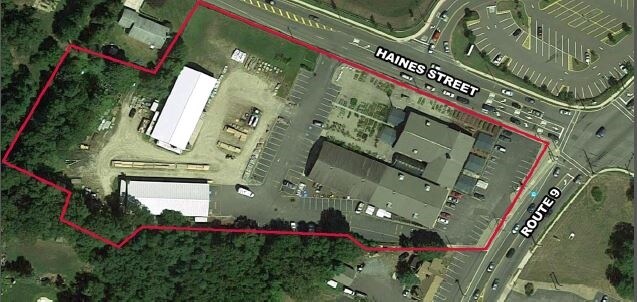
Property Detail
514 N Main St
01-00211-0000-00010
.55 AC N E METRO AMBULANCE LOT 1
Commercialnec
OCEAN
CPHD
New Jersey
B and X Area of moderate flood hazard, usually the area between the limits of the 100-year and 500-year floods.
10
2025
0.55 AC
2025
Ocean County
734002
Northern New Jersey
2,160 SF
Lakewood-New Brunswick, NJ
NEARBY LISTINGS FOR SALE OR LEASE
DEMOGRAPHICS near 514 N Main St
1 mile
3 mile
5 mile
2025 Total Population
7,023
36,710
58,508
2030 Population
7,157
37,676
60,138
Pop Growth 2025-2030
+ 1.91%
+ 2.63%
+ 2.79%
Average Age
39
41
41
2025 Total Households
2,419
13,530
21,586
HH Growth 2025-2030
+ 1.36%
+ 2.20%
+ 2.33%
Median Household Inc
$123,021
$103,919
$101,516
Avg Household Size
2.80
2.60
2.60
2025 Avg HH Vehicles
3.00
2.00
2.00
Median Home Value
$408,156
$398,441
$389,075
Median Year Built
1980
1981
1982
Nearby Places
Map Layers
Map Styles
 Street
 Aerial
Layers
 Traffic
 Biking
Places
Listings with unknown addresses are not visible on the map
- Restaurants
- Banks
- Shops
- Fitness
- Groceries
PUBLIC TRANSPORTATION
AIRPORT
Atlantic City International
Drive
Walk
Distance
Atlantic City International
65 min
35.8 mi
Freight Ports
Port of Philadelphia
Drive
Walk
Distance
Port of Philadelphia
69 min
54.6 mi
SALE & LEASE HISTORY
LISTING DATE
SALE/LEASE

Sep 24, 2016
For Sale
Sep 24, 2016
For Sale
Mar 30, 2017
For Sale
Nearby Properties
Address
Land Use
TOTAL SIZE
Lot Size
Zoning
Address
Land Use
TOTAL SIZE
Lot Size
Zoning
85.65 AC
R40
Address
Land Use
TOTAL SIZE
Lot Size
Zoning
15.27 AC
C-2
Address
Land Use
TOTAL SIZE
Lot Size
Zoning
46.40 AC
ML-4
Address
Land Use
TOTAL SIZE
Lot Size
Zoning
13.83 AC
CN
Address
Land Use
TOTAL SIZE
Lot Size
Zoning
85.65 AC
R40
Address
Land Use
TOTAL SIZE
Lot Size
Zoning
7.49 AC
R20
Address
Land Use
TOTAL SIZE
Lot Size
Zoning
2.76 AC
TC
Address
Land Use
TOTAL SIZE
Lot Size
Zoning
15.12 AC
R-2
Address
Land Use
TOTAL SIZE
Lot Size
Zoning
9.32 AC
TCO+
Address
Land Use
TOTAL SIZE
Lot Size
Zoning
6,600 SF
10.67 AC
PRD
Address
Land Use
TOTAL SIZE
Lot Size
Zoning
67,548 SF
10.98 AC
CN
Address
Land Use
TOTAL SIZE
Lot Size
Zoning
86,000 SF
2.87 AC
R20
Address
Land Use
TOTAL SIZE
Lot Size
Zoning
11.24 AC
R-2
Address
Land Use
TOTAL SIZE
Lot Size
Zoning
37.70 AC
TCMX
Address
Land Use
TOTAL SIZE
Lot Size
Zoning
23.70 AC
BCWD
Address
Land Use
TOTAL SIZE
Lot Size
Zoning
89.90 AC
R-2
Address
Land Use
TOTAL SIZE
Lot Size
Zoning
56.23 AC
BC
Address
Land Use
TOTAL SIZE
Lot Size
Zoning
18.15 AC
TCMX
Address
Land Use
TOTAL SIZE
Lot Size
Zoning
11,695 SF
9.31 AC
R20
Address
Land Use
TOTAL SIZE
Lot Size
Zoning
4,230 SF
10.65 AC
CPHD
Address
Land Use
TOTAL SIZE
Lot Size
Zoning
40 AC
TCEC
Address
Land Use
TOTAL SIZE
Lot Size
Zoning
4.85 AC
CPHD
Address
Land Use
TOTAL SIZE
Lot Size
Zoning
398 AC
PW
Address
Land Use
TOTAL SIZE
Lot Size
Zoning
3.34 AC
C-1
Address
Land Use
TOTAL SIZE
Lot Size
Zoning
5.14 AC
CPHD
Address
Land Use
TOTAL SIZE
Lot Size
Zoning
58,375 SF
5.46 AC
CPHD
Address
Land Use
TOTAL SIZE
Lot Size
Zoning
37,476 SF
14.66 AC
R6
Address
Land Use
TOTAL SIZE
Lot Size
Zoning
16,992 SF
31.88 AC
FO
Address
Land Use
TOTAL SIZE
Lot Size
Zoning
52,212 SF
4.41 AC
TCCN
Address
Land Use
TOTAL SIZE
Lot Size
Zoning
13,092 SF
1.79 AC
C-2
The World's #1 Commercial Real Estate Marketplace
Connect with us
© 2026 CoStar Group
The information above has been obtained from sources believed reliable. While we do not doubt its accuracy we have not verified it and make no guarantee, warranty or representation about it. It is your responsibility to independently confirm its accuracy and completeness. Any projections, opinions, assumptions, or estimates used are for example only and do not represent the current or future performance of the property. The value of this transaction to you depends on tax and other factors which should be evaluated by your tax, financial, and legal advisors. You and your advisors should conduct a careful, independent investigation of the property to determine to your satisfaction the suitability of the property for your needs.