Property Record
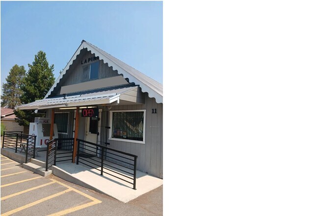
51470 Highway 97, La Pine, OR 97739

Property Detail
51470 Highway 97
114946
LOT 13 * EXCEPTING THEREFROM: HY 1.52 AC
Commercialnec
Deschutes
LPTC
Oregon
B and X Area of moderate flood hazard, usually the area between the limits of the 100-year and 500-year floods.
13
2025
1.52 AC
2025
Deschutes County
000201
Portland
11,773 SF
Bend, OR
NEARBY LISTINGS FOR SALE OR LEASE
-
-
View all La Pine listings for lease on LoopNet.com
DEMOGRAPHICS near 51470 Highway 97
1 mile
3 mile
5 mile
2025 Total Population
2,158
5,707
11,408
2030 Population
2,289
6,105
12,127
Pop Growth 2025-2030
+ 6.07%
+ 6.97%
+ 6.30%
Average Age
44
47
47
2025 Total Households
896
2,384
4,752
HH Growth 2025-2030
+ 6.03%
+ 7.01%
+ 6.31%
Median Household Inc
$54,500
$52,291
$54,292
Avg Household Size
2.30
2.30
2.30
2025 Avg HH Vehicles
2.00
2.00
2.00
Median Home Value
$371,599
$347,377
$381,743
Median Year Built
2001
1997
1994
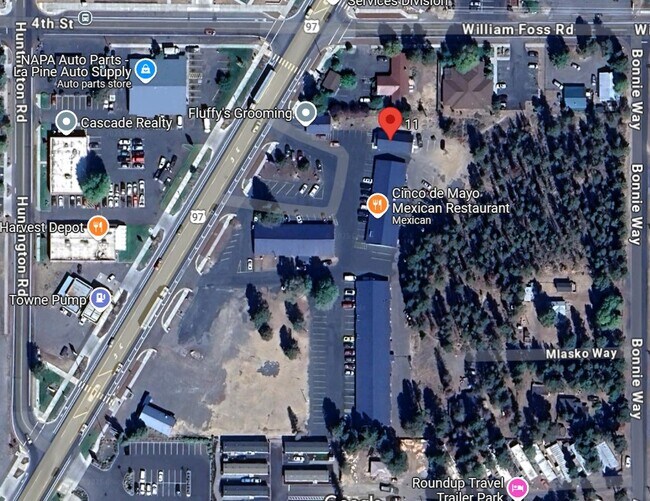
Nearby Places
Map Layers
Map Styles
 Street
 Aerial
Transit
 Traffic
 Biking
Places
Listings with unknown addresses are not visible on the map
- Restaurants
- Banks
- Shops
- Fitness
- Groceries
SALE & LEASE HISTORY
LISTING DATE
SALE/LEASE

Aug 04, 2025
For Lease
Nearby Properties
Address
Land Use
TOTAL SIZE
Lot Size
Zoning
Address
Land Use
TOTAL SIZE
Lot Size
Zoning
35,466 SF
2.51 AC
LPTC
Address
Land Use
TOTAL SIZE
Lot Size
Zoning
26,194 SF
2.33 AC
LPPF
Address
Land Use
TOTAL SIZE
Lot Size
Zoning
11,100 SF
7.93 AC
LPMUC
Address
Land Use
TOTAL SIZE
Lot Size
Zoning
27,316 SF
2.67 AC
LPTC
Address
Land Use
TOTAL SIZE
Lot Size
Zoning
19.33 AC
LPMPR
Address
Land Use
TOTAL SIZE
Lot Size
Zoning
19,291 SF
1.82 AC
LPTC
Address
Land Use
TOTAL SIZE
Lot Size
Zoning
1.82 AC
LPTC
Address
Land Use
TOTAL SIZE
Lot Size
Zoning
33,206 SF
1.35 AC
LPTC
Address
Land Use
TOTAL SIZE
Lot Size
Zoning
41,616 SF
6.66 AC
LPTC
Address
Land Use
TOTAL SIZE
Lot Size
Zoning
17,802 SF
4.70 AC
LPMUC
Address
Land Use
TOTAL SIZE
Lot Size
Zoning
3,677.33 AC
F1
Address
Land Use
TOTAL SIZE
Lot Size
Zoning
Address
Land Use
TOTAL SIZE
Lot Size
Zoning
15,263 SF
4.10 AC
RSC-C/M
Address
Land Use
TOTAL SIZE
Lot Size
Zoning
17.66 AC
LPMPR
Address
Land Use
TOTAL SIZE
Lot Size
Zoning
4,800 SF
2.15 AC
LPIND
Address
Land Use
TOTAL SIZE
Lot Size
Zoning
13,155 SF
0.83 AC
LPCRMU
Address
Land Use
TOTAL SIZE
Lot Size
Zoning
1 SF
2.25 AC
LPTC
Address
Land Use
TOTAL SIZE
Lot Size
Zoning
19,526 SF
1.85 AC
LPTC
Address
Land Use
TOTAL SIZE
Lot Size
Zoning
1.85 AC
LPTC
Address
Land Use
TOTAL SIZE
Lot Size
Zoning
5,982 SF
2.58 AC
LPTC
Address
Land Use
TOTAL SIZE
Lot Size
Zoning
16,041 SF
0.52 AC
LPCRMU
Address
Land Use
TOTAL SIZE
Lot Size
Zoning
25,320 SF
3.33 AC
LPMUC
Address
Land Use
TOTAL SIZE
Lot Size
Zoning
3,994 SF
1.32 AC
LPTC
Address
Land Use
TOTAL SIZE
Lot Size
Zoning
5 AC
RR10
Address
Land Use
TOTAL SIZE
Lot Size
Zoning
17,501 SF
5 AC
RR10
Address
Land Use
TOTAL SIZE
Lot Size
Zoning
52,520 SF
2.17 AC
LPPF
Address
Land Use
TOTAL SIZE
Lot Size
Zoning
38.73 AC
LPIND
Address
Land Use
TOTAL SIZE
Lot Size
Zoning
8,227 SF
0.89 AC
LPPK
Address
Land Use
TOTAL SIZE
Lot Size
Zoning
33,618 SF
5 AC
LPIND
Address
Land Use
TOTAL SIZE
Lot Size
Zoning
3,248 SF
1.60 AC
LPTC
The World's #1 Commercial Real Estate Marketplace
Connect with us
© 2026 CoStar Group
The information above has been obtained from sources believed reliable. While we do not doubt its accuracy we have not verified it and make no guarantee, warranty or representation about it. It is your responsibility to independently confirm its accuracy and completeness. Any projections, opinions, assumptions, or estimates used are for example only and do not represent the current or future performance of the property. The value of this transaction to you depends on tax and other factors which should be evaluated by your tax, financial, and legal advisors. You and your advisors should conduct a careful, independent investigation of the property to determine to your satisfaction the suitability of the property for your needs.