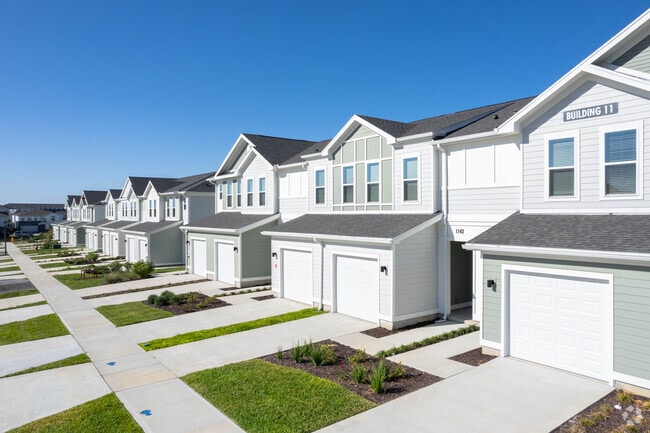
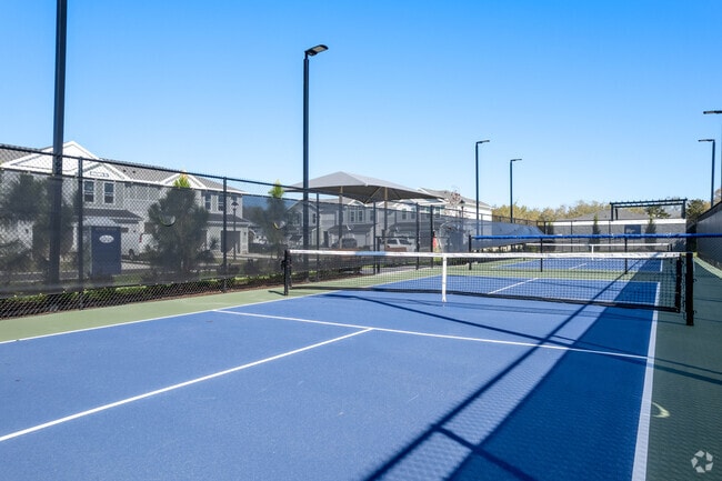
Property Record
515 Corso Ln, Davenport, FL 33897

Property Detail
515 Corso Ln
26-25-12-000000-022010
BEG SE COR OF SE1/4 OF SE1/4 OF SEC RUN S89-26-02W ALONG S BNDRY 1314.74 FT TO W BNDRY OF SE1/4 OF SE1/4 OF SEC RUN N00-32-48W 1304.59 FT TO S R/W LINE OF FLORENCE VILLA GROVE RD PER MB 21 PG 61 RUN S ALONG SAID R/W LINE FOLL 4 COURSES: N88-28-13E 34
Multifamilydwelling
POLK
RC
Florida
B and X Area of moderate flood hazard, usually the area between the limits of the 100-year and 500-year floods.
28.76 AC
2024
North Polk
2025
Tampa/St Petersburg
012415
Lakeland-Winter Haven, FL
442,457 SF
NEARBY LISTINGS FOR SALE OR LEASE
DEMOGRAPHICS near 515 Corso Ln
1 mile
3 mile
5 mile
2025 Total Population
8,449
57,295
115,189
2030 Population
10,026
68,144
137,639
Pop Growth 2025-2030
+ 18.66%
+ 18.94%
+ 19.49%
Average Age
38
38
38
2025 Total Households
2,907
21,886
42,566
HH Growth 2025-2030
+ 19.06%
+ 19.00%
+ 19.79%
Median Household Inc
$84,726
$72,764
$81,839
Avg Household Size
2.90
2.60
2.70
2025 Avg HH Vehicles
2.00
2.00
2.00
Median Home Value
$326,017
$339,305
$380,677
Median Year Built
2005
2005
2007
Nearby Places
Map Layers
Map Styles
 Street
 Aerial
Layers
 Traffic
 Biking
Places
Listings with unknown addresses are not visible on the map
- Restaurants
- Banks
- Shops
- Fitness
- Groceries
PUBLIC TRANSPORTATION
AIRPORT
Orlando International
Drive
Walk
Distance
Orlando International
43 min
29.0 mi
Freight Ports
Port of Tampa Bay
Drive
Walk
Distance
Port of Tampa Bay
79 min
64.3 mi
Nearby Properties
Address
Land Use
TOTAL SIZE
Lot Size
Zoning
Address
Land Use
TOTAL SIZE
Lot Size
Zoning
883,200 SF
75.26 AC
P-D
Address
Land Use
TOTAL SIZE
Lot Size
Zoning
414,620 SF
16.64 AC
P-D
Address
Land Use
TOTAL SIZE
Lot Size
Zoning
480,142 SF
29.57 AC
OPD
Address
Land Use
TOTAL SIZE
Lot Size
Zoning
489,411 SF
19.04 AC
Address
Land Use
TOTAL SIZE
Lot Size
Zoning
277,285 SF
U-ORG-P-D
Address
Land Use
TOTAL SIZE
Lot Size
Zoning
364,023 SF
18.77 AC
OPD
Address
Land Use
TOTAL SIZE
Lot Size
Zoning
418,368 SF
12.66 AC
Address
Land Use
TOTAL SIZE
Lot Size
Zoning
375,912 SF
9.36 AC
U-ORG-P-D
Address
Land Use
TOTAL SIZE
Lot Size
Zoning
381,117 SF
10.72 AC
Address
Land Use
TOTAL SIZE
Lot Size
Zoning
321,417 SF
23.19 AC
Address
Land Use
TOTAL SIZE
Lot Size
Zoning
128,000 SF
19.60 AC
P-D
Address
Land Use
TOTAL SIZE
Lot Size
Zoning
306,139 SF
19.77 AC
P-D
Address
Land Use
TOTAL SIZE
Lot Size
Zoning
357,292 SF
1.34 AC
P-D
Address
Land Use
TOTAL SIZE
Lot Size
Zoning
333,280 SF
14.73 AC
Address
Land Use
TOTAL SIZE
Lot Size
Zoning
353,423 SF
16.51 AC
PUD
Address
Land Use
TOTAL SIZE
Lot Size
Zoning
277,616 SF
19.03 AC
Address
Land Use
TOTAL SIZE
Lot Size
Zoning
330,913 SF
16.74 AC
PUD
Address
Land Use
TOTAL SIZE
Lot Size
Zoning
59,868 SF
0.81 AC
P-D
Address
Land Use
TOTAL SIZE
Lot Size
Zoning
272,106 SF
12.22 AC
Address
Land Use
TOTAL SIZE
Lot Size
Zoning
142,828 SF
429.01 AC
P-D
Address
Land Use
TOTAL SIZE
Lot Size
Zoning
315,346 SF
22.69 AC
PUD
Address
Land Use
TOTAL SIZE
Lot Size
Zoning
299,696 SF
9.79 AC
PUD
Address
Land Use
TOTAL SIZE
Lot Size
Zoning
283,492 SF
11.97 AC
PUD
Address
Land Use
TOTAL SIZE
Lot Size
Zoning
114,592 SF
18.46 AC
OCT
Address
Land Use
TOTAL SIZE
Lot Size
Zoning
196,553 SF
6.13 AC
Address
Land Use
TOTAL SIZE
Lot Size
Zoning
71,280 SF
4.91 AC
P-D
Address
Land Use
TOTAL SIZE
Lot Size
Zoning
97.51 AC
P-D
Address
Land Use
TOTAL SIZE
Lot Size
Zoning
330,563 SF
20.07 AC
PUD
Address
Land Use
TOTAL SIZE
Lot Size
Zoning
71,280 SF
0.59 AC
P-D
The World's #1 Commercial Real Estate Marketplace
Connect with us
© 2026 CoStar Group
The information above has been obtained from sources believed reliable. While we do not doubt its accuracy we have not verified it and make no guarantee, warranty or representation about it. It is your responsibility to independently confirm its accuracy and completeness. Any projections, opinions, assumptions, or estimates used are for example only and do not represent the current or future performance of the property. The value of this transaction to you depends on tax and other factors which should be evaluated by your tax, financial, and legal advisors. You and your advisors should conduct a careful, independent investigation of the property to determine to your satisfaction the suitability of the property for your needs.