Property Record
515 E Palm Valley Blvd, Round Rock, TX 78664
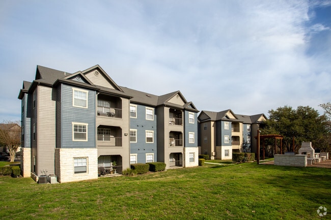

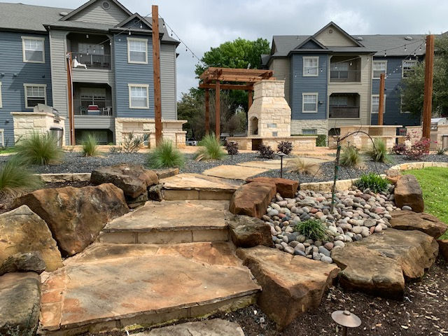
Property Detail
515 E Palm Valley Blvd
R347834
STEEPLECHASE DOWNS AMENDED, LOT 5-A, ACRES 15.4263
Multifamilydwelling
Williamson
PUD
Texas
AE The base floodplain where base flood elevations are provided. AE Zones are now used on new format FIRMs instead of A1-A30 Zones.
5-a
2024
15.43 AC
2025
Round Rock
021503
Austin
375,523 SF
Austin-Round Rock-San Marcos, TX
NEARBY LISTINGS FOR SALE OR LEASE
-
-
View all Round Rock listings for sale on LoopNet.com
DEMOGRAPHICS near 515 E Palm Valley Blvd
1 mile
3 mile
5 mile
2024 Total Population
13,196
102,569
245,078
2029 Population
14,920
116,281
274,016
Pop Growth 2024-2029
+ 13.06%
+ 13.37%
+ 11.81%
Average Age
36
37
37
2024 Total Households
5,016
38,590
89,244
HH Growth 2024-2029
+ 13.56%
+ 13.90%
+ 12.33%
Median Household Inc
$64,215
$90,884
$111,255
Avg Household Size
2.50
2.60
2.70
2024 Avg HH Vehicles
2.00
2.00
2.00
Median Home Value
$338,804
$413,207
$455,966
Median Year Built
1985
1998
2003
Nearby Places
Map Layers
Map Styles
 Street
 Aerial
Transit
 Traffic
 Biking
Places
Listings with unknown addresses are not visible on the map
- Restaurants
- Banks
- Shops
- Fitness
- Groceries
PUBLIC TRANSPORTATION
AIRPORT
Austin-Bergstrom International
Drive
Walk
Distance
Austin-Bergstrom International
42 min
29.9 mi
Freight Ports
Calhoun Port
Drive
Walk
Distance
Calhoun Port
206 min
177.4 mi
Nearby Properties
Address
Land Use
TOTAL SIZE
Lot Size
Zoning
Address
Land Use
TOTAL SIZE
Lot Size
Zoning
1,240,638 SF
171.60 AC
Address
Land Use
TOTAL SIZE
Lot Size
Zoning
2,089,779 SF
167.49 AC
Address
Land Use
TOTAL SIZE
Lot Size
Zoning
956,707 SF
71.90 AC
C1
Address
Land Use
TOTAL SIZE
Lot Size
Zoning
536,741 SF
80.32 AC
SF2
Address
Land Use
TOTAL SIZE
Lot Size
Zoning
422,682 SF
95.18 AC
Address
Land Use
TOTAL SIZE
Lot Size
Zoning
485,021 SF
50.17 AC
C1
Address
Land Use
TOTAL SIZE
Lot Size
Zoning
325,797 SF
36.36 AC
Address
Land Use
TOTAL SIZE
Lot Size
Zoning
533,151 SF
26.90 AC
PUD
Address
Land Use
TOTAL SIZE
Lot Size
Zoning
445,321 SF
12.52 AC
Address
Land Use
TOTAL SIZE
Lot Size
Zoning
543,958 SF
60.19 AC
Address
Land Use
TOTAL SIZE
Lot Size
Zoning
273,462 SF
47.12 AC
Address
Land Use
TOTAL SIZE
Lot Size
Zoning
456,943 SF
66.31 AC
SF2
Address
Land Use
TOTAL SIZE
Lot Size
Zoning
470,992 SF
25.92 AC
Address
Land Use
TOTAL SIZE
Lot Size
Zoning
323,284 SF
14.21 AC
Address
Land Use
TOTAL SIZE
Lot Size
Zoning
295,750 SF
21.46 AC
Address
Land Use
TOTAL SIZE
Lot Size
Zoning
362,216 SF
19.72 AC
Address
Land Use
TOTAL SIZE
Lot Size
Zoning
618,605 SF
14.11 AC
PUD
Address
Land Use
TOTAL SIZE
Lot Size
Zoning
326,015 SF
11.11 AC
Address
Land Use
TOTAL SIZE
Lot Size
Zoning
201,200 SF
9.48 AC
Address
Land Use
TOTAL SIZE
Lot Size
Zoning
477,454 SF
22.28 AC
Address
Land Use
TOTAL SIZE
Lot Size
Zoning
411,020 SF
29.91 AC
PUD
Address
Land Use
TOTAL SIZE
Lot Size
Zoning
332,752 SF
10.30 AC
Address
Land Use
TOTAL SIZE
Lot Size
Zoning
140,409 SF
17.15 AC
Address
Land Use
TOTAL SIZE
Lot Size
Zoning
330,541 SF
20.90 AC
PUD
Address
Land Use
TOTAL SIZE
Lot Size
Zoning
216,198 SF
9.47 AC
Address
Land Use
TOTAL SIZE
Lot Size
Zoning
673,809 SF
9.03 AC
PUD
Address
Land Use
TOTAL SIZE
Lot Size
Zoning
364,432 SF
20.56 AC
MF
Address
Land Use
TOTAL SIZE
Lot Size
Zoning
379,953 SF
11.74 AC
PUD
Address
Land Use
TOTAL SIZE
Lot Size
Zoning
285,835 SF
25.69 AC
C1
Address
Land Use
TOTAL SIZE
Lot Size
Zoning
203,198 SF
14.04 AC
The World's #1 Commercial Real Estate Marketplace
Connect with us
© 2026 CoStar Group
The information above has been obtained from sources believed reliable. While we do not doubt its accuracy we have not verified it and make no guarantee, warranty or representation about it. It is your responsibility to independently confirm its accuracy and completeness. Any projections, opinions, assumptions, or estimates used are for example only and do not represent the current or future performance of the property. The value of this transaction to you depends on tax and other factors which should be evaluated by your tax, financial, and legal advisors. You and your advisors should conduct a careful, independent investigation of the property to determine to your satisfaction the suitability of the property for your needs.