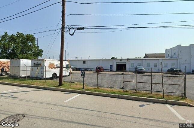
Property Record
20 Mildred Ave, Clifton Heights, PA 19018


Current Lease Availabilities
Property Detail
20 Mildred Ave
16-13-02477-00
1 1/2 STY BLDG 368 X 153
Lightindustrial
DELAWARE
B and X Area of moderate flood hazard, usually the area between the limits of the 100-year and 500-year floods.
Pennsylvania
2024
1.29 AC
2025
Delaware County
401502
Philadelphia
13,526 SF
Philadelphia-Camden-Wilmington, PA-NJ-DE-MD
NEARBY LISTINGS FOR SALE OR LEASE
DEMOGRAPHICS near 20 Mildred Ave
1 mile
3 mile
5 mile
2025 Total Population
27,781
211,422
508,736
2030 Population
28,020
213,106
510,560
Pop Growth 2025-2030
+ 0.86%
+ 0.80%
+ 0.36%
Average Age
40
40
40
2025 Total Households
11,250
81,014
194,574
HH Growth 2025-2030
+ 0.96%
+ 0.86%
+ 0.33%
Median Household Inc
$72,695
$73,915
$67,189
Avg Household Size
2.40
2.50
2.50
2025 Avg HH Vehicles
2.00
2.00
1.00
Median Home Value
$221,994
$247,519
$251,013
Median Year Built
1955
1952
1949
Nearby Places
Map Layers
Map Styles
 Street
 Aerial
Layers
 Traffic
 Biking
Places
Listings with unknown addresses are not visible on the map
- Restaurants
- Banks
- Shops
- Fitness
- Groceries
PUBLIC TRANSPORTATION
TRANSIT/SUBWAY
Providence Rd (Route 102 - SEPTA)
Drive
Walk
Distance
Providence Rd (Route 102 - SEPTA)
1 min
13 min
0.7 mi
Springfield Rd (Route 102 - SEPTA)
Drive
Walk
Distance
Springfield Rd (Route 102 - SEPTA)
3 min
14 min
0.8 mi
Magnolia Av (Route 102 - SEPTA)
Drive
Walk
Distance
Magnolia Av (Route 102 - SEPTA)
2 min
16 min
0.9 mi
Penn St (Route 102 - SEPTA)
Drive
Walk
Distance
Penn St (Route 102 - SEPTA)
4 min
17 min
0.9 mi
Clifton-Aldan (Route 102 - SEPTA)
Drive
Walk
Distance
Clifton-Aldan (Route 102 - SEPTA)
3 min
17 min
0.9 mi
COMMUTER RAIL
Primos (R3 - Southeastern Pennsylvania Transportation Authority Regional Rail (SEPTA Regional Rail))
Drive
Walk
Distance
Primos (R3 - Southeastern Pennsylvania Transportation Authority Regional Rail (SEPTA Regional Rail))
1 min
2 min
0.1 mi
Clifton-Aldan (Route 102 - Southeastern Pennsylvania Transportation Authority Rapid Transit (SEPTA Subway & Trolley))
Drive
Walk
Distance
Clifton-Aldan (Route 102 - Southeastern Pennsylvania Transportation Authority Rapid Transit (SEPTA Subway & Trolley))
3 min
16 min
0.9 mi
AIRPORT
Philadelphia International
Drive
Walk
Distance
Philadelphia International
16 min
7.0 mi
Freight Ports
South Jersey Port
Drive
Walk
Distance
South Jersey Port
30 min
15.3 mi
Nearby Properties
Address
Land Use
TOTAL SIZE
Lot Size
Zoning
Address
Land Use
TOTAL SIZE
Lot Size
Zoning
158,496 SF
Address
Land Use
TOTAL SIZE
Lot Size
Zoning
15,660 SF
56.60 AC
Address
Land Use
TOTAL SIZE
Lot Size
Zoning
448,864 SF
32.89 AC
Address
Land Use
TOTAL SIZE
Lot Size
Zoning
702,532 SF
11 AC
Address
Land Use
TOTAL SIZE
Lot Size
Zoning
20,880 SF
27.20 AC
Address
Land Use
TOTAL SIZE
Lot Size
Zoning
6,040 SF
16.45 AC
Address
Land Use
TOTAL SIZE
Lot Size
Zoning
25,680 SF
31.64 AC
Address
Land Use
TOTAL SIZE
Lot Size
Zoning
136,972 SF
27 AC
Address
Land Use
TOTAL SIZE
Lot Size
Zoning
312,988 SF
24 AC
Address
Land Use
TOTAL SIZE
Lot Size
Zoning
3,600 SF
6.61 AC
SPPOA
Address
Land Use
TOTAL SIZE
Lot Size
Zoning
255,316 SF
6 AC
Address
Land Use
TOTAL SIZE
Lot Size
Zoning
2,608 SF
198.92 AC
Address
Land Use
TOTAL SIZE
Lot Size
Zoning
131,980 SF
9.17 AC
Address
Land Use
TOTAL SIZE
Lot Size
Zoning
40,572 SF
6.52 AC
Address
Land Use
TOTAL SIZE
Lot Size
Zoning
702,532 SF
Address
Land Use
TOTAL SIZE
Lot Size
Zoning
68,096 SF
7.78 AC
Address
Land Use
TOTAL SIZE
Lot Size
Zoning
282,520 SF
24.44 AC
Address
Land Use
TOTAL SIZE
Lot Size
Zoning
160,959 SF
7.97 AC
RM2
Address
Land Use
TOTAL SIZE
Lot Size
Zoning
Address
Land Use
TOTAL SIZE
Lot Size
Zoning
187,056 SF
16 AC
Address
Land Use
TOTAL SIZE
Lot Size
Zoning
164,834 SF
13 AC
Address
Land Use
TOTAL SIZE
Lot Size
Zoning
60,588 SF
9.43 AC
Address
Land Use
TOTAL SIZE
Lot Size
Zoning
110,424 SF
5.32 AC
Address
Land Use
TOTAL SIZE
Lot Size
Zoning
33,326 SF
7.73 AC
Address
Land Use
TOTAL SIZE
Lot Size
Zoning
185,840 SF
7.97 AC
RM2
Address
Land Use
TOTAL SIZE
Lot Size
Zoning
40,850 SF
25.81 AC
Address
Land Use
TOTAL SIZE
Lot Size
Zoning
122,018 SF
16.24 AC
Address
Land Use
TOTAL SIZE
Lot Size
Zoning
150,450 SF
9 AC
Address
Land Use
TOTAL SIZE
Lot Size
Zoning
51,280 SF
7 AC
Address
Land Use
TOTAL SIZE
Lot Size
Zoning
152,403 SF
16.98 AC
The World's #1 Commercial Real Estate Marketplace
Connect with us
© 2026 CoStar Group
The information above has been obtained from sources believed reliable. While we do not doubt its accuracy we have not verified it and make no guarantee, warranty or representation about it. It is your responsibility to independently confirm its accuracy and completeness. Any projections, opinions, assumptions, or estimates used are for example only and do not represent the current or future performance of the property. The value of this transaction to you depends on tax and other factors which should be evaluated by your tax, financial, and legal advisors. You and your advisors should conduct a careful, independent investigation of the property to determine to your satisfaction the suitability of the property for your needs.